While you might know Oahu best for the big city of Honolulu, it is also the perfect place to experience serene natural beauty. In this Oahu hiking guide, we will go over the best hikes in Oahu Hawaii with incredible views so you won’t miss a beat when exploring the island.
Whether you stay in the South near the city or head to the North Shore, there are beautiful hikes all around the island of Oahu. There are hiking trails for all skill levels and can be a great way to immerse yourself into Hawaiian culture.
Oahu is often remembered for Pearl Harbor, so there are various bunkers located around the island, that now serve as fun hiking destinations. Graffiti artists have transformed these boring concrete pillboxes into beautiful works of art.
Oahu also has dormant volcanic craters that offer hikes along the rim with epic views of the island. And almost no matter where you hike, you get stunning views of the aqua blue water that surrounds the island. So get ready to add many of these best hikes in Oahu Hawaii to your vacation itinerary.
Lanikai Pillbox:
0.9 miles, 406 ft elevation gain
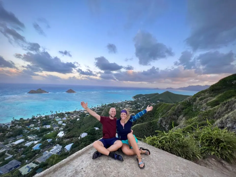
The Lanikai Pillbox Hike (aka Kaiwa Ridge Trail) actually took me by surprise. It’s definitely one of the most popular hikes in Oahu, but for a good reason.
My idea was to go during the day so the sunshine could accentuate the aqua blue water. But we decided to go for a sunset hike instead. But this hike faces east, so it’s also a great choice for sunrise too.
A sunset over the mountains behind us was even more special than we could have imagined.

The best part about this ridge hike is the panoramic views from the top overlooking Lanikai Beach and the Mokulua Islands. Plus it is a short hike, so it’s easy to get to the top and have a beautiful reward in no time.
But parking for this hike becomes the first challenge you face. There is no parking lot, so you must park in the residential neighborhood. They only allow cars to park on one side of the road (signs are clearly labeled in the area). But this will ultimately add some mileage onto the overall hike.
Once you park, head up to the trailhead on the paved road toward the golf course. There will be signs pointing you to the trail where it turns into dirt. Plus the golf course is fenced off, so you will know when you get there.
Head up the dirt path to the left. This trail can be very slippery after heavy rainfall. The trail starts climbing from this point, and honestly doesn’t really mellow out till you reach the first pillbox. So take your time if you need to take a break along the trail.
Your first goal destination is the first pillbox which will be plain in sight. Many people climb on top of the pillbox and take in the stunning panoramic views.
Then, head up to the second pillbox for an even higher view of the surrounding area.
Koko Crater Tramway:

1.6 miles, 885 elevation gain
Koko Crater Tramway is a very unique trail on this list of best hikes in Oahu. If you feel you have indulged in too many poke bowls or need to work off some of those Mai Tai’s, then this is the hike for you as it is a steep incline to top of Koko Head Lookout.
The Koko Crater hike is a straight up staircase on an old tramway and can honestly be quite dangerous. But another very popular hike in Oahu nonetheless.
Parking for the trailhead is in the Koko Head District Park. Then head up the paved road to the left behind the last baseball field. You will generally see the direction you should head from the tramway tracks up in the distance. Eventually, the paved road ends as you run into the old tramway and you start the intense climb up from here.
It’s best to go in the morning when the weather is a bit cooler or in the evening. But make sure you have enough daylight as the hike will be very dangerous with no light.
We didn’t follow that advice and went during the middle of the day and it was HOT! Most people climb a few steps and have to take a breather. So it’s not uncommon to kind of play leapfrog with many of the other hikers. Unless there are some savage hikers that are on their 3rd or 4th lap up the tramway (seriously, this happens).
The steps up the tramway are rather awkward and large. But most can be done in 1 large step or 2 small steps between each track.
There is one bridge section that is especially dangerous where there is no ground between the wood panels. You can skip this part and go around on a bypass dirt trail to the right. But just be extra cautious with every step if you choose to go this path.
Slowly but surely you will make it to the top and be offered breathtaking views over the crater, endless ocean views and a little bit of downtown Honolulu. You can walk toward the ocean along the ridge to have a beautiful view of Hanauma Bay and really get the full view of the crater.
Olomana Trail “Three Peaks Trail”:
4.4 miles, 1,856 ft elevation gain
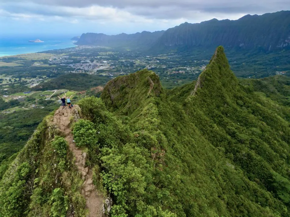
Olomana Trail is seriously an exciting hike, but it’s definitely NOT FOR EVERYONE. Especially if you are afraid of heights. Only choose this hike if you are in good shape, have hiking experience, and have some scrambling experience. There are sections that require climbing narrow rocky spines.
The trail is also known as three peaks trail because there are well, three peaks. Most people make it to the first peak and turn around. Making it to the 2nd or 3rd peaks depends solely on your skill level.
Please only do this steep hike if you came to the island with the proper hiking gear (hiking shoes with good traction, backpack to carry your stuff, 1+ liter of water per person, etc). You are going to need 2 free hands at times so you won’t be able to carry anything up the trail if you don’t have a backpack to put it in.
People DO die on this trail, so you need to come prepared.
Parking for this trailhead is another unique situation. There is a designated parking area on Maunawili Rd (aka Auloa Rd). MAKE SURE YOUR TIRES AREN’T TOUCHING THE PAVEMENT AND ARE STRICTLY ON THE GRAVEL. There are signs stating this and supposedly people have gotten tickets if their tires are touching the pavement even just a little bit.
You then walk up toward the busy highway but then turn down the paved road (Loop Rd) that lines the busy road to start. Walk along this road for just under 1 mile. You will have to enter a gated golf course driveway. No one was in the booth when we arrived so we just proceeded.
The trail starts to the left, tucked into the woods. There is a sign warning you about the recent deaths. You should take this warning seriously.
The trail starts through a beautiful forest. It starts as a steady climb, and there aren’t many views at the start. But after a while, you will emerge from the forest and start to gain some views.
Then, you will encounter the first rope section. The trail is steep and rocky, so it is often advised to use the ropes to help you up this section. We found plenty of helpful roots to guide us up this area with some assistance from the ropes.
Then comes another section where no ropes are needed but still a steady climb up. A little further, you reach the second rope section where a rope is basically essential to help you up the rock wall. This part of the trail becomes very narrow and there are steep cliffs on each side as you walk this spine. So be sure to be extra careful from this section on.
You eventually hit the first summit which offers epic panoramic views of the area.
Then, you will decide whether or not to turn back here. Our suggestion is to turn back as we think the first summit offers the best views. Having the second and third peaks in front of you makes for great photo composition.
But if you are a daredevil and can’t say you’ve done the hike without making it to the 3rd summit, then it’s time to push on. Getting to the second summit is really just a steep dirt path. It’s actually relatively easy compared to the first peak.
The saddle between the 2nd and 3rd summit is the most challenging. Only experienced hikers with scrambling/climbing experience should push on. There are ropes to help guide you up the steeper sections, but there are steep cliffs on either side as you summit to the top.
Keep in mind that any ropes you find along Olomana Trail are unofficial and unmaintained. So attempting this hike is at your own risk. Be smart and know your limits.
Hanauma Bay:
.8 miles, 193 ft elevation gain
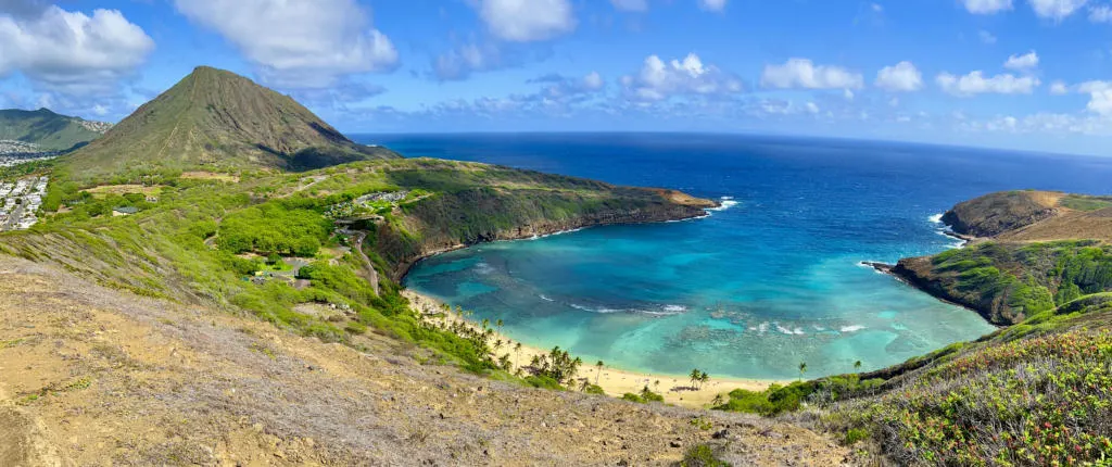
Hanauma Bay Trail is one of the best hikes in Oahu and offers a stunning bird’s eye view of Hanauma Bay.
This area is owned by the government, so you will see signs to stay out. But a local parking attendant told us it was okay to go up there and if a government official told us to leave, then obviously we’d have to turn around and leave.
So with that, we trudged ahead and climbed up the edge of Hanauma Bay. The hike is really straightforward once you reach the trailhead. It’s on a steep paved path and you can really go as far as you want. Jake and I specifically just wanted a bird’s eye view above the bay with the beautiful blue water and reefs below.
You can continue much further to the other end of the crater edge which will eventually turn into a dirt path.
Definitely consider getting a permit for Hanauma Bay to visit the beach when you are done. The cost is $25 but must be bought (2 days in advance). Parking is an additional $3 and on a first-come, first-serve basis. Hanauma Bay is closed Monday & Tuesday each week to give the marine life a break from tourists.
Parking for this trailhead can be a challenge. You can park in the Hanauma Bay Parking lot for $3 or park at the Koko Head District Park and walk along the deserted road to the trailhead. This only adds about .4 miles to the overall short hike.
Lulumahu Falls:
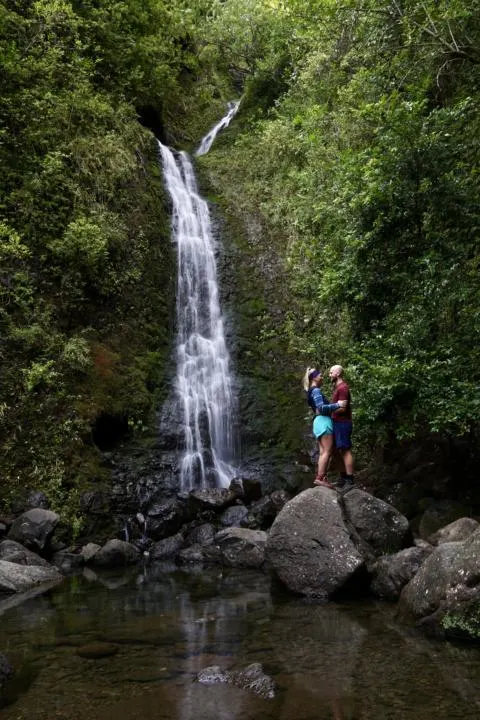
1.6 mi, 931 ft elevation gain
Lulumahu Falls is one of the best hikes in Oahu if you want to get off the beaten path. You must obtain a permit to hike this trail which often steers people away from this hike. But it’s really quite easy to get a ticket online.
Once you have your permit, head to the trailhead. Which is a large dirt lot right off the highway. It’s a bit confusing where the trailhead starts because there’s a couple holes in the fence. But just find the gated-off old road and start there.
It starts off as a wide trail through a beautiful bamboo forest. This trail is often muddy in spots, especially in the dense forest where the sun can’t reach to dry it out.
But there will often be a decent path to take to at least not lose a shoe in the mud. The trail can be a bit confusing at times when it splits into different trails. So it can be a good idea to have a GPS map downloaded from AllTrails. There’s also pink ribbons marking the trail, but they are a little hard to follow.
Continue on the path until you reach the first river crossing. Here you can often cross the river without getting your feet wet. You can choose either side of the river as there is a path on either side.
Jake and I chose the path to the right and had no issues staying with the trail. There will eventually come another river crossing which means you are getting close to the falls. Keep following heavy foot traffic and it will lead you to Lulumahu Falls!
Many people choose to stand under the falls, but the water is quite chilly. Plus the area doesn’t get much sun as it is tucked in and surrounded by trees.
Manoa Falls:
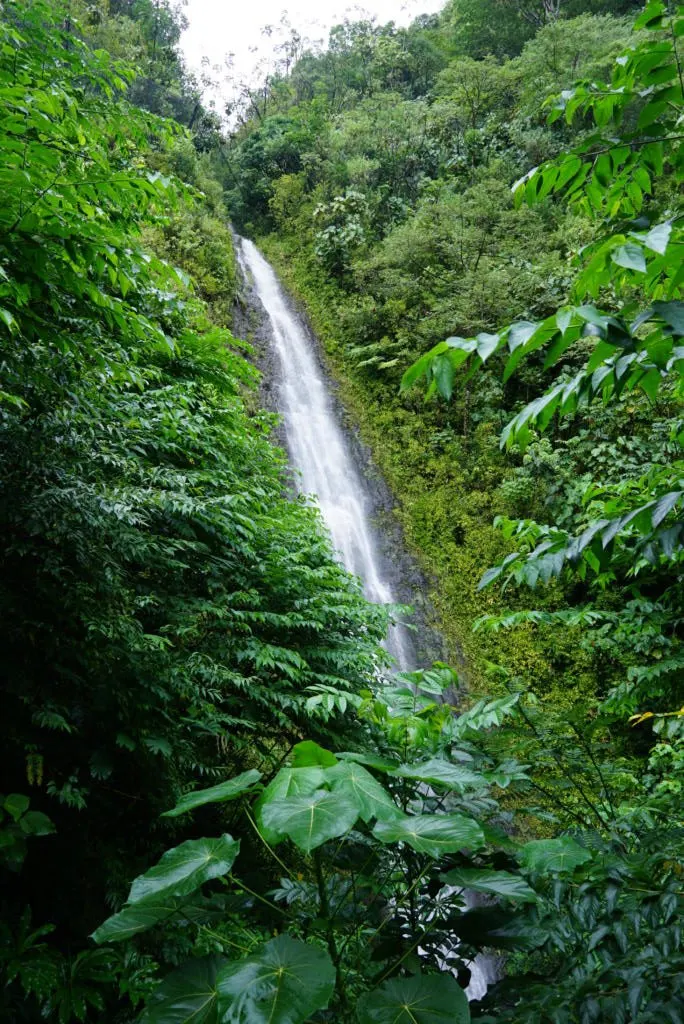
1.7 miles, 633 ft elevation gain
Manoa Falls trail is a unique easy hike in Oahu that is sure not to be missed. There is a $5 parking fee per vehicle.
The journey to Manoa Falls is just about as cool as the falls themselves which makes it one of the best hikes in Oahu. The trail to a better vantage point to see the falls has since been closed off for restoration. So once you get to the falls it is sort of blocked by vegetation. Still beautiful nonetheless.
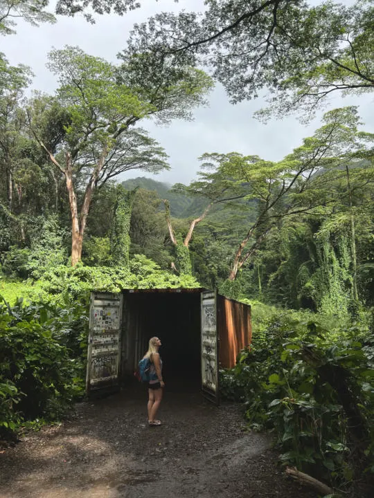
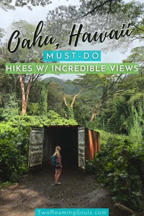
But we enjoyed this waterfall hike right from the start, as there is an old shipping container that looks like a movie scene out of a Jurassic Park movie. Plus stunning old trees that stand super tall and just add a beautiful atmosphere to the hike.
Continuing on, you travel through a lush forest and eventually climb up to where you can see the falls. The best viewpoint is actually right at the top of the stairs. The further you walk toward the waterfall, the more the view gets obstructed.
Crouching Lion:
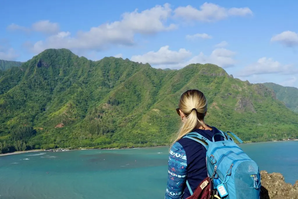
.4 miles, 216 ft elevation gain
On the east side of the island, you will find one of the best hikes in Oahu, The Crouching Lion.
This trail is technically closed at the moment. But thought it was worth mentioning in case it reopens as it was one of our all-time favorite hikes in Oahu.
It’s a rather short but steep climb to a stunning view overlooking the bay. Plus a very unique rock wall with beautiful texture just on the other side of the lookout which we found equally as cool.
If the trail does reopen, park in a dirt pull-off on the opposite side of the highway. You will have to walk alongside the road for just a little bit to get to the trailhead.
At the moment, there are signs stating “the trail is closed”. But this is where the trailhead starts.
When we hiked the trail, there were ropes in sections that might be difficult to climb if there was recent rainfall. The trail can be pretty steep in areas, but if you take your time and small steps, you should be fine.
Really hoping this trail does open again, because we think it is one of the best hikes in Oahu.
Diamond Head:

Photo by Zetong Li on Unsplash
1.8 miles, 452 ft elevation gain
Just a short drive from downtown Honolulu you will find one of the most popular trails of the best hikes in Oahu. Diamond Head Hike offers spectacular views of Waikiki Beach and surrounding downtown Honolulu.
While the hike is short, it is a steep climb to the top of the lookout. But the hike is pretty straightforward and easy to follow.
You will need to plan in advance if you want to visit the Diamond Head State Monument because it requires a permit. During the slow season, you might be able to snag a permit day of, but they often sell out in advance. Permits can be purchased up to 30 days in advance.
The park is open daily from 6:00 am to 4:00 pm. The entry cost is $5.00 and parking is an additional $10.00.
Click here to reserve a permit.
Lake Waimaluhia at Ho’omaluhia Botanical Garden:
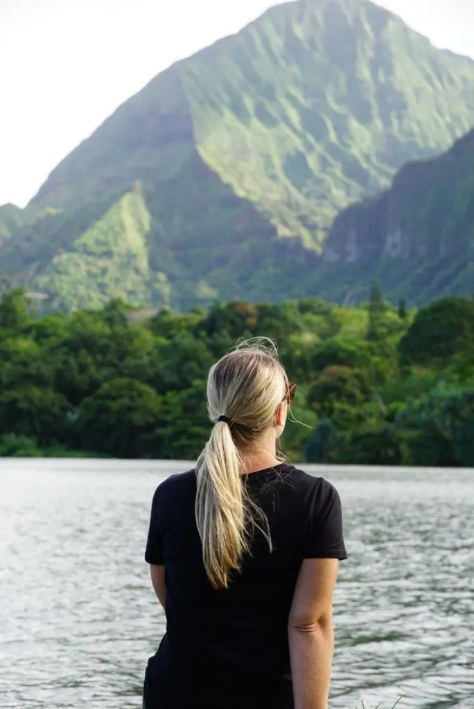
.8 miles, 145 ft elevation gain
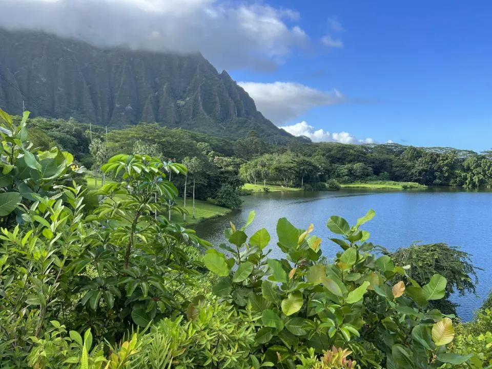
An easy hike in Ho’omaluhia Botanical Garden is hiking to Lake Waimaluhia. It’s more of a nature walk, than a hike. You can reach the lake by different starting points around the botanical gardens. But the most common starting point is from the visitor center and continues along a paved path through the botanical garden.
Here you can learn about all the plants that are both native and transported to the island. Then, the trail turns to a rocky dirt trail. It’s pretty easy to follow.
Shortly, you will come upon Lake Waimaluhia with the dramatic mountain landscape in the background. You can extend the hike by walking around the east side of the lake.
Or we found the starting point from Kahua Lehua Campsite parking area to be also very beautiful.
Ehukai Pillbox Hike:
2.3 mi, 734 ft elevation
On the North Shore is the Ehukai Pillbox Hike. It’s another hike to a bunker that was used in World War II. It’s an intermediate hike that loops around in a short but steep 2.3 miles.
After heavy rainfall this trail can be very muddy and slippery. There are ropes in the sections that are extra slippery and hard to climb. Through a beautiful forest, you will find the first pillbox which looks over Sunset Beach.
After you reach the first pillbox, you can continue onto the second pillbox which is about an additional 5-minute hike. Some people have claimed to get lost finding it, so be sure to download the Alltrails map to help get you there.
Parking for this hike is at Sunset Beach Neighborhood Park.
Makapu’u Lighthouse:
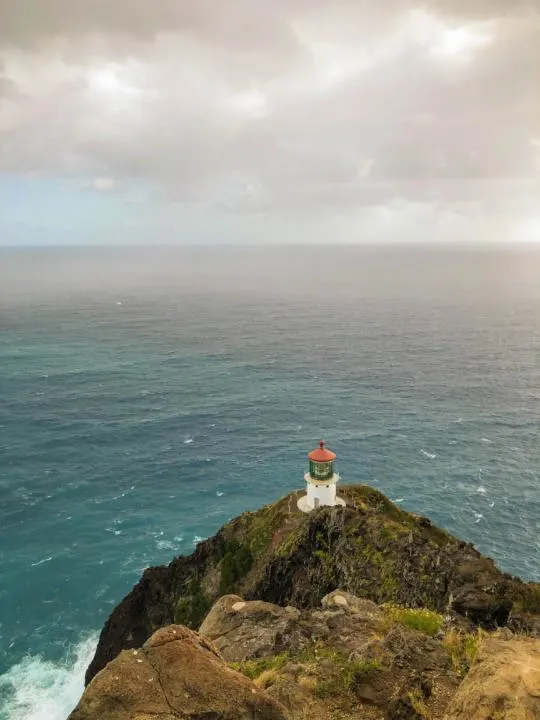
Photo by Verstappen Photography on Unsplash
2.5 mi, 505 ft elevation
One of the best hikes in Oahu if you enjoy lighthouses is a lovely hike to the Makapu’u Lighthouse. It is a short 2.5 miles on the southeast tip of Oahu. The lighthouse was built in 1909 and is still active to aid in navigation today.
There is a parking lot but it often gets full in the morning, so you might need to park along the Kalaniana Hwy. Be careful when crossing the road to the trailhead.
There is a paved trail the whole way, and it’s usually dry. About .5 mile into the hike, there will come a sharp turn where you will head north toward the Makapu’u Lighthouse.
People are not allowed in the lighthouse, but a beautiful sight to see nonetheless. You can also get a stunning view of Waimānalo Beach. During whale migration season (November to May) you might be able to spot humpback whales breaching in the distance.
Also on a clear day, you might be able to spot Molokai and Lanai in the distance.
Haiku Stairs via Moanalua Valley:
10.5 miles with 5,029 ft elevation
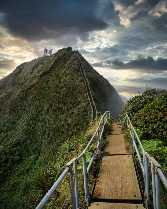
The most famous hike in Oahu is the Haiku Stairs (aka the stairway to heaven). Sadly, in 1987 it became illegal to climb the stairs. The stairs were damaged in a storm back in 2015, and there are no plans to restore the stairs. Ultimately, making it very dangerous for hikers to use the stairs. Although many avid hikers have found a way around this “legality”.
A legal way to get to the Haiku Stairs is by hiking the long trek through Moanalua Valley. The trail is 10.5 miles with 5,029 ft elevation, so a rather challenging hike. And ultimately you can hike the valley, but it is still technically illegal to climb on the stairs.
Parking for the Moanalua Valley hike starts in the Moanalua Valley Neighborhood Park. The trail starts off rather flat and mellow, but then turns into a never-ending climb up to the top. So this hike is only suggested for in-shape, experienced hikers. You can read this blog post by Denny & Nikki for the full details of this hike.
Waimea Falls:
1.9 mi, 272 ft elevation gain
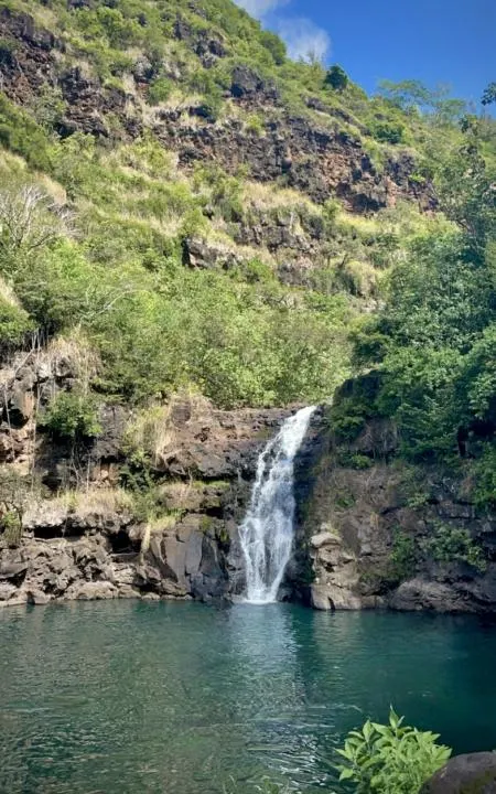
On the North Shore of the island, you will find one of the best hikes in Oahu if you are looking for a great spot to swim and cool off in the hot summer months.
Waimea Falls is located in the Waimea Valley. It costs $25 to enter the park. The trail meanders along a well-maintained paved trail.
Do note, the falls can be dry if there hasn’t been any recent rainfall. But if there has been recent rainfall, it can also be a stunning flow into a swimming hole.
I wouldn’t put this at the top of the list for best hikes in Oahu, rather an add-on if you are looking for a good hike on the north shore. It is usually quite crowded, so try going for off-peak times if you want avoid the crowds.
Pink Pillbox/Ma’ili Pillbox (Pu’u O Hulu):
1.6 mi, 679 ft elevation gain
If you are looking for a short easy hike on the west side of Oahu, then the Pink Pillbox Hike is worth visiting. The trail is pretty exposed with no shade. The west side of Hawaii is known to be hot and dry.
From the top you will get a great view of nearby towns Nanakuli and Waianae.
Parking for the trail is right off Kaukama Road. The trail is easy to follow, but if you are concerned about getting lost, download the Alltrails GPS map so you don’t lose your way.
You will know when you make it to the Pink Pillbox because of the vibrant pink color that contrasts with the surrounding area.
Takeaway | Best Hikes In Oahu Hawaii With Incredible Views
Oahu is one of the best Hawaiian Islands for some surreal hiking opportunities. Many of the hikes climb up in elevation offering epic panoramic views around the island. The southeast near Honolulu definitely has the highest density of hiking opportunities, but there are many other beautiful hikes around the island.
We hope this guide for the best bikes in Oahu, Hawaii with incredible views helps you have an amazing adventurous trip on the island.
If you are heading over to Maui, be sure to check out the Waihee Ridge Trail or some of the most epic waterfalls on the Road To Hana.
Save these ‘Best Hikes in Oahu, Hawaii’ on Pinterest


Best Places To Stay In Oahu In 2023 | Great Hotels For Every Budget - tworoamingsouls
Wednesday 22nd of March 2023
[…] here, you are closer to some of the best outdoor activities in Oahu, like hiking trails, Ho’omaluhia Botanical Gardens, and Kualoa […]
Where To Stay In Oahu, Find The Perfect Spot For You - tworoamingsouls
Wednesday 8th of March 2023
[…] East side is closer to the best outdoor activities in Oahu, like hiking trails, Ho’omaluhia Botanical Gardens, and Kualoa Ranch. Kualoa Ranch is a popular Hollywood film […]