Kodachrome Basin State Park is one of Utah’s most scenic state parks. While often overshadowed by the surrounding national parks, Kodachrome Basin is a unique park with some spectacular natural attractions. It’s $10 per day per vehicle to come experience the park. And while you could easily spend several days exploring, fit hikers can cover most of the trails in the park in a single day.
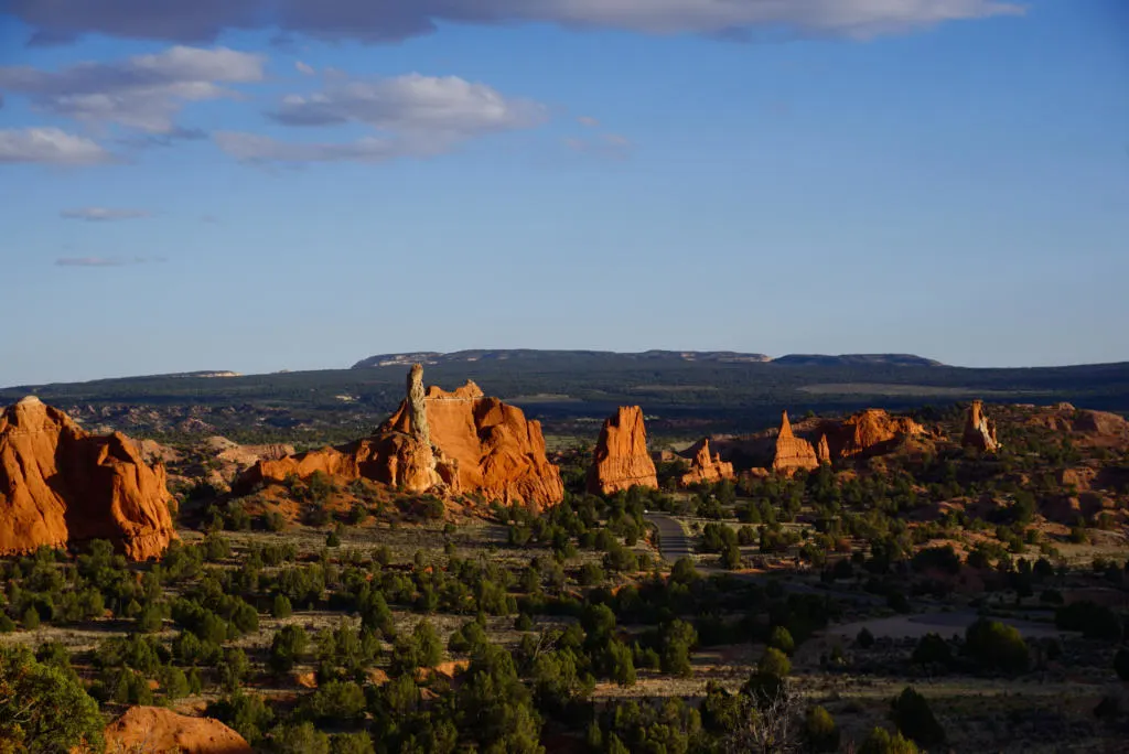
Kodachrome Basin is best known for its many sandstone spires, towers, hoodoos, and also unique sedimentary pipes. These tall skinny rock formations jut out from the desert floor, reaching for the sky. Some form in rows, some in random groupings, or some standing in defiance all alone. There are nearly 70 sandstone spires, ranging from 6 to 170 feet tall. Additionally, there are 67 sedimentary pipes in the park and surrounding land.
The sandstone spires and sedimentary pipes are formed by water and wind eroding the land to reveal pockets of denser rock. This process has occurred over millions of years, but continues happening every day with each gust of wind and drop of rain.
Kodachrome Basin State Park has a great network of trails that explore these rock formations, in addition to caves, slot canyons, natural amphitheaters, and more. These are our picks for the best hikes in Kodachrome Basin.
Hiking Trails In Kodachrome Basin State Park
Angel’s Palace Trail
- Stats: 1.5 miles, 226 ft elevation
- Open to hikers.
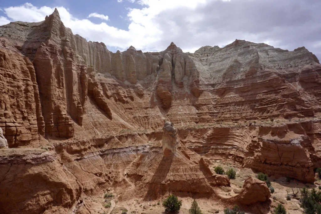
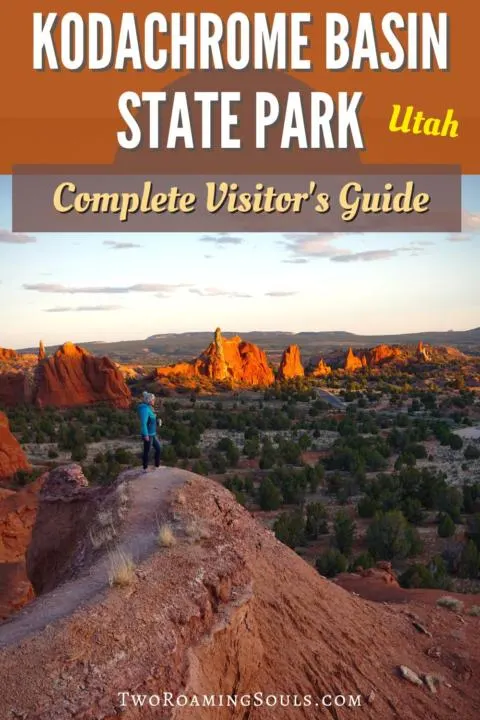
Angel’s Palace is a “can’t miss” trail if you come to Kodachrome Basin, and highly recommended for sunset. This short trail climbs quickly on top of a maze of rock formations for incredible views of the park. And the trail is named after the giant natural amphitheater, Angel’s Palace.
There are several optional thin spur trails that take you out on ledges with steep drop-offs on both sides. These make especially great photo ops, especially with sunset lighting.
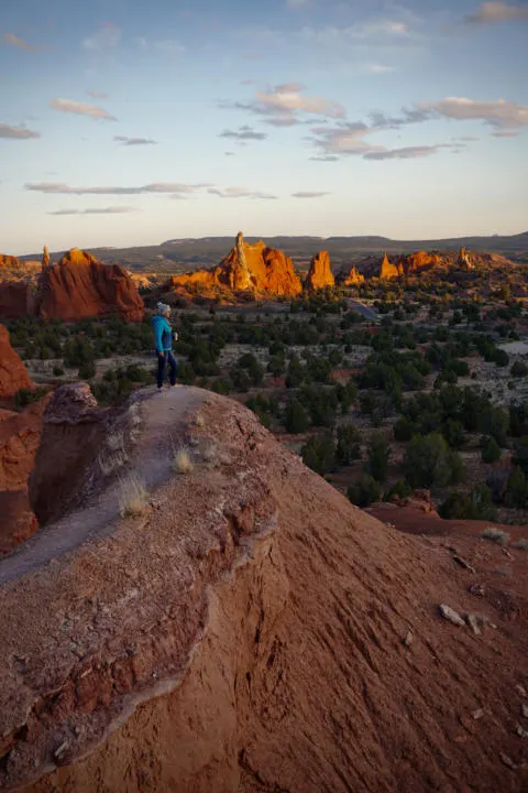
The hike is not very challenging, but some steep sections and loose rock and sand require careful footing. And the trail is not a traditional loop, but rather includes a few short possible loops along the way. With other social trails forming, we did find it a little challenging to follow the “correct” trail at times.
Panorama Trail
- Stats: 7.3 miles, 836 ft elevation
- Open to: Hikers, Horses, Bicycles.

This longer hike experiences nearly the entire western side of the park. It includes many notable features like Fred Flintstone Spire, Indian Cave, Ballerina Spire, Secret Passage, Cool Cave, Mammoth Spire, and of course Panorama Point.
The spur trail to Panorama Point takes you to a vantage point where you can see nearly 360 degrees views of the entire area. All of Kodachrome Basin to the north, the pinkish/white cliffs of Bryce Canyon National Park to the west, and some white mesa peaks in Grand Staircase-Escalante National Monument to the south. The sight is impressive to behold with your eyes but doesn’t necessarily make for great photos, because everything is so far away. Panorama Point makes up the majority of the elevation climb on this hike. So if you are exhausted, you could skip it to make the hike easier.
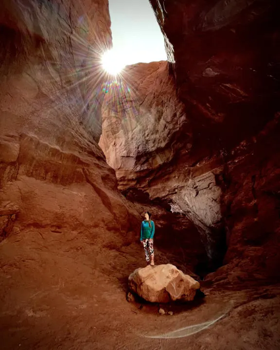
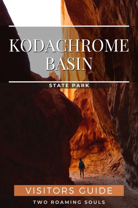
Honestly, the most impressive thing on the hike (and maybe in the entire park) is the Cool Cave. The spur trail into the cave follows a narrow slot as it curves around a corner and eventually opens up into a semi-enclosed cave. In the afternoon sunlight pours into the cave, providing a golden glow that is great for photos. We have been in many slot canyons and caves, and this one is really quite unique and impressive.
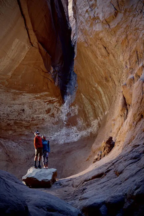
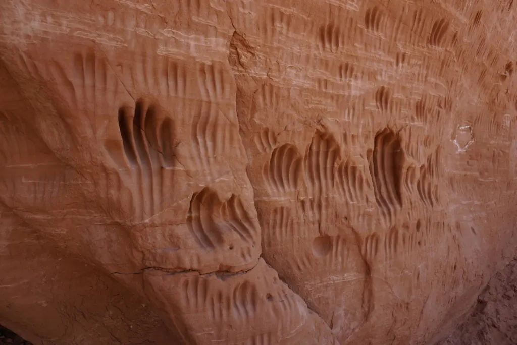
Indian Cave is a small rock overhang along the trail that was inhabited by Native Americans. On the rock wall adjacent to the cave are hand-prints “carved” into the wall.
Grand Parade Trail
- Stats: 2.1 miles, 236 ft elevation
- Open to: Hikers, horses, bicycles.
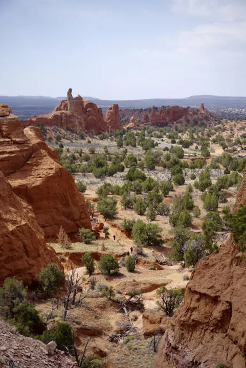
The Grand Parade Trail remains on the floor of the basin. The trail makes a loop around the badlands and rock formations. There are two box canyons to explore along the trail (hikers only). If you have experienced slot canyons before, they are probably a little underwhelming.
Shepherd’s Loop (extension of Panorama Trail)
- Stats: Additional 3 miles
- Open to: Hikers, canyoneers.
Shepherd’s Loop is an add-on to Panorama Trail that is a strenuous 3 miles. It is completed with either a scramble down a wash, or a rappel into Cool Cave. This area is also the only part of the park that allows backcountry camping (with a permit).
Shakespeare – Sentinel Trail
- Stats: 1.7 miles, 318 ft elevation
- Open to hikers.
The Shakespeare – Sentinel Trail makes a loop around a cluster of rock formations in the southeastern corner of the park. The Shakespeare arch collapsed due to natural erosion in 2019. A reminder that the rock formations in Kodachrome Basin are not frozen in time, but yet always changing.
Nature Trail
- Stats: 0.5 miles, 26 ft elevation
- Open to: Hikers, ADA Accessible.
The Kodachrome Basin Nature Trail is the most accessible trail in the park. It follows a short hard-surface loop. The trail has several informational signs that introduce visitors to the plants, animals, and geology found in the park.
Chimney Rock
- Stats: No hiking, 1-mile drive on dirt road
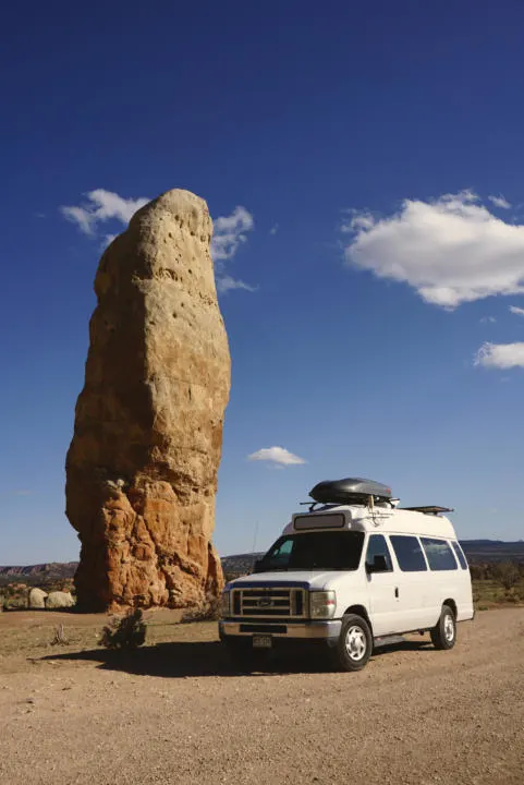
Chimney Rock is the tallest of the sedimentary rock pipes in Kodachrome Basin. A short 1-mile drive on moderately washboard road brings you out to Chimney Rock. It stands alone in a field against a backdrop of badland cliffs.
Trail Rules and Regulations
-Stay on established trails
-Dogs are allowed in the park and on trails, but must be on a maximum 6-foot leash. Clean up after dogs and do not leave them unattended.
-Don’t Bust The Crust: the biological soil crust is vital to the desert ecosystem. Do not step on any crust, one footstep can undo decades of growth.
-Climbing or scrambling on rock faces is prohibited.
-It’s unlawful to touch, collect, or alter any plants, animals, rocks, or artifacts in the park.
Other Things To Do In Kodachrome Basin
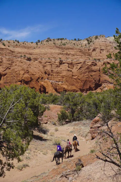
Guided Horseback Riding Tours – These 1-hour ($54) or 2-hour ($75) guided horseback tours are a unique way to see the park.
Disc Golfing Course – This 18-hole disc golfing course begins and ends right at the Visitor Center. You can bring your own discs, or buy/rent from the Visitor Center.
Camping In Kodachrome Basin State Park
For such a small park, Kodachrome Basin has three campgrounds: Basin Campground, Arch Campground, and Bryce Campground. Between the three of them, there are 63 campsites, with a mix of reservable and first-come first-served.
Reservable Sites: 1-31, 46-56, and bunkhouses (6-person cabins). Call (800) 322-3770 or go to stateparks.utah.gov.
There are water and restrooms available at all campgrounds. Each site has a picnic table, cement pad, fire pit, and BBQ grill. A dump site is located only at Basin Campground.
There is a laundromat in the park, and despite it’s rustic old-western vibe from the outside, is quite clean and modern inside.
Or if camping isn’t your style, find hotels and vacation rentals nearby.
Visiting Kodachrome Basin State Park
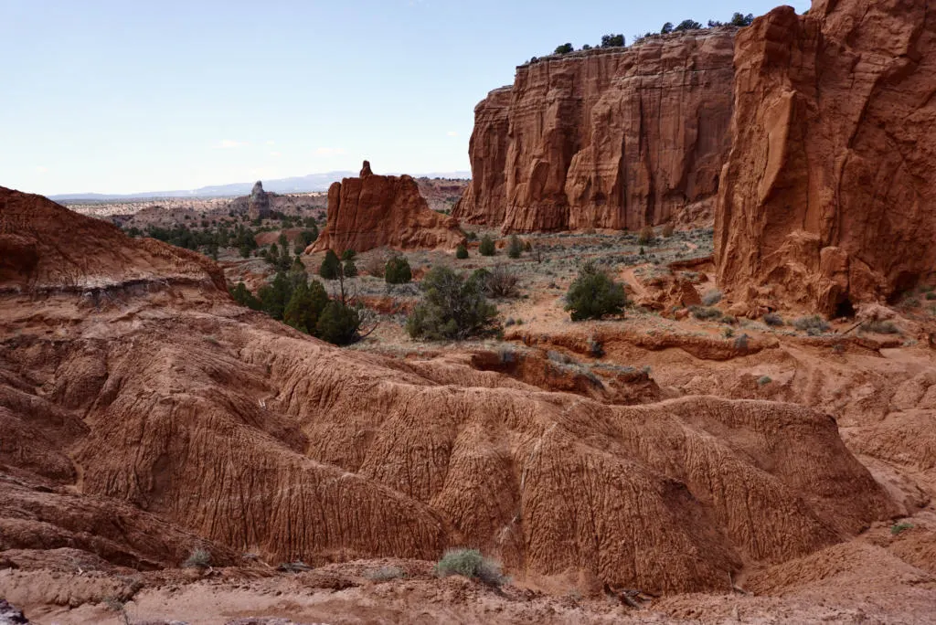
Kodachrome Basin State Park is one of the most scenic state parks in the country. The red sandstone hoodoos and sedimentary pipes are intriguing formations that entice visitors.
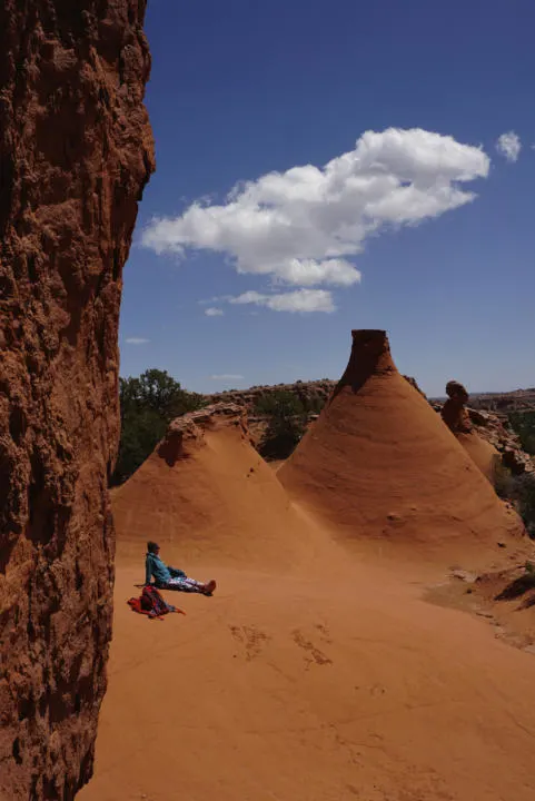
The best time to visit is spring and fall because of the comfortable temperatures. But the fall gets a slight edge because it’s typically less windy. However, the park is open year-round 6am to 10pm. Summer and winter can still be great times to visit for those who are prepared. Summer brings intense heat, often over 100 degrees. And winter can bring fresh layers of snow, adding yet another layer of intrigue. Enjoy your trip to Kodachrome Basin State Park!
Share ‘Kodachrome Basin State Park Visitor’s Guide’ On Pinterest!
