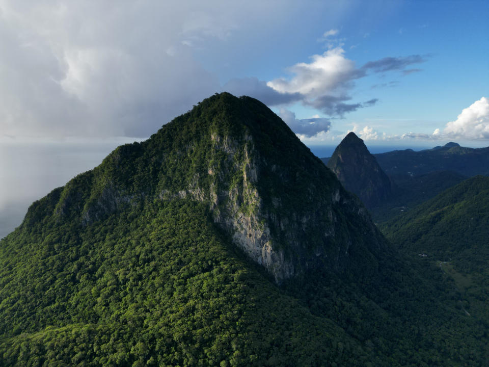
St. Lucia is a beautiful mountainous island in the Caribbean. Beyond sipping a cocktail on one of the best beaches, many adventure seekers are drawn to Saint Lucia to experience the mountains, waterfalls, hot springs, rainforests, and more. The island is most famous for the twin Piton mountains, Petit Piton & Gros Piton, which are a UNESCO World Heritage Site. But whether hiking the Pitons or exploring other attractions, there is a lot to experience on the best hikes in St. Lucia.
The Culture of Hiking in St. Lucia
Hiking in St. Lucia is a little different than what we are used to in the US, where hiking is typically free and individual. Most of the popular trails in St. Lucia require paying for a local guide.
We found that fees could range anywhere from a nominal fee up to $100USD (EC$270) per person! And even noticed people report paying different prices for the same hike. Perhaps people booking blindly through their hotel or a tour operator are getting charged more??? Or locals are just seeing if they can squeeze a little extra money out of people willing to pay more.
Less experienced hikers may be happy to pay to ensure they have a great experience. But for experienced hikers like us, paying for a guide usually felt like an unnecessary inconvenience. Though sometimes guides offered valuable and interesting information about the local environment (plants, animals, history, etc).
Tourism is such a big business in St. Lucia, that nearly everywhere we went there was some local trying to offer some service in exchange for money. In our experience, some paid guides are more official/required than others.
Some of the best hikes in St. Lucia absolutely require paid guides, whereas others might just be an opportune local trying to make some money. So sometimes if you insist that you do not need a guide, you can avoid paying. However many locals make a living by offering guide services. So we often didn’t feel right declining their service, even though we were perfectly capable of completing most hikes on our own.
Preparing For The Climate in St. Lucia
Hiking in St. Lucia requires some special preparation. First of all, it’s hot and humid year-round. Hiking early in the morning can help you avoid the midday sun, but it will still be hot. So prepare to sweat A LOT! You need to bring lots of water to replace the fluids you are losing. And bug spray is recommended for mosquitoes and flies.
St Lucia gets a lot of rain, so prepare for muddy and slippery trails. Bring footwear with good traction, and something to protect cameras and electronics that can’t get wet.
And the last little piece of advice is to check for ‘hours of operation’. And maybe even make a phone call to confirm, because hours posted online were not always accurate.
Tet Paul Nature Trail

Trail Stats
Distance: 0.6 miles (0.97 km)
Elevation: 134 feet (40 m)
Type: Lollipop Loop
Paid Guide: Yes
Cost: ($10 USD, EC$27)
Bathroom: Yes
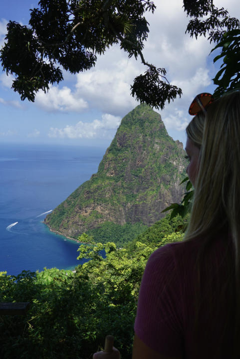
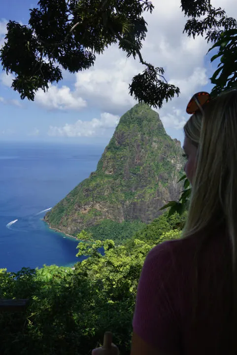
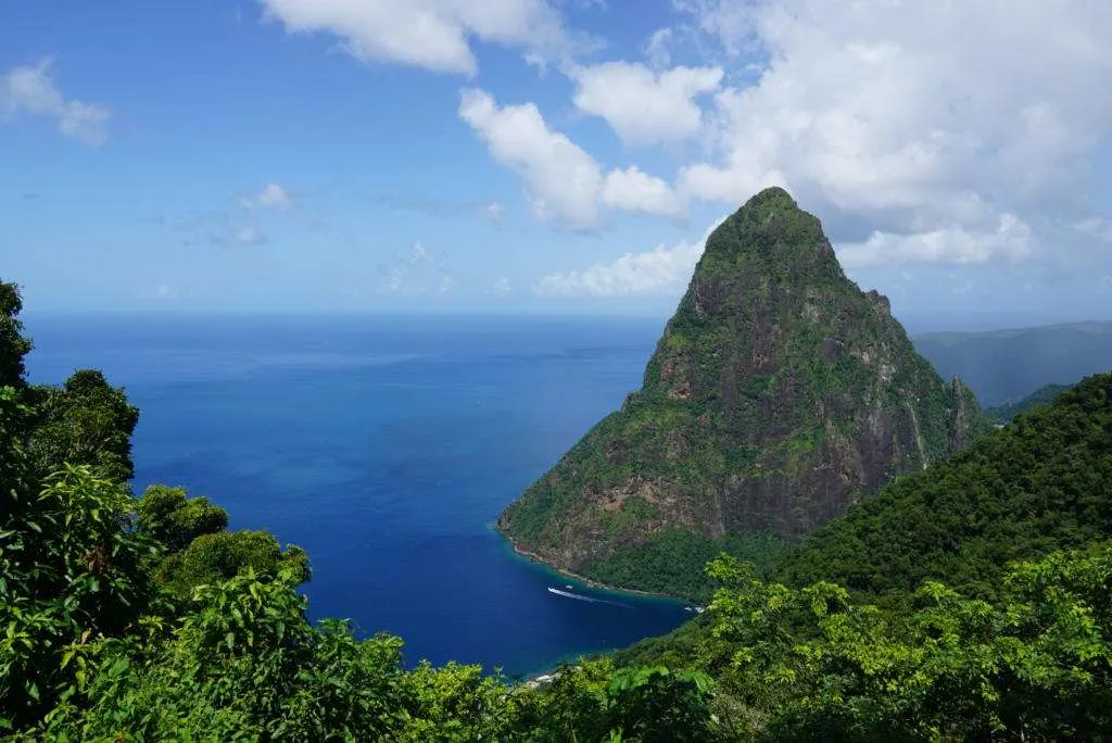
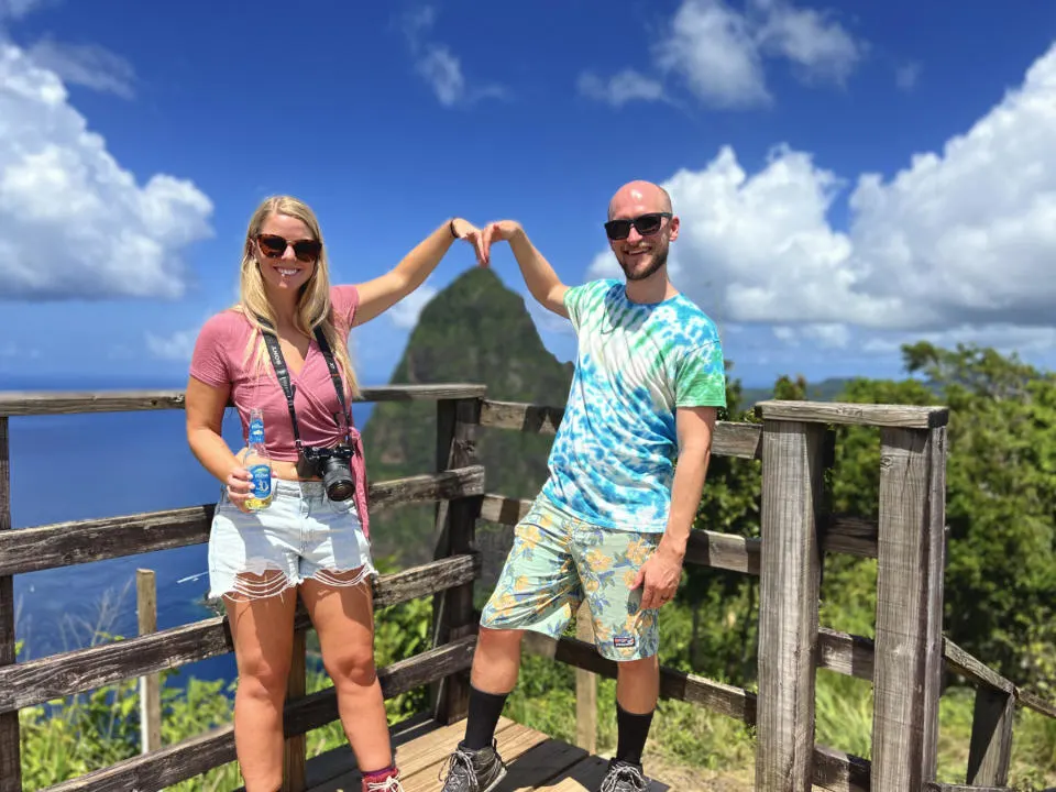
This is an absolute must-do hike in St. Lucia. Quite simply, it offers the best views of the Pitons on the whole island, and the hike is relatively easy. You basically get to drive up most of the way, and then hike the last little bit to a few EPIC viewpoints.
The Tet Paul Nature trail does require a paid guide, but for these views, it’s worth the money. Your guide will take you along the trail while providing interesting information about St. Lucia and identifying the large variety of plants and flowers they have on the property. Their organic farm is loaded with all kinds of bountiful plants. From familiar favorites like pineapple, coconut, and bamboo, to tons of other plants and flowers you’ve probably never heard of. The guide also provides a short tour of a historic farmhouse with old artifacts.
However, the guide is a negative because you feel obligated to keep moving along. You can’t just sit and enjoy the view for long. Our guide was helpful and willing to take photos of us, even giving ideas for funny poses with the Piton. But the final images are still just amatuer “touristy” photos, with some awkward use of Portrait mode.
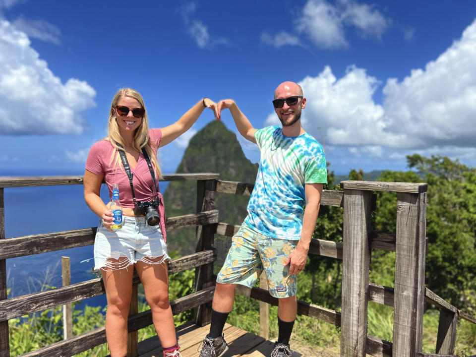
I would have rather set up a tripod and taken more professional-looking photos of ourselves. But I didn’t want to insult our guide.
The hike itself is only a short 0.6 miles, but there is one short steep section up to the top. They do provide walking sticks, but any reasonably fit person will be fine without one (I usually like to keep my hands free for my camera).
There are three main viewpoints along the trail. The first one is right below Gros Piton and looks over the coast to the south (and St Vincent on a clear day).
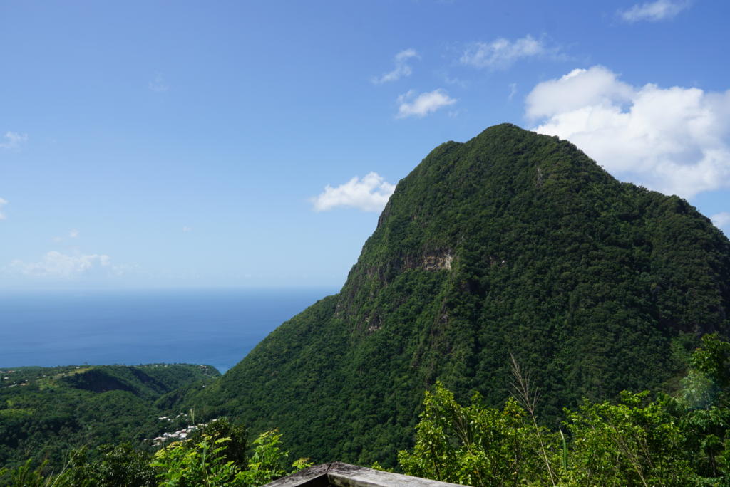
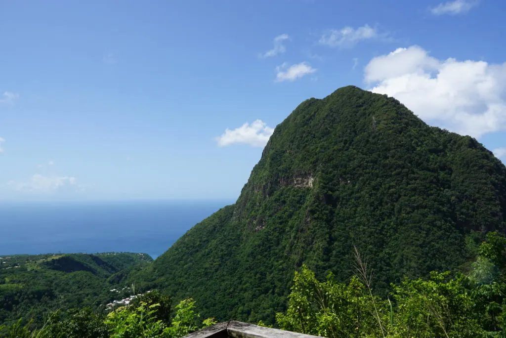
The second viewpoint is probably the most photogenic, with a beautifully framed view of Petit Piton and Jalousie Bay and Sugar Beach. And the final viewpoint at the summit has amazing 360 views.
There is also a vendor at the top selling local snacks, drinks, and souvenirs. So even on the top of a mountain in St. Lucia you cannot escape someone trying to sell you something! The ice cold Piton beer was refreshing though!
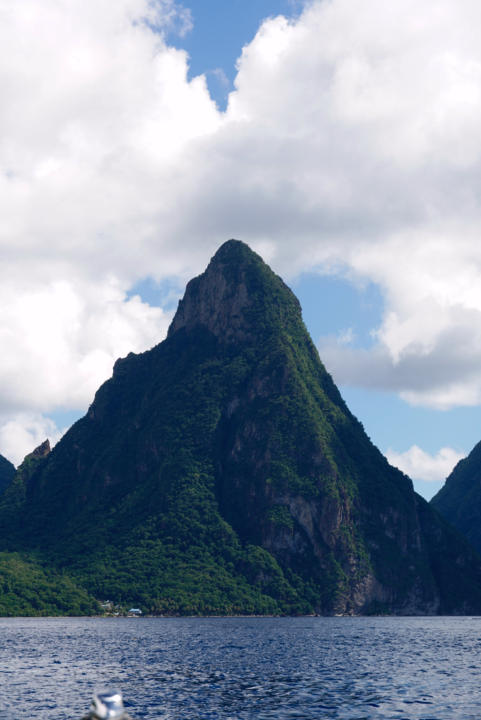
Petit Piton

Trail Stats
Distance: 1 mile (1.6 km)
Elevation: 1,250 ft (381 m)
Type: Out-and-back
Paid Guide: Yes
Cost: $30-$100 USD per person
Bathroom: No
Hiking to the summit of Petit Piton is certainly one of the best hikes in St. Lucia. But don’t let the name and 1-mile distance fool you, this hike is challenging. While it is the smaller of the two Pitons, it is actually the steeper one. The route to the top is so steep that it’s really more of a climb than a hike. While you don’t need actual climbing gear, lots of upper body is required to complete.
Anticipate hot and humid weather no matter when you go, and bring plenty of water. You can expect incredible views of Soufriere to the north, and Gros Piton and Jalousie Bay/Sugar beach to the south.
A paid guide is highly encouraged by the locals, and they can be persistent. But any experienced and fit hiker can complete the trail without a guide. I’ve seen guide prices anywhere from $30 to $140 per person. So I would certainly haggle with them to ensure you don’t get ripped off.
Gros Piton

Trail Stats
Distance: 2.9 miles (4.7 km)
Elevation: 1,814 ft (552 m)
Type: Out-and-back
Paid Guide: Yes
Cost: $50-$100 USD per person
Bathroom: Yes
Gros Piton is the taller (2619 ft, 786 m), and less pointy of the two Pitons. The trail winds around the mountain, making it somewhat less steep than hiking Petit Piton. But make no mistake, this is another steep trail that will require lots of scrambling and upper body strength during the final push.
The best views are from the “halfway” point. You can see Petit Piton, although somewhat cut off by the side of the mountain. After this viewpoint, you begin the final steep push to the top. Views from the actual summit are great but somewhat less magnificent than the “halfway” point. So a lot of people turn back there.
The cost for a guide appears to again be subject to change. (The St. Lucian people are very good at getting money from tourists.) I’ve seen guide prices between $50-$100 USD per person. So again, do everything in your power to insist on $50 per person. They also offer walking poles for $5 USD, you might want them for the first half, but they won’t be much use in the steeper second half.
En Bas Saut Falls Trail

Trail Stats
Distance: 1.4 miles (2.2 km)
Elevation: 567 ft (172 m)
Type: Out-and-back
Bathroom: No
Permit: No
Cost: No, but locals may offer/insist on paid guiding
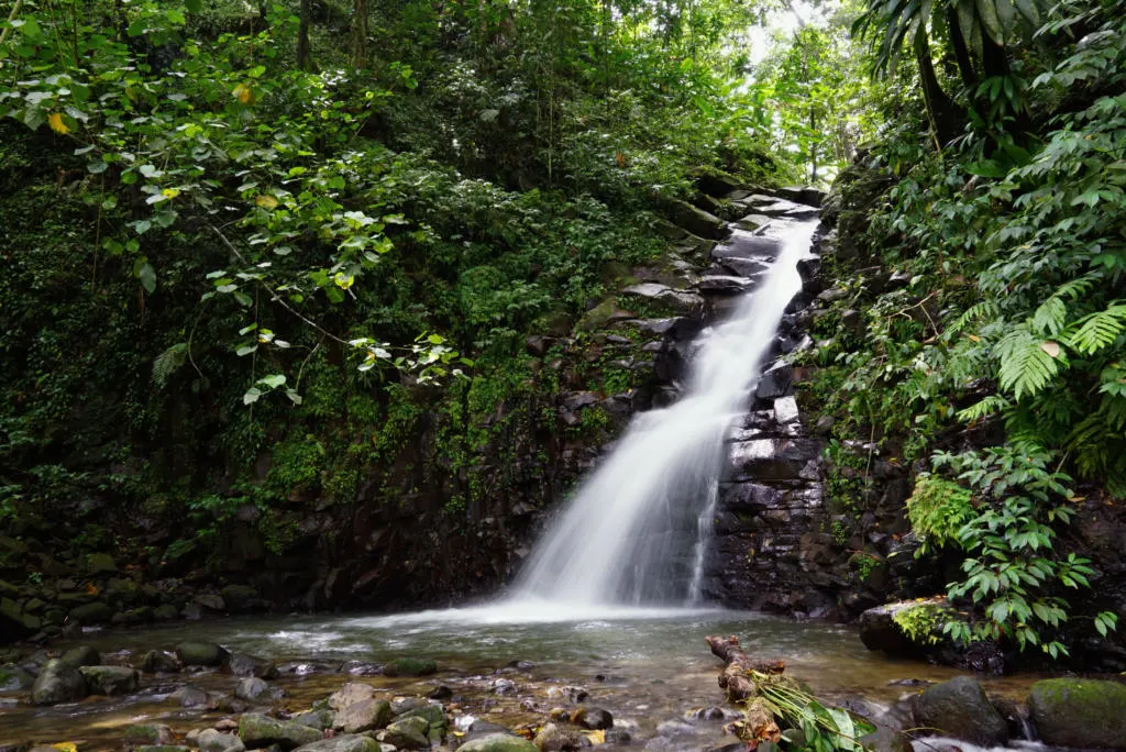
En Bas Saut Falls Trail is one of the more remote hikes in St. Lucia. The falls are tucked deep in the rainforest in the interior of the island. So while the hike itself is not that hard, just getting to the trailhead can be an adventure in itself. The hike to the falls is pretty short (1.5 miles, 2.2km round-trip) but it is steep and often muddy. And there are a few river crossings that may require getting your feet wet, or crossing slippery rocks. The drive to the trailhead requires driving off-road, where high clearance is needed, and 4×4 is recommended. The trailhead is located up the road from the tiny town of Migny. We found that Google Maps would not plan the route there, but Apple Maps would.
But if you do make it out there, the waterfall is definitely a hidden gem. We didn’t see a single other person, which added to the wonder and mystery. The waterfall descends into a plunge pool that is perfect for a refreshing swim in the cool water. If you are serious about doing this hike, I urge you to read my entire post to be well-prepared.
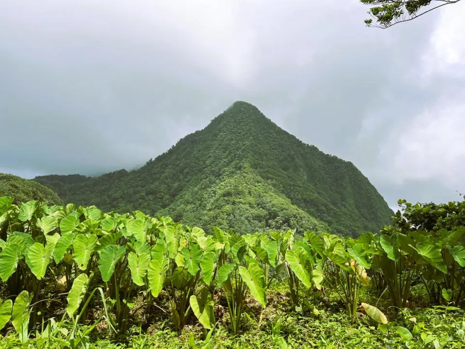
Mount Gimie

Trail Stats
Distance: 2.9 miles (4.7 km)
Elevation: 1,820 ft (554 m)
Type: Out-and-back
Paid Guide: No
Bathroom: No
Mount Gimie is the tallest peak in St. Lucia, standing at 3,120ft (950m) tall. If you are the bold kind of person who wants the achievement of climbing the highest peak, then Mt Gimie is your answer. But be prepared for a crazy and difficult adventure.
The trail doesn’t have many views, but rather a “deep in the jungle” kind of feel. So if you are thinking “highest peak = best views” then I would consider one of the other hikes on the list. You can see nearly the entire island from the top, but there’s a good chance the views are blocked by clouds.
Along the trail, there is a waterfall but it doesn’t quite make the list of best waterfalls in St. Lucia.
The hike begins high in the rainforest, and even getting to the trailhead is a challenge. The pavement ends a few miles before the trailhead and its a bumpy ride from there. A high-clearance vehicle is nearly essential and 4×4 is recommended. Just like En Bas Saut Falls, the trailhead is located up the road from the tiny town of Migny. We found that Google Maps would not plan the route there, but Apple Maps would.
Canaries Waterfall Trail
Trail Stats
Distance: 4 miles (6.4 km)
Elevation: 1,512 ft (460 m)
Type: Out-and-back
Paid Guide: No
Bathroom: No
The Canaries Waterfall Trail is located just up the hill from the fishing village of Canaries. This trail has a few great waterfalls to see. But the only reason I would avoid this hike is because of snakes. Several locals told us the venomous Fer-De-Lance snake is common in this area. Maybe take it with a grain of salt, but said they refused to even go there.
Fort Rodney and Signal Hill
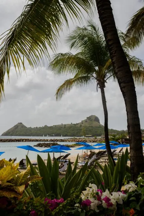
Photo by Christina Victoria Craft on Unsplash
Trail Stats
Distance: 1.5 miles (2.4 km)
Elevation: 288 ft (88 m)
Type: Out-and-back
Paid Guide: No ($10 entry fee)
Bathroom: Yes
The hike to Fort Rodney and Signal Hill is located in Pigeon Island National Park. The daily admission fee for the park is $10 USD ($27 EC) per person. Of all the best hikes in St. Lucia, this one offers a nice blend of exercise, views, and history. The park sits on a hilly peninsula on the northwestern tip of St. Lucia. But it wasn’t always that way. Pigeon Island used to be an actual island until 1972 when a man-made causeway was built during the dredging of Rodney Bay.
The island has artifacts from the Arawak and Carib people, ancient inhabitants of the island. Then the actual Fort Rodney was built by the British and used as a strategic defense against the French stationed in Martinique. On most clear days you can see Martinique, St. Lucia’s neighboring island to the north. See the ruins of the old Fort Rodney, cannons, soldier barracks, and prison cells.
The hike has a short steep climb to the top of Signal Hill, which you could skip if you are not up for it. But it does offer the most panoramic views of the area.
Conclusion | Best Hikes In St. Lucia
As you can see, there is a lot to experience on the best hikes in St. Lucia. From stunning mountains and waterfalls, to rainforests and historical sites. If you are someone who gets bored sitting on a beach everyday, then you can certainly find some excitement on the trails in St. Lucia.
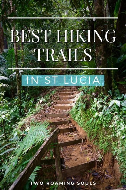
Help Share ‘Best Hikes in St. Lucia’ On Pinterest!


Best St. Lucia Excursions & Tours (Snorkeling, Scuba Diving, Mud Baths & more) - tworoamingsouls
Saturday 15th of April 2023
[…] A popular hike in the North near Gros Islet at Pigeon Island National Park is Fort Rodney and Signal Hill. The hike is 1.5 miles (2.4 km) and 288 ft (88 m) in elevation. Or this private north tour will guide you through this hike and any other northern activities of your choice. In our St. Lucia hiking post, you can learn more about this hike and other great hikes in St. Lucia. […]
Where To Stay in St. Lucia Ultimate Guide (Which Side Of The Island Is Best)? - tworoamingsouls
Friday 17th of March 2023
[…] west side of Saint Lucia is a popular tourist hub for the most popular hiking, waterfalls, mudbaths, hot springs, etc. on the island. Therefore, when looking for where to stay […]
En Bas Saut Falls Trail | Adventurous Hike In St. Lucia - tworoamingsouls
Tuesday 13th of December 2022
[…] Now it’s time to find your next hike to do in St. Lucia! […]
Best Beaches in Soufriere | Ultimate Guide - tworoamingsouls
Tuesday 13th of December 2022
[…] be sure to check out some of the best hikes in St. Lucia as well! En Bas Saut Waterfall was our favorite for getting more remote on the […]