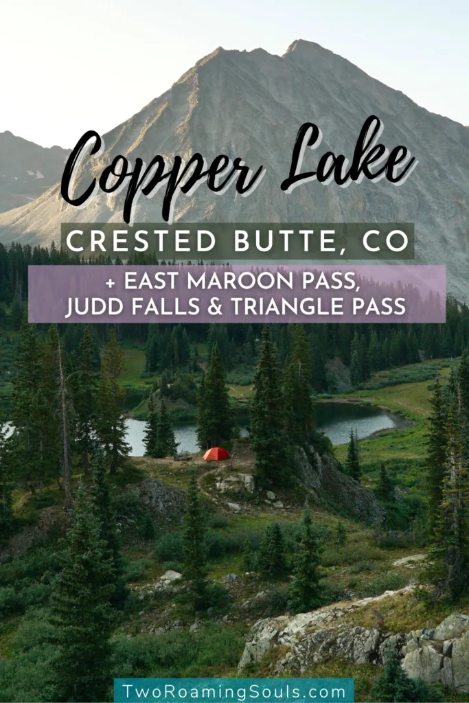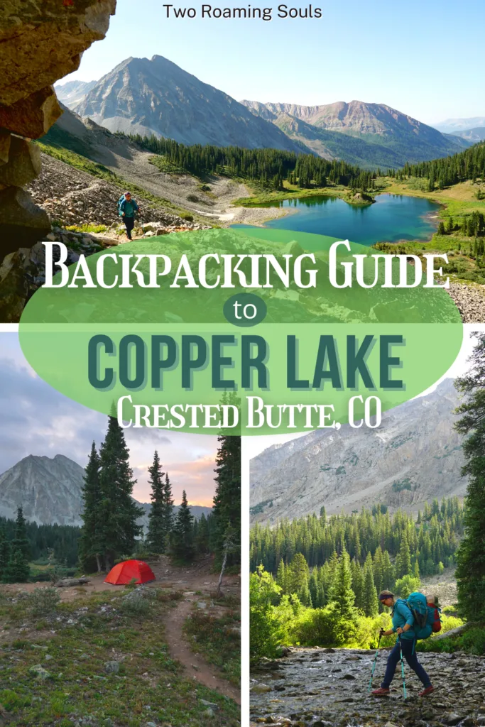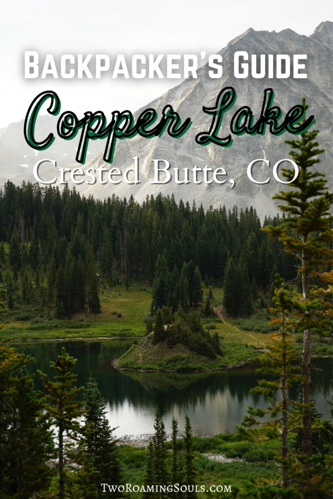
Copper Lake is one of the prettiest Alpine Lakes in the Crested Butte area. The trail is a well-marked intermediate trail, that can be done as a long day hike or as an overnight backpacking adventure.
In this guide, we include all the details for day hiking up to Copper Lake Trail. As well as a detailed guide for backpacking around Copper Lake. Along Copper Creek Trail you will encounter Judd Falls and continuing past Copper Lake you can reach the top of East Maroon Pass.
And if you are up for an all-time adventure, you can add in the challenging Triangle Pass loop hike.
This post may contain affiliate links. Disclosure policy.
Stats For Copper Creek Trail Up To Copper Lake
Distance: ranges depending on the parking lot and final destination
- Shortest route: 10 miles (from the upper parking lot to Copper Lake roundtrip)
- Longer route: 13 miles (from the lower parking lot to the top of East Maroon Pass roundtrip)
- Including Triangle Pass: additional 6 miles roundtrip
Elevation: ≈1800 ft – 2431 ft (depending on parking lot & final destination) Additional ≈2585 ft including Triangle Pass
Difficulty: Moderate
Type: Out & back
Permit: No (but overnighters register at the registration box after Judd Falls)
Bathroom: At Lower Trailhead
Dogs: Yes (must be on leash)
Trailhead for Copper Lake
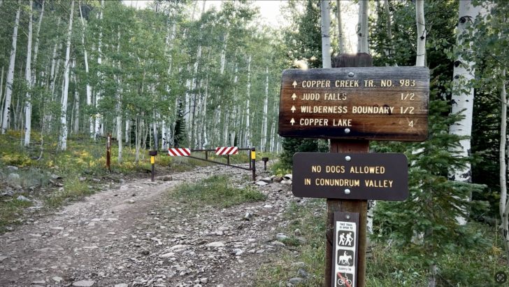
Getting to the trailhead from town is rather easy. Drive North on Gothic Road (aka County Road 317). You will pass through the “Gothic Ghost Town” (which is now the Rocky Mountain Biological Laboratory). You will run into the Judd Falls/Copper Creek Trail head right after the town of Gothic.
There are two different trailheads for the Copper Creek Trail. The lower parking lot is easy to get to for any 2WD vehicle. There is also a pit toilet at the lower lot.
Additionally, there is an upper parking lot for Copper Creek Trail. 4WD and high clearance are encouraged. However, it is only .5 miles, and if you have decent off-road experience, it can be done in a 2WD, high-clearance vehicle. (We drove the road in our 2WD campervan).
There are several sections that absolutely require high clearance and strategic driving. If you have doubt at all, you should just hike up the road!
The upper parking area is rocky, but enough flat spots to park to fit 10+ vehicles.
When Is The Best Time Of Year To Hike Copper Creek Trail

The best time to hike Copper Creek Trail is in late summer to early fall, from June to October.
Do note, that in early June, there might still be snow on the trails, and you can expect most of the river crossings to be flowing heavy (more details below). Also, depending on the summer temperatures, the lake might still be frozen.
During the months of July & August are the best months to hike to Copper Lake. Crested Butte is known as the wildflower capital of Colorado. During these months you can experience an abundance of blooming wildflowers!
Copper Creek Trail is closed in Winter due to snow (typically December-April).
How Many Days Do You Need At Copper Lake
Copper Lake can be done as a day hike. But Copper Lake is also a popular overnight backpacking route.
And if you add in Triangle Pass, you can extend the trip to a 3-day, 2-night backpacking adventure (which is our suggestion)!
Start Of Copper Creek Trail to Copper Lake

The hike will either start at the lower Judd Falls/Copper Creek Trailhead and you will hike up to the upper lot via the road. Or if you choose to drive this portion, the hike will start from the upper lot saving about 1 mile of hiking roundtrip.
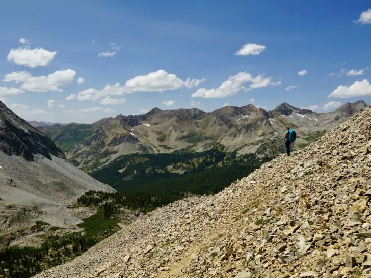
From the upper lot, you pass by a gate blocking cars from driving further up the road. The trail starts off on a wide rocky path with a slight incline. The path passes through a beautiful aspen grove and narrows in width.
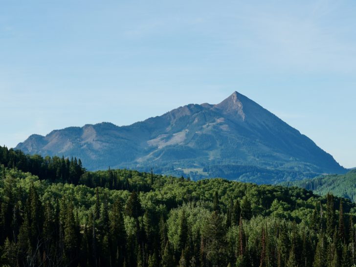
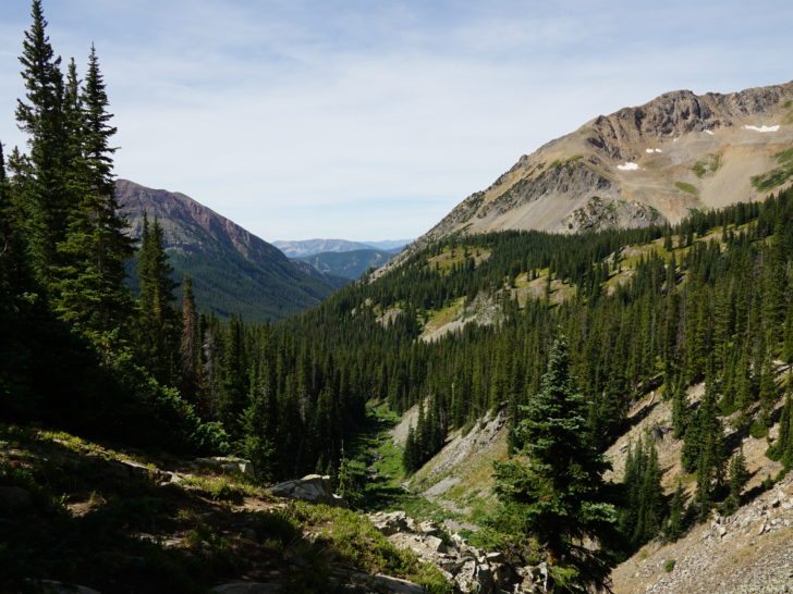
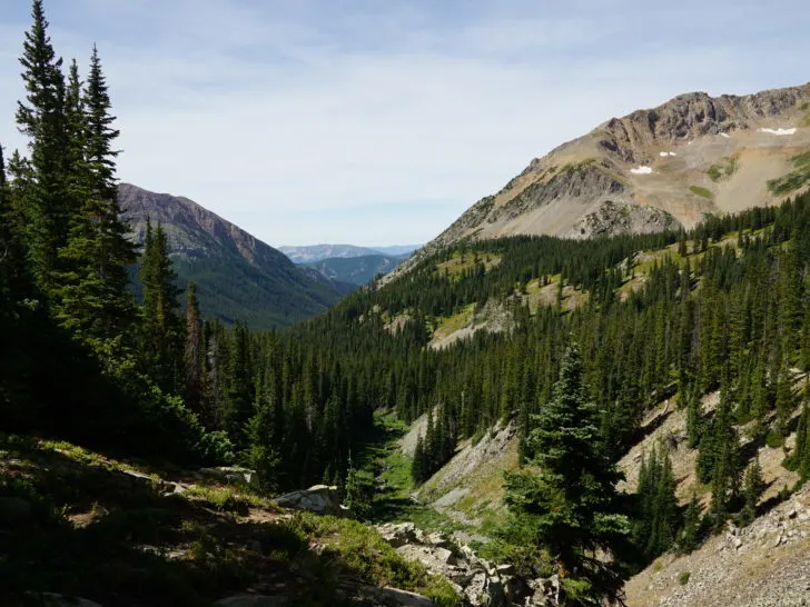
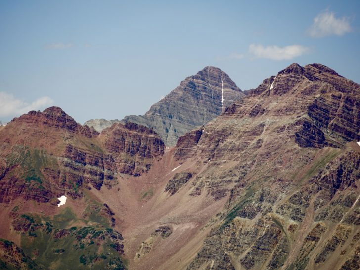
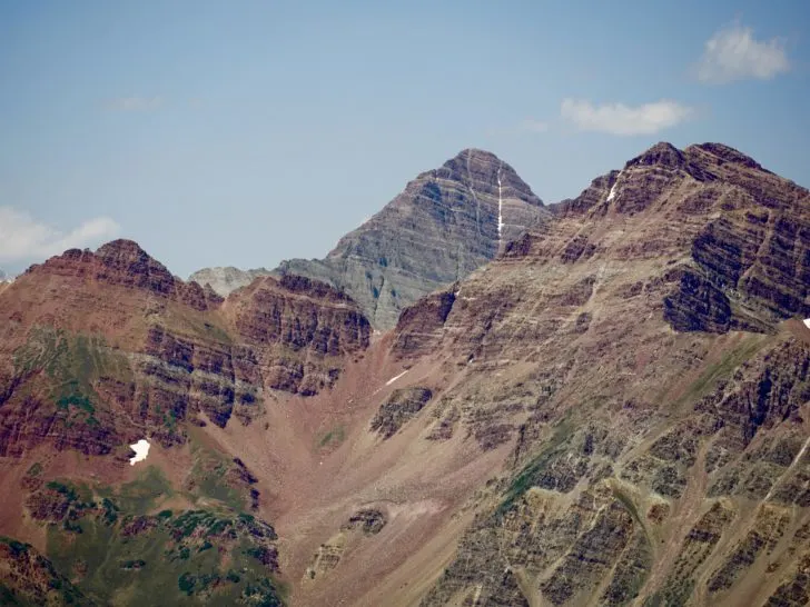
Shortly, you pop out to the valley where you get epic views of Gothic Mountain, Snodgrass Mountain, and Mount Crested Butte.

Around .6 miles from the upper parking lot you reach Judd Falls Overlook.
Judd Falls

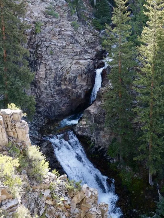
A popular stop or final destination on the Copper Creek Trail is Judd Falls. The trail leads to a nice bench overlooking the cascading Judd Falls. Personally, the falls are a bit underwhelming so we continued on the trail quickly.
Hiking a bit further up the trail offers a bit more of an open view of the falls. But there is no hike leading down to the falls, so the overlook is really all you get.
Many people turn back here and head back to the trailhead. But obviously, since you are reading this post, you want more details about heading up to Copper Lake!
Continuing on Copper Creek Trail

The trail continues past the falls up toward the lake. If you plan on backpacking Copper Lake Trail, you need to register for an overnight permit via the registration box. It is a free self-issue permit.
Continuing on the trail, there is a large cliff edge, so pay attention here and stay far left from the cliff.
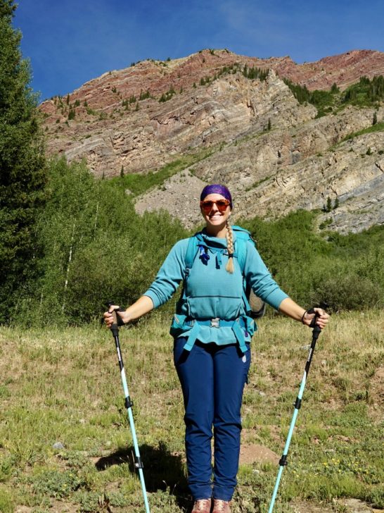
The trail is pretty wide most of the route but can be rocky in some sections. We suggest using hiking poles not only for propulsion but also for balance, especially on river crossings.
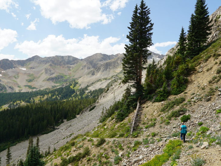
After Judd Falls, the hike meanders through a nice forest and eventually opens up to an open valley. Shortly after this portion, you will run into the first river crossing.
First Creek Crossing to Copper Lake
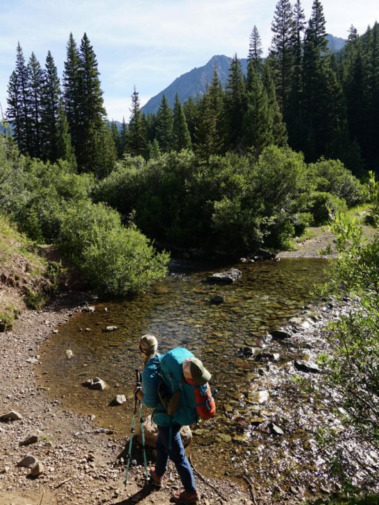

The first creek crossing has the heaviest flow of water and the widest crossing of the hike. In early summer the crossing will be flowing pretty good, and there is no way to cross without getting your feet wet.
We suggest switching to a river hiking shoe that can offer good traction and easily dry or shed water. Additionally, having a good pair of hiking poles will offer stability when crossing the rushing creek.
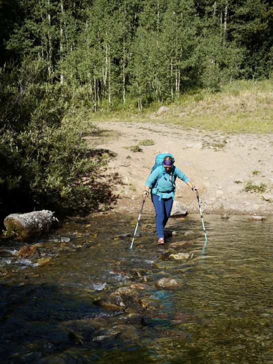
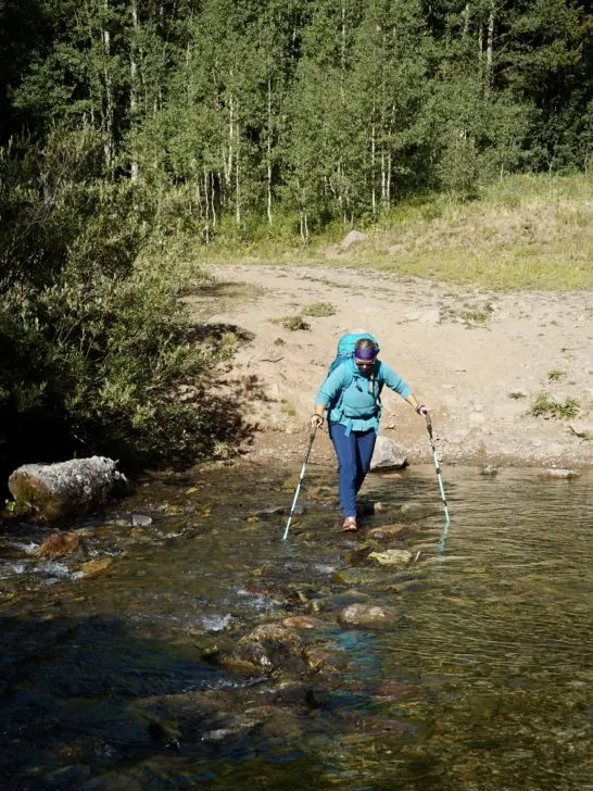
During late summer, the water level is flowing much lower. If you have a good pair of waterproof shoes, you can cross the creek on some small rocks without getting your feet wet. If your shoes aren’t waterproof, then you will likely need to take them off or commit to soggy feet.
Then, continue on the trail through the forest.
2nd-4th Creek Crossing to Copper Lake
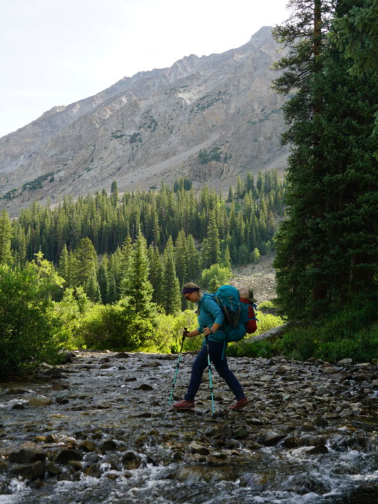

Shortly after the first creek crossing, you will hit the “2nd creek crossing”. This is just a small flow of water that goes over the trail. There are a few logs that can help you get across without getting your feet wet (as of Aug 2023). Obviously, the flow of water can easily change anything in its path.
The 3rd creek crossing is wide which helps level out the flow a bit, there are a few different levels in the creek. In early summer, you will likely need to cross without shoes or a change of shoes, but later in the summer, you can cross without getting your feet wet.
The 4th crossing is another smaller creek crossing with logs that can maybe help you cross without getting your feet soaked.
Ultimately, expect to need to change shoes for the creek crossings or have soggy feet for the remainder of the hike. If the water level is low, you may get lucky and keep your feet dry!
After the 4th creek crossing the trail gets slightly steeper in elevation. But overall it’s still a moderate elevation change. The last mile has the steepest incline and gets a bit rockier.
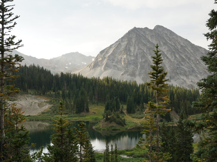
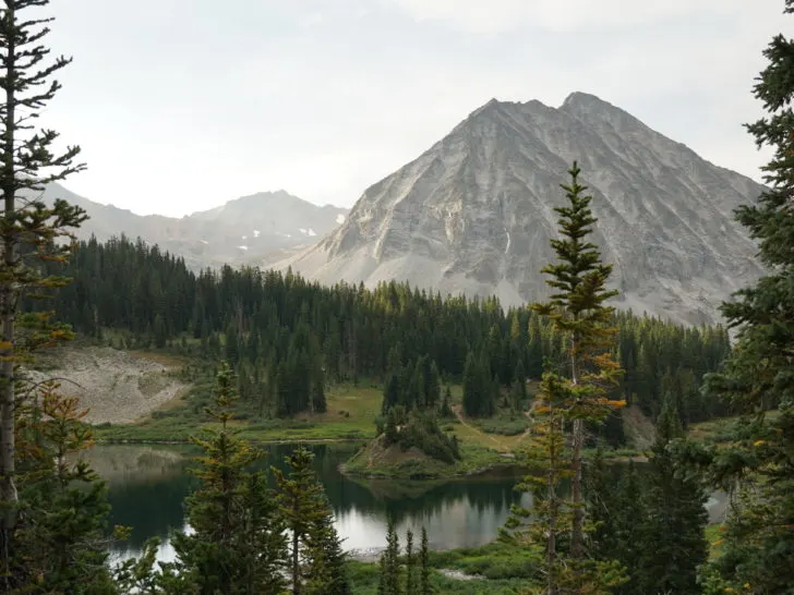
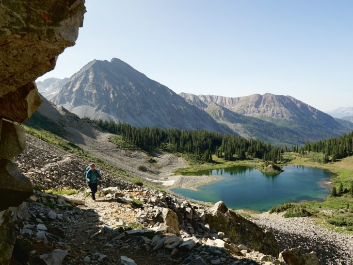
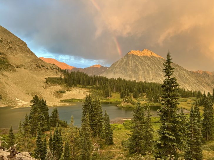
Copper Lake

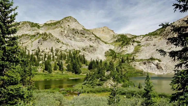
Finally, you reached the stunning Copper Lake!!! There is a small “island peninsula” that you can climb for a fun perspective of the lake.

We highly suggest crossing the small creek to the left (west) side of the lake. Here you can see White Rock Mountain behind the blue-green-colored lake and pine trees in between.
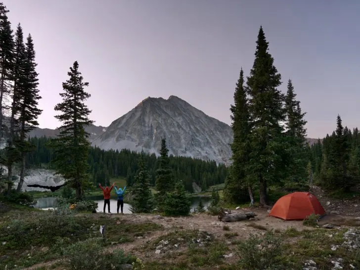
Camping At Copper Lake
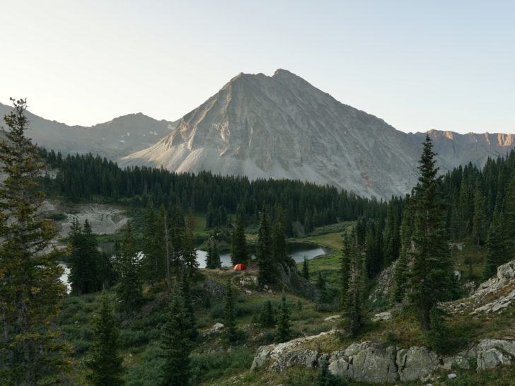
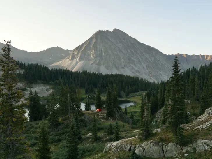
Camping at Copper Lake is only allowed at designated sites. There are 6 sites available around the lake.
Hiking in you will encounter campsites 5 & 6 first right before getting to the lake. Campsite 5 is barely off the trail but has the easiest access to the water.
Campsite 6 is on the edge of the cliff with epic views down the valley but no views of the lake.
Just across the creek is campsite 2-4. Campsites 2 & 3 have brief views of the lake but have a nice view of White Rock Mountain. Campsite 4 is tucked away (South) behind campsites 2 & 3 (also views down valley).
Campsite 1 is a gem and has the BEST views of all the campsites. But it is also the hardest to get to and adds about a ¼ mile to the hike. Therefore a ½ mile roundtrip any time you want to come back to the main trail. And it’s the furthest from the lake shore.
To get to campsite #1, follow along the trail to the right (west), through the “swamp” area. You will need to slightly bushwhack to get to campsite 1, but it’s truly the best view there!
During weekends in peak season (July-early August), campsites can be competitive.
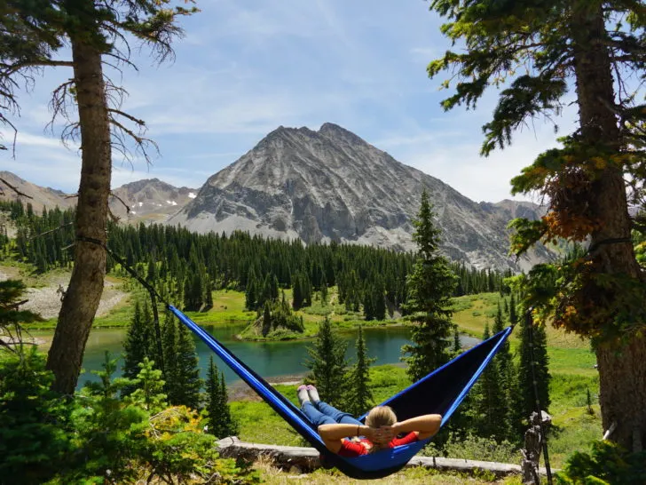
Swimming At Copper Lake
Swimming at Copper Lake is allowed, but keep in mind this is an Alpine Lake. Diving into frigid water head first can lead to Cold Water Shock. This means you hyperventilate underwater due to the shocking temperatures and take water into the lungs.
It’s best to get into an alpine lake feet first and gradually rather than jumping in.
The shoreline of Copper Lake is either rocky or has spikey shrubs. Plus it is mucky around the shore, so be careful swimming.
The best places to enter the water are on the peninsula in the middle of the lake or from Campsite #1 there is a trail down to the rocky northeast corner.
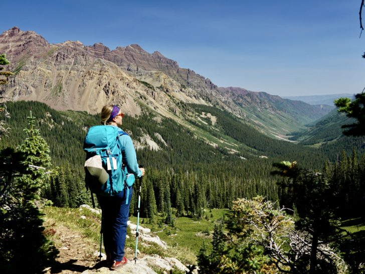
East Maroon Pass

East Maroon Pass is an extension of Copper Creek Trail. Once you reach the lake there is a path around the lake to the right (east). The trail transitions from Copper Creek Trail to East Maroon Pass 1983.
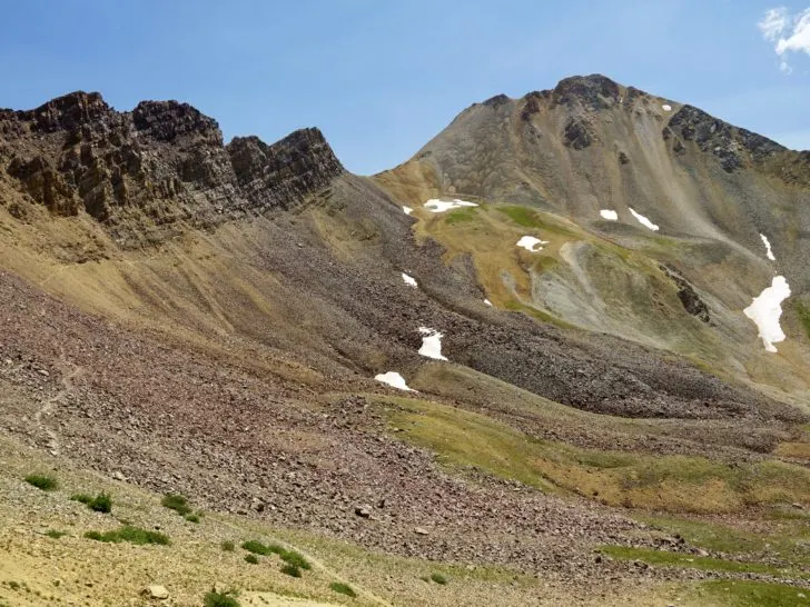
East Maroon Pass 1983 follows along the back side (north) of the lake in a rock scree field. Here you will gain elevation as you climb around the back of the lake. It offers great views above the beautiful alpine lake, views down the valley, and White Rock Mountain.
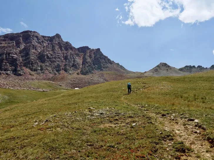
As you continue climbing, you will leave the view of the lake and climb up in elevation. Here you can witness tons of beautiful wildflowers. Then, you hit the summit where you can see down the East Maroon Valley.
Many hikers turn back here (especially if day hiking). But you can continue on this trail down the valley or do a loop hike on Triangle Pass which circles back to Copper Lake. Or continue to Conundrum Hot Springs.
Triangle Pass Loop (aka Copper Pass)

If you do Copper Lake as a 3-day+ backpacking route, then you can easily add in a loop day hike around Triangle Pass. The hike is 6 miles and from my brief calculations (2585 ft elevation gain).
We highly suggest using a GPS tracker because the trail is hard to follow in sections. We personally like to use AllTrails. You can pay for AllTrails+ to download the map which will track your route. But there is a free way to use the app.
Before going on the hike make sure you look up the hike and save it to a list via the AllTrails App. Be sure to click on the map when you have service so it loads in the app. This should allow you to use the map offline.
This hike is not an easy adventure, but surely gets you off the beaten path. On a weekday, we didn’t see a single soul out on the trail after parting from East Maroon Pass.
After reaching the summit of East Maroon Pass, you will gradually descend down in elevation back to the tree line on the valley floor. You will get glimpses of the red wall that makes West Maroon Pass so epic. But don’t worry, you will get a grand view of this wall as you climb back up Triangle Pass.
Once you reach tree line, continue going down in elevation until you come to another creek crossing. Again, depending on the time of year, you may or may not get your feet wet. You cross back and forth a couple of times, but eventually, you will want to end up on the right side of the creek to continue on the trail. (This might be a good time to check your GPS to make sure you are on the right path, we noticed a few spur trails).
The trail then opens up to a meadow. Eventually, you come to another creek crossing in the forest. There is a small waterfall, but it can be hard to see unless you go off trail.
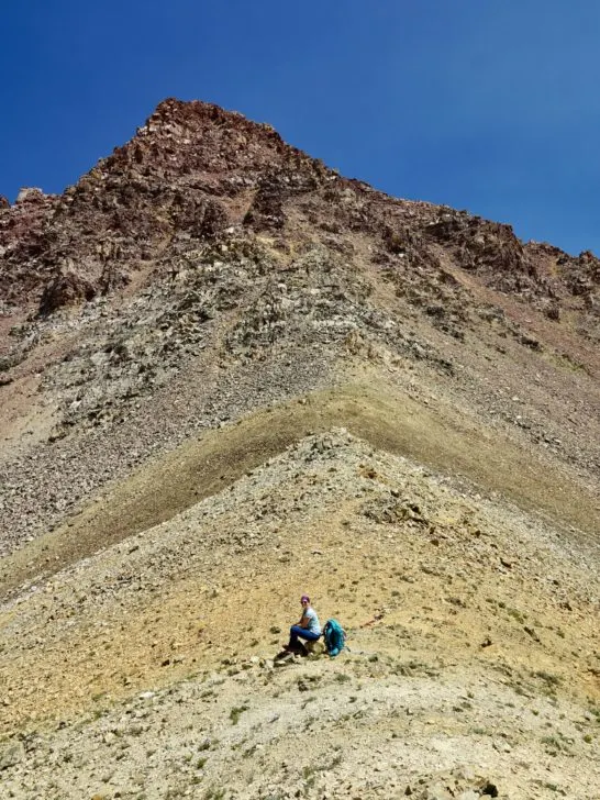
Summiting Copper Pass toward Triangle Pass

The trail splits shortly after this creek crossing. This is a crucial turning point to continue toward Copper Pass/Triangle Pass. The trail turns right (southeast) on Copper Spur Trail 1983.1.
Otherwise, East Maroon Pass 1983 travels 7 miles on Maroon Creek Trail 1982 along the East Maroon Creek. From here you climb around 1468 ft in elevation to the summit of Copper Pass. It passes through an alpine tundra field. Look out for a few cairns if you get lost or follow a GPS.

Once you reach the summit of Copper Pass, there will be another crucial turn on the trail. The right trail (southeast) leads back toward Copper Lake. The left will lead along Triangle Pass Trail to the summit of Triangle Pass.

This is another way to reach the Conundrum Hot Springs from the Crested Butte side (do note you need permits to camp near the Conundrum Springs). The Conundrum Creek is often accessed via the Aspen side, which is a much shorter trail.

Bear Safety At Copper Lake
Copper Lake and the surrounding areas are in black bear country, so there are a few important bear safety tips to know.
We recommend carrying bear spray with you and having it easily accessible.
It is required to carry a Bear Canister when backpacking in this area. You must keep all food and scented items in here when the items are not directly with you or in your bag next to you.
Cook meals away from your tent site. And store the bear canister at least 80 paces away from your tent overnight.
Weather Along Copper Creek Trail

When hiking in the mountains, there is always a chance for afternoon thunderstorms. Check the weather before sending out on the hike. But note that the projected weather can not always predict what the mountains will do.
Be prepared for any type of weather when hiking in the mountains. Pack layers, a rain jacket, and enough water.
Altitude Sickness
Do note this climb is at a high elevation. If you are coming from sea level or not acclimated to the elevation, your risk for altitude sickness increases.
This happens when your body doesn’t adjust to the lower oxygen levels and changes in air pressure. You might experience a headache, vomiting, loss of coordination, etc. If you feel any of these symptoms, you should turn back immediately to a lower elevation.
What To Pack For Copper Lake Backpacking Trip
Backpacking to Copper Lake is only allowed in Fall, Summer, and Spring. But due to the high elevation, it can get pretty chilly at night and early mornings. We suggest packing warm layers. Additionally, you should always have a rain jacket and a way to cover your backpacking to prevent items from getting soaked.

Here is the Ultimate Backpacking Checklist, including the essentials, bonus luxury items, and more.
Leave No Trace At Copper Lake
As always leave no trace principles apply when backpacking in the Grand Mesa, Uncompahgre, & Gunnison National Forests, and the Maroon Bells-Snowmass Wilderness.
There is no toilet at the lake or anywhere along the trail. You must dig a hole 6-8 inches deep and choose a site at least 200 feet away from water, campsites, and trails. Or you can always opt to carry your own waste in a wag bag.
Where To Filter Water At Copper Lake
There is an abundance of great places to filter water along Copper Creek Trail and at Copper Lake. There are 4 different creek crossings along the trail. Of course, you can also filter water from the lake itself.
Or there is also the creek flowing into the lake and the creek flowing out of the lake that can offer great places to filter water at Copper Lake.
We highly suggest the Platypus Gravity Works water filter. We’ve had this filter for years and it’s always easy to use and pumps out delicious and safe drinking water!
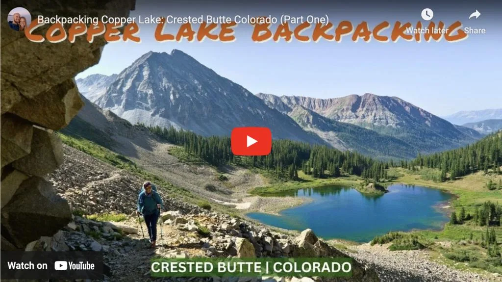
Check Out Our Video Backpacking Up To Copper Lake

Related Posts To Copper Lake in Crested Butte:
For more details on Triangle Pass, check out our detailed guide for the loop hike.
After the day hike, you might want to grab some tasty grub from one of the best restaurants in town. Plus here is a whole guide for the best things to do in Crested Butte.
Save this post for later