Triangle Pass is a unique off-the-beaten-path loop hike in the middle of the Maroon Bells-Snowmass Wilderness. You can access this hike from either Crested Butte or Aspen.
The Triangle Pass Loop crosses between the Gunnison National Forest and White River National Forest.
There are 3 different routes that will lead you to the Triangle Pass Loop. One route from Crested Butte and 2 different routes from Aspen. All routes offer a challenging hike no matter which one you take.

While Triangle Pass Loop will only take a day to hike, it will be an add-on hike to the 3 different routes leading you to the loop hike. Each hike to the pass is long with considerable incline. We suggest doing it as an overnight backpacking trip or longer because of the long routes leading you to the pass itself.
In this post, I will cover the 3 different ways you can summit Triangle Pass. You can do any of these hikes as an out and back. Or if you have multiple cars or a shuttle you can do this as a thru hike. Some of the routes will require a permit and/or staying in designated campsites.
This post may contain affiliate links. Disclosure policy.
Stats For Triangle Pass
Distance:
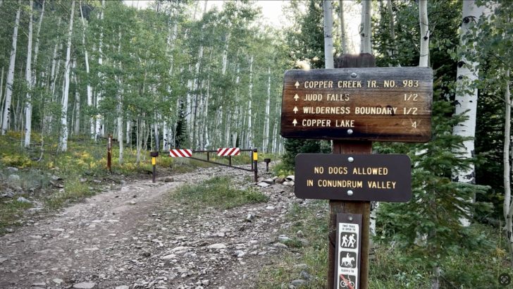
- Crested Butte Side via Copper Creek Trail: 17.96 miles
- Aspen Side via East Maroon Pass Trail: 24.77 miles
- Aspen Side via Conundrum Creek Trail: 26.14 miles
Elevation:
- Crested Butte Side via Copper Creek Trail: 4,282 ft
- Aspen Side via East Maroon Pass Trail: 5,200 ft
- Aspen Side via Conundrum Creek Trail: 6,673 ft
Difficulty: Hard
Type: Out & back (but can also be done as a thru-hike)
Permit: Depends on route (Need permit to camp at Conundrum Hot Springs)
Bathroom: At Lower Trailhead For Copper Creek Trail (None at East Maroon Pass & Conundrum Hot Springs Trailheads)
Dogs: Yes (must be on leash for East Maroon Pass & Copper Creek Trail)
(Dogs NOT allowed past Silver Dollar Pond for Conundrum Creek Trail)
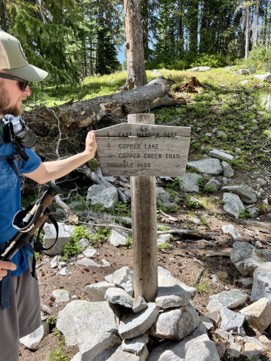
Maps For Each Different Route Leading Up To Triangle Pass Loop
Here are a few helpful maps from each trailhead including Triangle Pass Loop.
The Copper Creek Trail to Triangle Pass (Crested Butte, CO)
East Maroon Pass To Triangle Pass (Aspen, CO)
Conundrum Creek Trail To Triangle Pass (Aspen, CO)
Start of Hike For Triangle Pass:

There are a few different ways to do the Triangle Pass loop hike in Colorado.
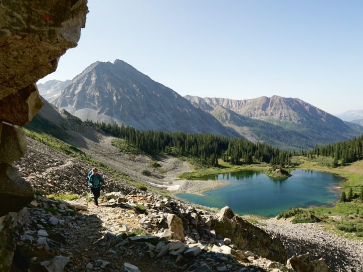
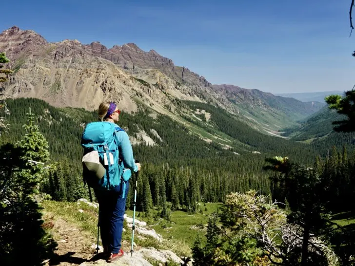
Personally, my favorite route is the Crested Butte Route. It’s the easiest route, least elevation gain, and you get to witness Judd Falls, Copper Lake, and the East Maroon Valley. When we did Triangle Pass, we did a 3-day, 2-night backpacking adventure up at Copper Lake. (You can learn all the details for Copper Lake via our in-depth guide).
Or if you choose the Conundrum Hot Springs Route, you can read our in-depth guide for this hike too!
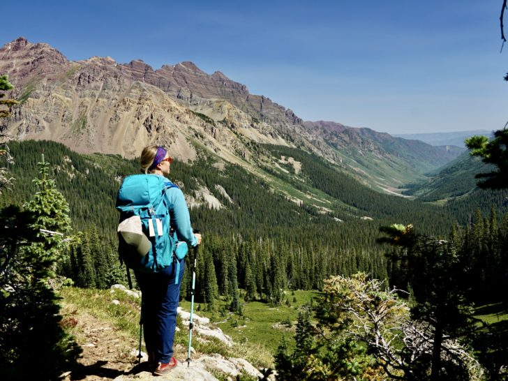
Lastly, you can reach the Triangle Pass loop from East Maroon Pass. Before reaching Triangle Pass, the hike is 8.4 miles one way up the valley.
Each hike has a steady incline up to the summit of Triangle Pass over many miles. And offers a unique perspective of this whole breathtaking area.
Creek Crossings Before Reaching Triangle Pass
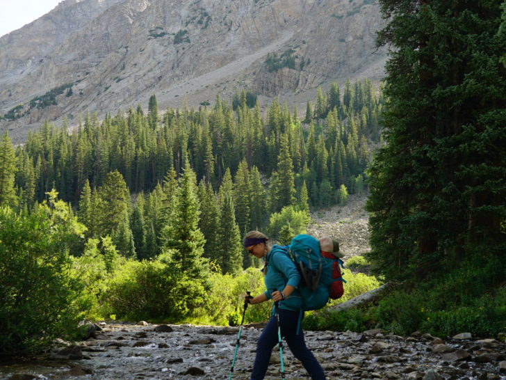

Each route leading up to Triangle Pass will have some creek crossings. From East Maroon Pass you will encounter the East Maroon Creek. From Copper Lake, you will encounter Copper Creek. And from the Conundrum Hot Springs, you will encounter the Conundrum Creek.
Earlier in the season when the snow is rapidly melting, the creeks will be flowing heavily.
You may want to consider carrying a good pair of river hiking shoes to change into for the creek crossings. Plus a pair of hiking poles is always helpful to keep you balanced in a rushing creek.
Tip: For river crossings above ankle deep: Face your body upward toward the flow. Brace yourself with tracking poles and move sideways to cross. It’s much easier to maintain balance this way in a flowing river.
Later in the season when the flow is lower, you will likely be able to cross the creeks without getting your feet wet with some waterproof shoes. (Jake & I are big fans of the Altra Lone Peak RSM).
Hiking The Triangle Pass Loop
Now that you’ve made it up to the start of Triangle Pass Loop, it’s time to hike the different sections along the route. You will enter the loop at 3 different points depending on the route you choose.
The Section from Copper Lake to the Top of East Maroon Pass

Starting from Copper Lake, you will need to follow along the backside (north) of the lake. The trail transitions from Copper Creek Trail to East Maroon Pass 1983.
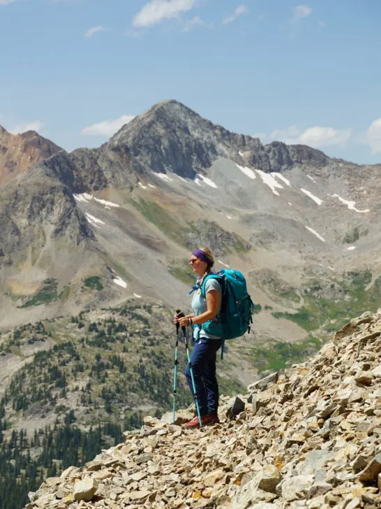
The trail gradually climbs up over a rock scree field. Be sure to look behind you as this section offers great views above the beautiful alpine lake, extended views down the valley, and White Rock Mountain.
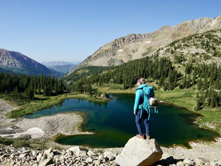

Once you pass through the scree field, the trail turns into dirt and you do a few switchbacks until you reach the top of East Maroon Pass. This section usually has an abundance of beautiful wildflowers.
The Section from the Top of East Maroon Pass into the Valley
Once you reach the top of East Maroon Pass, then you will descend into the East Maroon Valley. First, you will follow a dirt path that turns into another scree field. But shortly the trail turns back into dirt.
After the rock section, the trail leads back below tree line. The trail descends from here through several switchbacks. Then, you will run into the creek where you will need to cross a couple of times.
There becomes a crucial point where you need to turn up toward Copper Pass. (But this will also be your starting point if you are coming up from East Maroon Trail 1983).
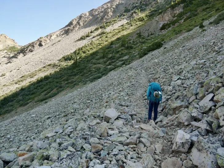
The Section from the Valley of East Maroon Pass up to Copper Pass

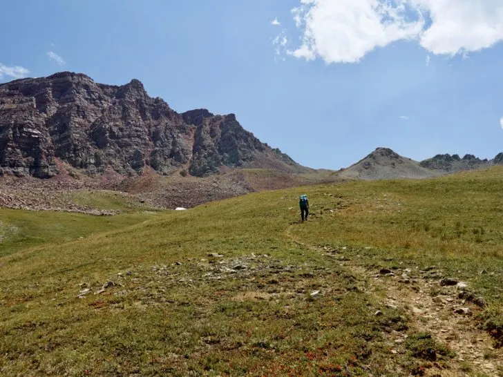
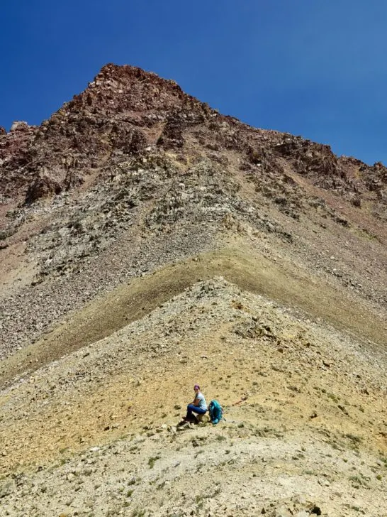
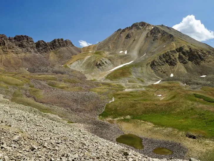
The climb up to Copper Pass is the hardest part of the Triangle Pass Loop. It is a steady incline to up above 11,000 ft. Therefore the oxygen is thin and you will likely be breathing heavily as you ascend.
From the forest, this trail climbs back above the treeline into alpine meadows. The trail is not heavily trafficked, so there are a few sections where the trail disappears. Some people have left Cairns behind to help guide the route. Otherwise, this can be a great section to use a GPS tracker.
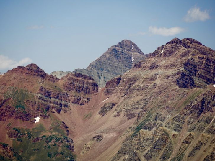
Don’t forget to look behind you for the epic red wall that lines the East Maroon Valley. And eventually, Maroon Peak reveals itself behind.
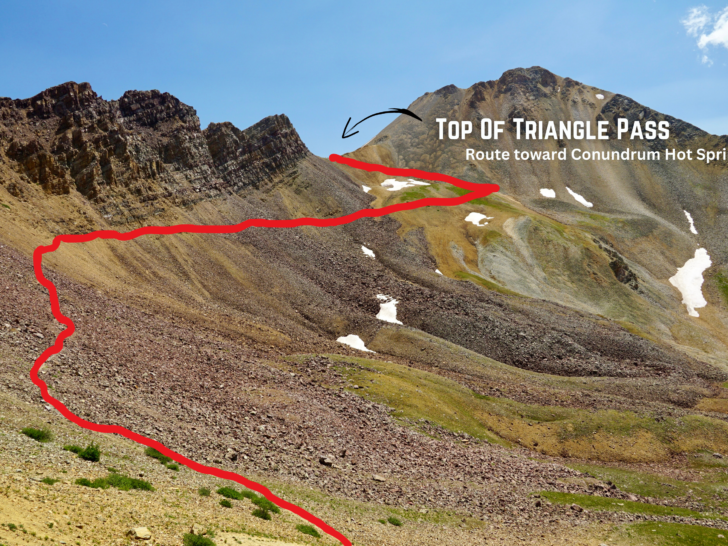
The Section from Copper Pass to Conundrum Trail

Wahoo, now that you’ve made it to the top of Copper Pass, you will slightly descend the other side of the pass before you complete the loop back to Copper Lake or ascend Triangle Pass.


Most of this section either passes along a scree field or overgrown bushes. (This was my least favorite part of Triangle Pass).
This is the point where anyone doing the Conundrum Trail will enter onto the Triangle Pass Loop.

The Copper Pass to Copper Lake

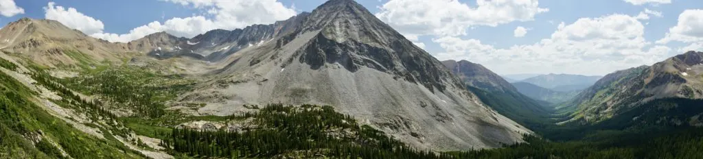
Descending this section has beautiful views of White Rock Mountain and a large basin on your left. To the right is the valley where Copper Creek Trail descends back towards Crested Butte. It’s a mostly rocky descent back down towards Copper Lake.

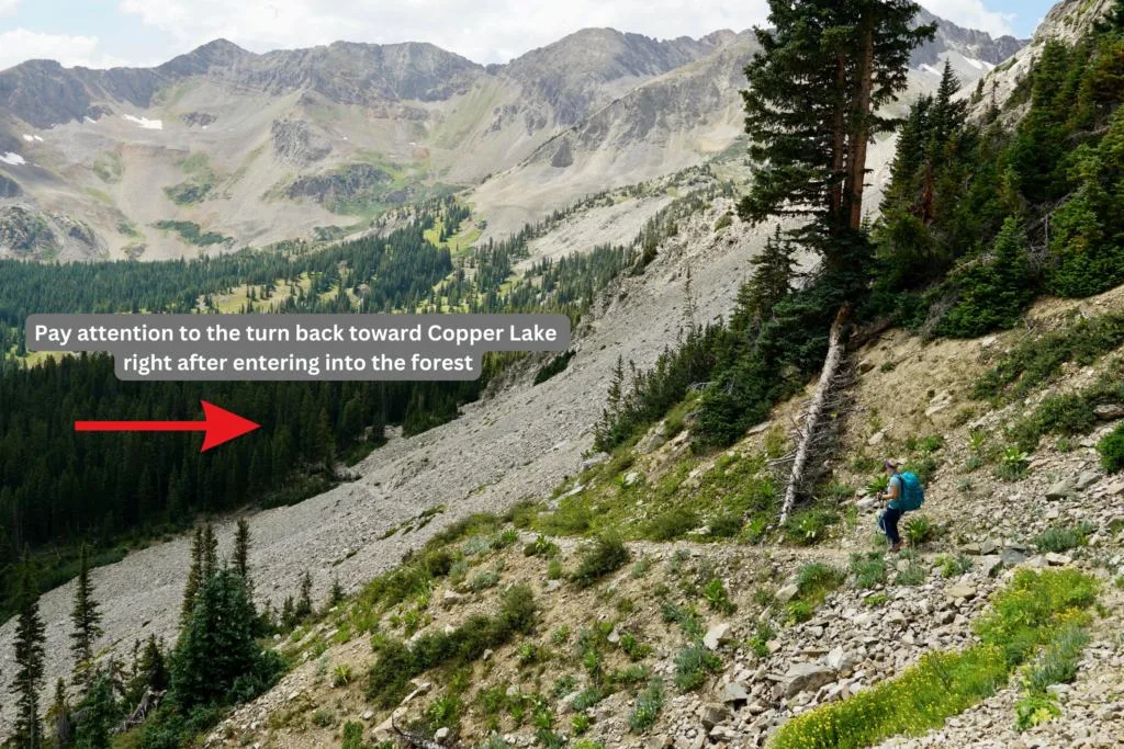
There is one more “shortcut” to head back toward Copper Lake. This turn comes right after exiting the final section of the scree field. There is a sign on the trail to help you make this turn! (Or you can always check your GPS tracker).

How Many Days Do You Need For Triangle Pass Loop
The Triangle Pass loop itself can be done in just one day. But obviously, the trails leading you to the Triangle Pass Loop are no joke (5 – 11.3 miles one-way).
I would certainly suggest at least an overnight stay somewhere along one of the other trails to break the hike up. Ultimately, I would suggest including Triangle Pass into a 3-day, 2-night trip.
The first night either camp at Copper Lake (if coming from Crested Butte), along East Maroon Pass (if coming from Aspen), or at Conundrum Hot Springs (permit required).
Using a GPS for Triangle Pass
While the trail is not too difficult to follow, we suggest having a GPS tracker just in case. We personally like to use AllTrails. But of course, you can also purchase a traditional GPS tracker for hiking as well. (We personally find them overpriced and to be a little less reliable).
How To Use AllTrails As Your GPS Mapping System
You can pay for AllTrails+ to download the map which will track your route and show you established trails via a topographic map. But there is also a free way to use the app too (which is what we use).
Before going on the hike make sure you look up the hike and save it to a list. Be sure to click on the map when you have service so it loads in the app. This should allow you to use the map offline.
This hike is not an easy adventure, but surely gets you off the beaten path. There are a few sections where a “sister trail” has been formed and can lead you astray. We didn’t see a single soul out on the trail after parting from East Maroon Pass.
Shuttling Cars For A Triangle Pass Thru Hike
There is the option to do Triangle Pass as a thru-hike. The best option is probably starting at the Conundrum Trailhead and then finishing through East Maroon Pass (or vice versa).
Do note, that if you thru-hike, you will need to carry your heavy pack along the whole route (ultimately making it more challenging).
I do not suggest doing a thru-hike from Aspen to Crested Butte (or vice versa), because the drive would total just under 4 hours (one-way). While the towns are very close “as the crow flies” the drive around is not close.
Suggested Route For A Thru-hike Including Triangle Pass
My suggested route for a thru-hike for Triangle Pass would be from the East Maroon Trailhead to the Conundrum Trailhead. But first, this requires you to land a permit for the Conundrum Hot Springs.
I’d start at East Maroon Pass and hike up to Copper Lake (about 10 miles). Set up camp for the night here.
The next day, you will climb up Triangle Pass. You will essentially skip the section from the East Maroon Valley up to Copper Pass. But you can get an epic view at the summit of Copper Pass because you will pass by this area as you climb to the top of Triangle Pass.
From here you will cross over Triangle Pass and head toward Conundrum Hot Springs (about 5 miles). If you land a permit, you can stay the night and soak in the hot springs!
Best Time To Hike Triangle Pass
Triangle Pass stands around 12,919 ft. Therefore, there is likely to be snow up on the pass until July (maybe sometimes later into the summer season depending on the snowpack).
Ultimately the best time to hike Triangle Pass is in late July and early August.
Weather At The Top Of Triangle Pass

When hiking in the mountains, there is always a chance for afternoon thunderstorms. Though bad weather can occur at any time.
Check the weather before sending out on the hike. But note that the projected weather can not always predict what the mountains will do. Pressure, condensation, and heat can make for a nasty storm on top of mountain passes.
Be prepared for any type of weather when hiking in the mountains. Pack layers, a rain jacket, and enough water.
Altitude Sickness
Do note this climb is at a high elevation. If you are coming from sea level or not acclimated to the elevation, this increases your risk for altitude sickness.
This happens when your body doesn’t adjust to the lower oxygen levels and changes in air pressure. You might experience a headache, vomiting, loss of coordination, etc. If you feel any of these symptoms, you should turn back immediately and head toward a lower elevation.

Leave No Trace
As always leave no trace principles apply when hiking and backpacking in the Gunnison National Forest, White River National Forest, and the Maroon Bells-Snowmass Wilderness.
Pack out all your trash with you, and pick any up that you may see along the trail.
Also, there is no pit toilet anywhere along the trail. You must dig a hole 6-8 inches deep and choose a site at least 200 feet away from water, campsites, and trails. Or you can always opt to carry your own waste in a wag bag.
Related Posts to Triangle Pass Colorado Hikers Guide (Crested Butte or Aspen Route):
Check out our hiking guides for Copper Lake Trail or Conundrum Hot Springs for all the best information about each hike.
After the long backpacking adventure, you might consider refueling at one of Crested Butte’s Best Restaurants.
Also, here is a list of amazing things to do in Crested Butte. We love this small little ski town, there are so many great activities to keep you entertained.
Save This ‘Triangle Pass Colorado Hikers Guide (Crested Butte or Aspen Route)’ Post For Later