
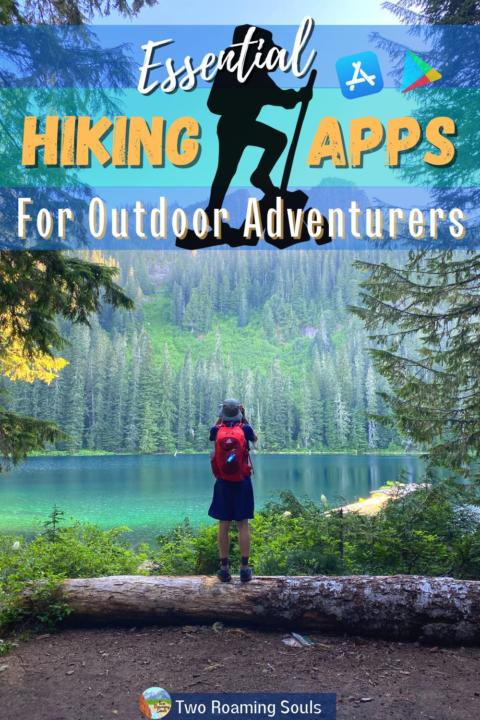
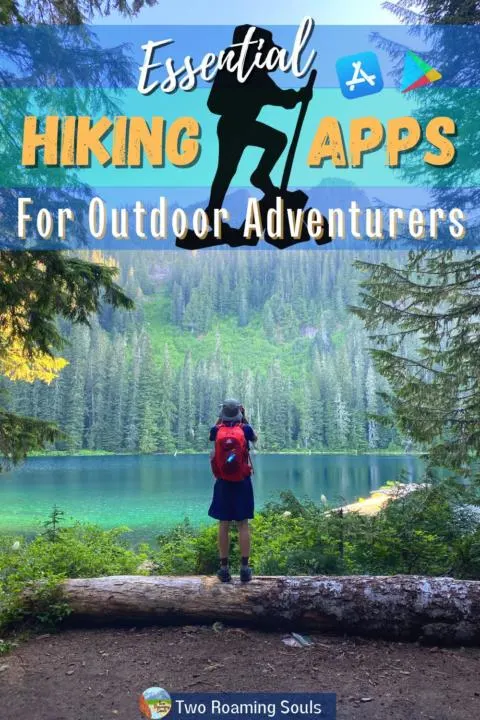
Finding hiking trails near me isn’t that hard if you have the right hiking app. There are a handful of great hiking apps that will provide tons of great hiking trails near you! Whether you are just looking for a nice easy walk to get the legs moving or a multi-day backpacking trail that leads you to some grand views, these best hiking apps will get you from point A to Point B safely and seamlessly! Let’s dive into the best hiking apps for how to find hiking trails near me.
This post may contain affiliate links. Disclosure policy.
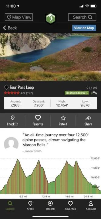
AllTrails:
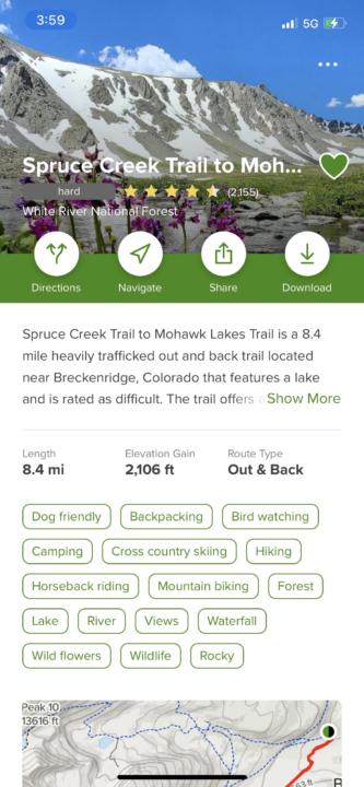
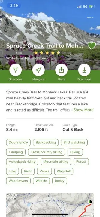
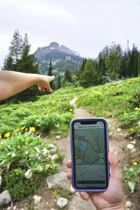
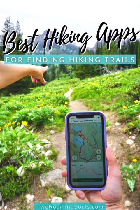
Alltrails is one of the best apps for finding hiking trails near me. It is our personal favorite hiking app. There are TONS of trails to choose from on the AllTrails app. Plus the app provides the mileage, elevation, route type and difficulty.
For finding hiking trails near me, simply just open the app, and a handful of hikes will pop up using your current location. At the top you will see “Top Trails Nearby”. You can scroll through and see if you find one you are interested in. Or there are other great categories to choose from such as: family friendly, best views, trails less traveled, best waterfalls, dog-friendly, weekend worthy, etc.
Or sometimes it’s easier to just click the map feature and you can find the best hiking trails near me.
There is always a brief intro of what to expect on the hike. Such as whether or not it is lightly, moderately or heavily trafficked out. Also, when the best time to visit is. What the trail features, such as lakes, rivers, wild flowers, etc. And of course whether or not it is dog friendly! You can find a more detailed description below.
One of our favorite features of the app is the review section. This section is peer reviewed and people will let you know whether they enjoyed the hike and give you any additional information you might need about the trail at that time. For example if you go hiking in early spring, maybe the trail needs a little maintenance or the trail is still covered in snow, so bring yaktrax, etc. The reviews have saved us a handful of times from not making the trek all the way to the trailhead to find out it’s closed.
Also in the app, you will find the topographic map. There is a black and green circle which indicates the start of the hike. Any yellow circle will be a waypoint, which is often what people find cool along the trail, or maybe a tough river crossing, etc. The red line is the trail.
If you are searching for a hike to do later, Alltrails has a feature where you can either save your favorite hikes, or put them into different lists. For example, when Jake and I visit a new state we will research all our favorite hikes and put them into that folder. This makes it easier to find the hikes we saved, versus just putting all the hikes we like into one “favorites” folder.
If you look at the map of the hike while you are in service range, you can follow the red line with the blue dot GPS tracking you. This can be super helpful when there is a “T” in the path and it’s not well marked. Or if you get lost…
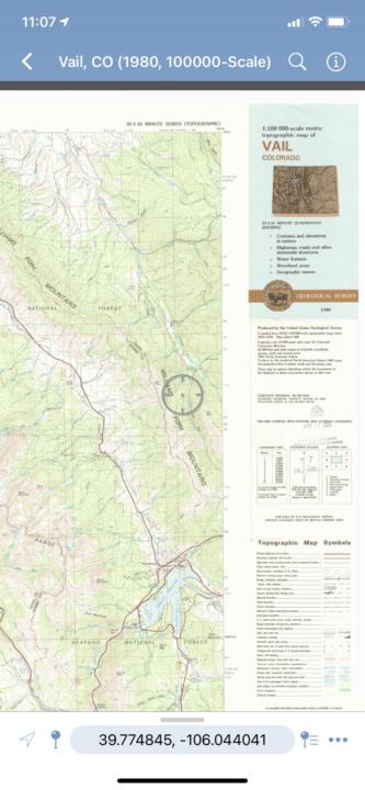
But if you want a topographic map with more details, consider purchasing the annual membership. The membership will allow you to download maps for offline use. Plus you can track your route and record the distance.
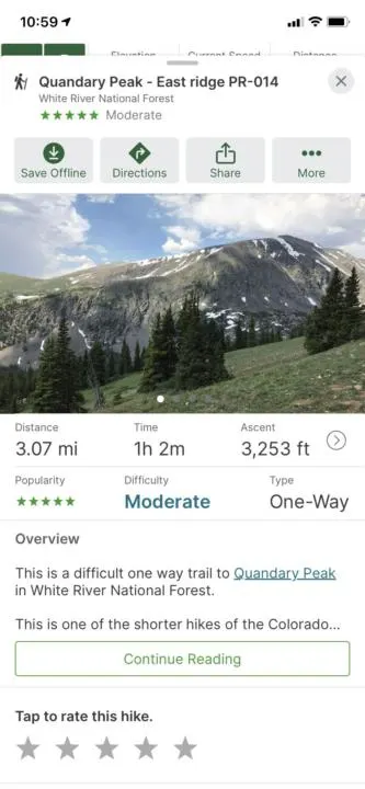
Hiking Project:
The hiking project app is crowd-sourced, so you are getting information from hikers themselves. The Hiking Project team does review every trail and makes sure the photos and routes are accurately being portrayed.
One of my favorite features of their hiking app is that they include the difficulty in the picture. Green circle meaning easy, blue square meaning moderate and black diamond meaning hard. So if you are looking for an easy hike and see a picture with a black diamond, you might as well keep scrolling!
When you first open the app, you will see a topographic map. If you want to search the top hikes in the area, click the menu in the top left corner. This will show you how to find the best hiking trails near me.
Right from there you will see the name of the hike, distance, difficulty level, type of hike and elevation change. Once you find the hiking trail near me that is best, click on it. Here you will find an overview explaining what to expect on the hike. Whether or not the trail is dog-friendly and the main features of the hike.
If you are ready to send it on the hike, click driving direction in the green box. Or if you are searching for a future hike, you can save the hike to your favorites to find later. You can also record your route once you make it to the trail head. It will track how far you went, the elevation you climbed
Another cool feature, is you can search hikes by state. So if you are planning a trip for a later date in a different state, you can plan ahead and find some epic hikes! And the best feature of all, it’s FREE!
Gaia GPS:

Gaia GPS is another great hiking app to find hiking trails near me.
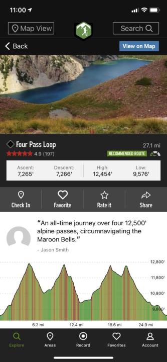
Once you find your desired hiking trail near me, the app provides you with the distance, average duration, ascent, popularity, difficulty and type of trail. Next, you can read an overview of the hike. Then, there are reviews from previous hikers.
One great feature, is if you scroll past the reviews, you can see other popular hikes in the area. So if you are in the area for the weekend or multiple days, you might find another great hiking trail nearby.
Although, one complaint is the Gaia GPS doesn’t always have every hike in the area, compared to some other hiking apps. And if it does find my GPS location, it will show me popular hikes that are much further away than my current location. Therefore, I find the app difficult to truly find hiking trails near me.
One of my favorite features of the app is the comment/review section. This is where peers can comment about the hike and give you any tidbits. For example if there are any trees down, if the trail is busy, or if the trailhead is open, etc.
Avenza:

Avenza is a hiking app that allows you to download maps for offline use. The map uses your GPS to locate where you are even if you are out of cell range.
You can also pin placemarks, make notes or add pictures anywhere along the map while hiking. It will also record distance and time. For example, if there was a cool lookout, you can snap a pic, make a note for next time to stop here again!
Avenza has a free version where you can download thousands of apps for offline use. Or you can upgrade your membership to Plus for $29.99/year if you want to download and use your own maps. Check out the different plans here.
Cairn:

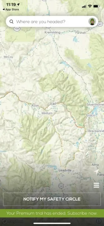
The Cairn apps main objective is to set you out on the trail with ultimate safety.
An awesome feature that I love about this app, is you can set up a safety circle. Before setting out on the hike, you can click the notify my safety circle if you don’t return back in the designated time. They will also send them your trip plans and a link to a map showing your progress.
Another cool feature is there are blue and grey dots on the trail that will show you where other hikers found cell phone coverage or not. So if you are out on the trail and need to get service, you can head toward a blue dot.
A couple drawbacks to using this app, is it can drain your battery because it is tracking your route. Also, be sure to make sure you don’t get charged for the premium plan if you just want to use the free features. They also don’t have every hike on their app, so they won’t always know how long the hike “should take”.
Google Maps:
You also don’t necessarily need a fancy hiking app to set off on the trail. Google maps can be downloaded for offline use and you can follow along with your GPS location. While there aren’t really maps to follow, you can often see a trail using satellite mode. Or if the trail is an official trail, you can set your start and end location, to follow along the trail.
Jake and I don’t use this as our main hiking app, but it can be useful at times when maybe a trail is more overgrown or you need to choose a different path. Or possibly if you get lost and need to find a way back to your car.
Takeaway | How To Find Hiking Trails Near Me:
Hiking is one of Jake’s and my favorite activities. It gets us out in nature, some exercise and leads us to some epic views! Many of these best hiking apps will keep you safe out on the trail, and helps get you to your end destination seamlessly. Not to mention its a great way to find hiking trails near me, no matter where you are in the world!
Now, what to pack on these fun hiking adventures? Check out our favorite hiking gear!
Help Share ‘How To Find Hiking Trails Near Me’ On Pinterest!

What To Do In Vail Besides Ski | Winter Guide - tworoamingsouls
Sunday 20th of February 2022
[…] you can find a hiking trail nearby and break trail. Trails are often packed down from other hikers, but if there is fresh snow, you […]