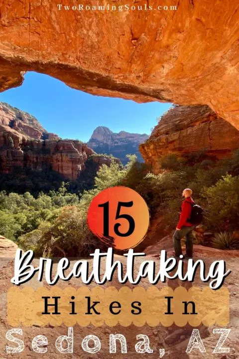
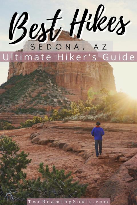
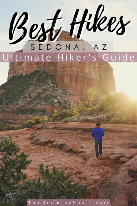
It’s no lie that Sedona, AZ is probably one of the most beautiful places in America. Simply just driving through the area will take your breath away, let alone getting out into nature is the absolute cherry on top. Sedona holds a special place in Jake’s and my heart because of all the breathtaking hikes in Sedona.
It can be hard for us to settle down in one spot without feeling antsy to continue exploring. But Sedona seems to have a never-ending supply of incredible hikes.


In this guide, we will go over the 15 Best Breathtaking Hikes In Sedona, Arizona. It really is hard to choose which one is better than the next, so these are in no particular order.
Note: Sedona is a VERY popular tourist spot. So to try and beat the crowds we suggest going at off-peak times (e.i. weekdays, winter, early in the morning, etc). And obviously, some are much more popular than the others, which we will try and highlight below. Also, many of these trailheads are much easier to get to if you have an OHV or 4×4 high-clearance vehicle.
This post may contain affiliate links. Disclosure policy.
Soldiers Pass:
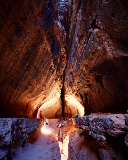

4.1 miles – 620 ft elevation change
Soldier’s Pass is definitely one of the more popular hikes in the area. But there are many different hiking destinations along the route, which makes for a very interesting hike. One of our favorite hikes is the “secret cave”. But it really is not much of a secret anymore, therefore going early in the morning will help you avoid some of the crowds.
Along the hike you will also encounter Devil’s Kitchen, The Seven Sacred Pools and of course the stunning panoramic view from on top of the ridge. But going off trail to find the “secret cave” will add an extra mile or so.
For the full details on this hike, check out our post: Soldier’s Pass Trail: How To Find The Secret Cave | Sedona, AZ
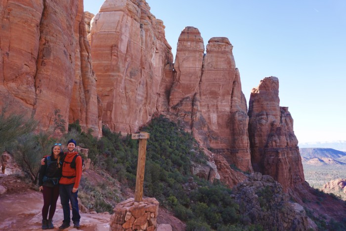
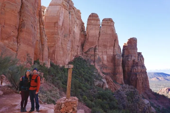
Fay Canyon:

2.6mi – 383 ft elevation change
Fay Canyon is one of our favorite breathtaking hikes in Sedona. We were able to avoid some of the crowds in Sedona and get off trail a little bit to explore a side canyon.
The hike is along a sandy path but well-maintained. Toward the end of the sandy path, you will see an “End Of Trail” sign, but if you don’t mind scrambling up the rocks you can explore the right or left forks of the canyon, it’s just not maintained. There are ancient ruins to the right, but Jake and I went left and found a cool side canyon that was carved out (pictured above).
There is also a turn off the trail at .5 miles to the right where you will find a cool cave. So be sure to find that either on the way in or out!

Robbers Roost:
3 miles – 462 ft elevation change
Jake and I felt we got pretty lucky while exploring Robbers Roost because we had it all to ourselves. It is a long drive to the trailhead, but it is a very unique cave.
The drive to the trailhead is about an hour down a long dirt road. If you are camping, you can camp back in this area. It is one of our favorite places we have camped because you get some EPIC views. But if you have a 4×4 high-clearance vehicle, you can drive even further up the road and make the hike much shorter than 3 miles. But because Jake and I only had our 2wd campervan, we figured we could walk faster than driving along the last section of the rocky dirt road.
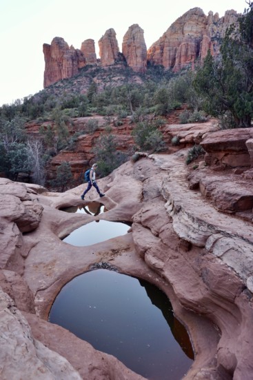
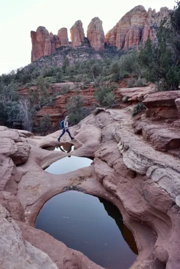
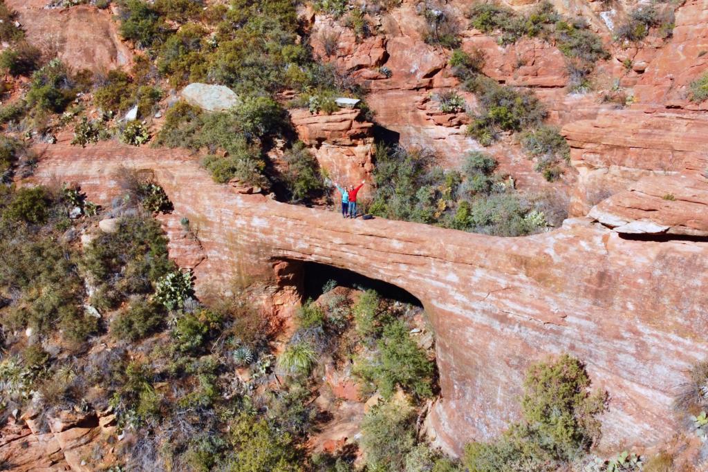
Devil’s Bridge:

4.3 miles – 564 ft elevation change
Devil’s Bridge is probably the MOST popular hike in Sedona. The parking lot is usually full by 8am and cars are parking along the road soon after. You can either hike to this famous spot from the paved parking lot or drive a 4×4 (high-clearance!!!) or OHV up the first section of the hike to shorten it substantially. But be prepared to experience Devil’s Bridge with many tourists. There is usually a line to capture the “famous” photo on top of the bridge.
This photo was taken in between visitors “taking turns” getting their photo on the bridge.
The hike is well worth it if you want to see a stunning arch with a legendary backdrop of Sedona. But if you really want to see an arch but without the crowds check out Vultee Arch (details below).
Bell Rock:
1.1 miles – 318 ft elevation change
Bell Rock is yet another very popular spot in Sedona, and known as an energy vortex.
You can simply stay grounded and walk around the area along a few different designated trails. Or if you have the desire to get up high and enjoy the view of below, you can climb up to the top of Bell Rock. But do be aware that it can be challenging getting up and down the top, so only climb up top if you feel comfortable. And be careful of delicate desert vegetation by only walking on solid rock or dirt.
West Fork:
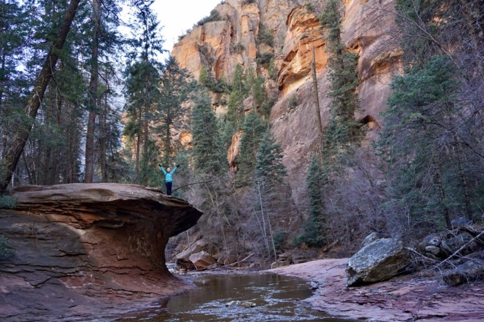
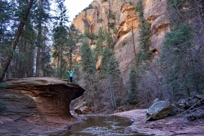
7.2 miles – 820 ft elevation change
West Fork Trail was a hike that caught Jake’s and my eye right away. We love river hikes and this one meanders along the creek between tall canyon walls. And eventually narrows to a slot canyon, where most people turn around, unless they want to continue through the water.
We even went in winter with plenty of snow to scare you off, but it was still so stunning. Just be sure to wear layers because you will be hiking through a canyon which means sun exposure can be scarce and intermittent. Or it hotter months, it’s a good escape from the heat.
There is an $11 fee for parking.
For the full details on this hike, check out our post: West Fork Trail: Sedona, AZ
Cathedral Rock:
2 miles – 744 ft elevation change
Cathedral Rock is known to be one of the energy vortexes of Sedona, AZ. The trailhead to Cathedral rock is located near the Village of Oak Creek. It is a short hike, but the climb is no joke.
When you reach the top, you’re standing between two giant red sandstone towers that present a window to incredible views on both sides.
Plus much of the hike is either along a cliff side or on steep slickrock. There are sections where climbing with hands and feet is mandatory. Therefore, if heights aren’t really “your thing” maybe sit this one out. As you can notice from this list of 15 Best Breathtaking Hikes In Sedona, Arizona, there are PLENTY of stunning hikes to choose from in the area.
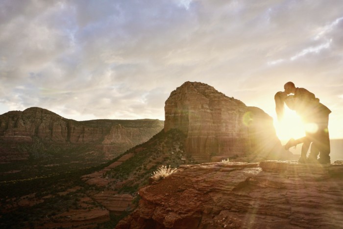
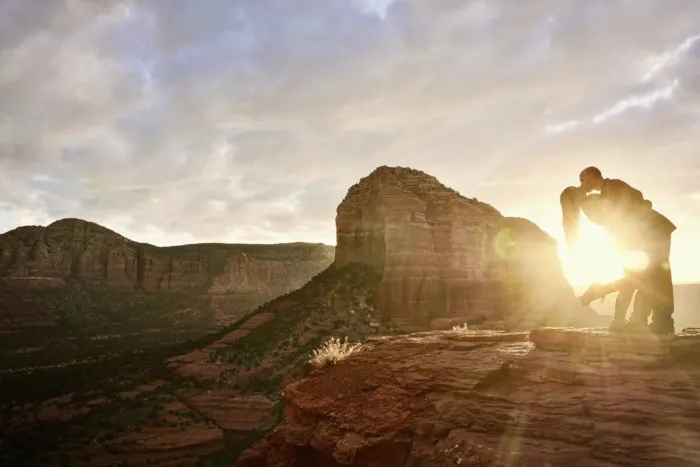
Airport Mesa:
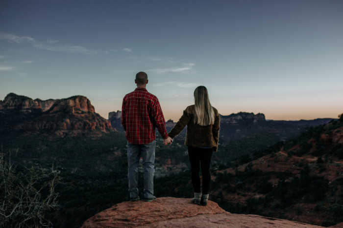
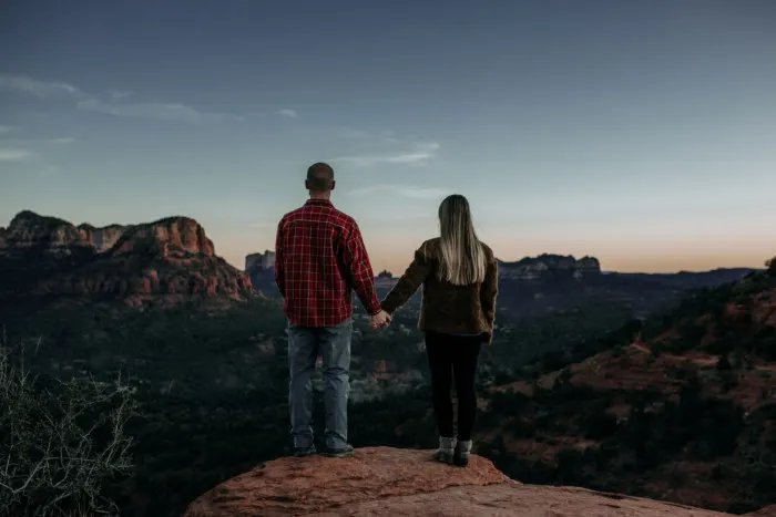
3.2 miles – 416 ft elevation change
Airport Mesa holds a special place in our hearts because we had a fun photoshoot done by our friend: Annie Corum. Definitely check out her website if you are interested in getting a photoshoot done, really anywhere in Arizona or the surrounding area! She is especially talented with adventurous weddings and elopement photography!
But Airport Mesa is a place that has many different spur trails leading you to some stunning panoramic views of the city. But there is a loop hike that will give you a good feel for the area.
Otherwise it’s less than a half mile just to hike up to the vista point.
In our opinion, it’s best viewed at sunrise or sunset. So either grab a coffee and head there for a stunning sunrise or grab a blanket, a couple drinks, and take in the beautiful sunset!
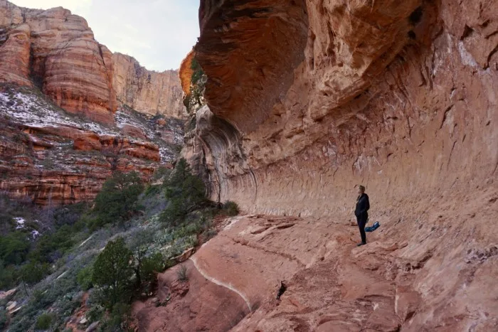
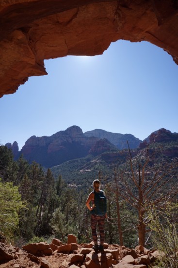
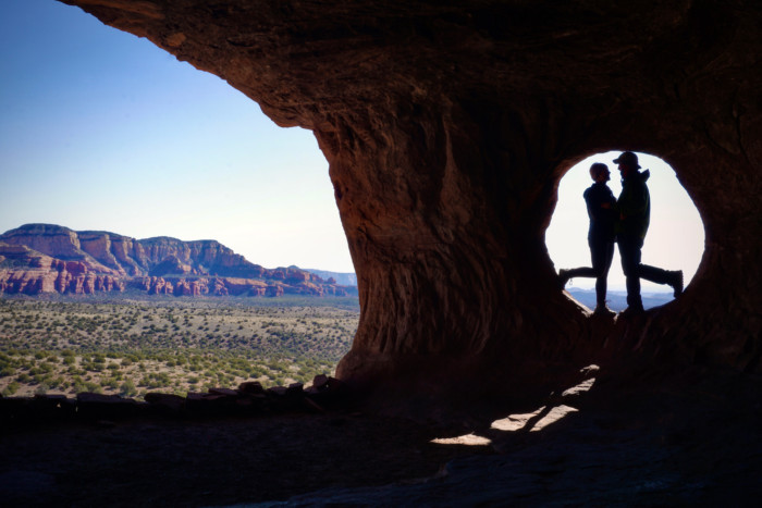
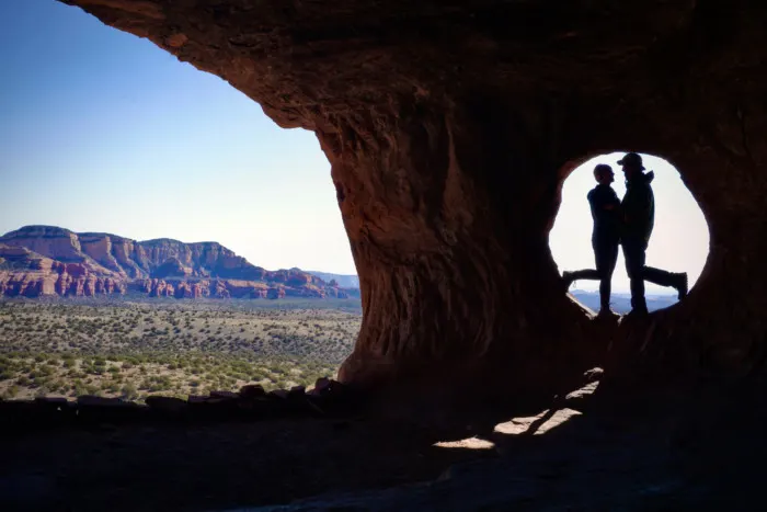
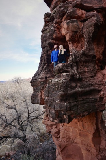
Birthing Cave:
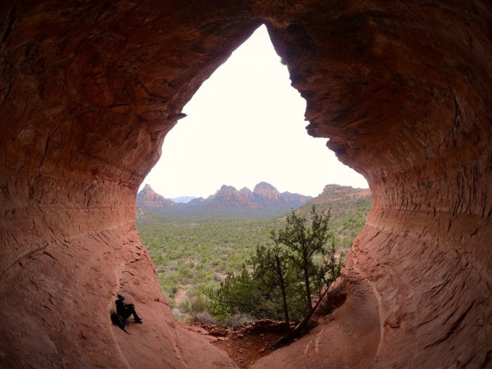
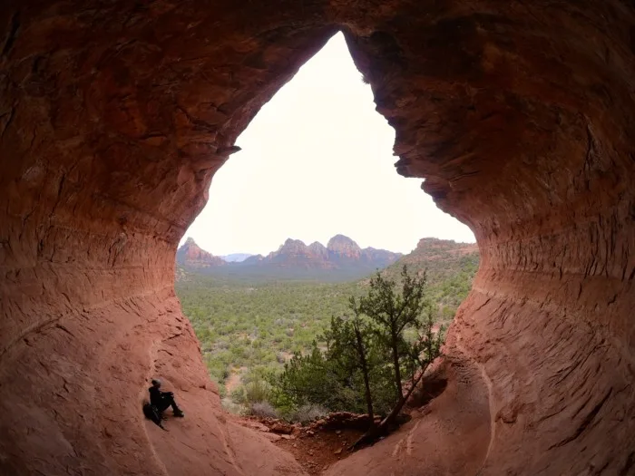
2 miles – 291 ft elevation change
Birthing Cave is a sneaky cool hike in the area. But as per usual, the place is getting much more popular. Which is essentially how Jake and I found it, so we can’t really complain. But the cave is best explored without others so you can enjoy it at peace and not have to feel like you are getting in peoples way of the view.
Therefore, we suggest going early, to try and have the cave to yourself. But if there are people there, you can wait outside the cave to give them time and take turns. But the views from within the cave are spectacular!
If you want a photo that encapsulates the entire cave then you need a wide angle lens.
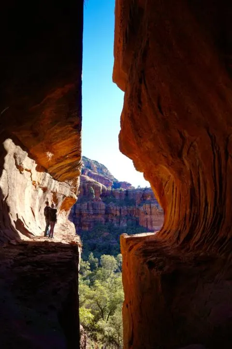
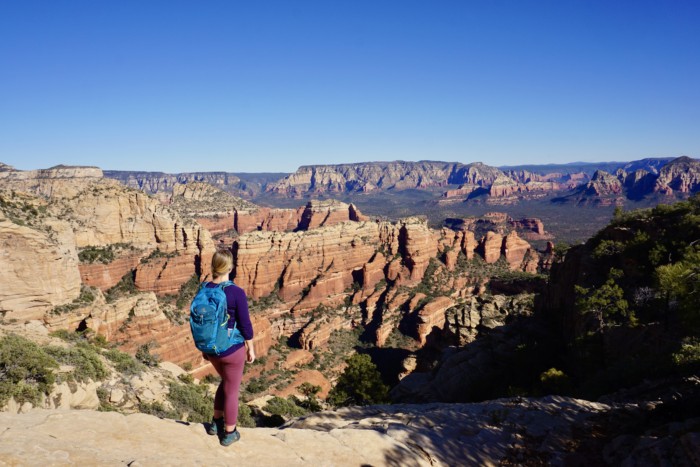
Boynton Canyon:

6.1 miles – 810 ft elevation change
Boynton Canyon starts along a residential area, but quickly encompasses you in a beautiful red sandstone canyon. But the last section turns into a tall shady canyon where suddenly you find yourself among tall ponderosa pines. The last section of the canyon features the “white-ish” upper layers of rock formation. The hike is rather easy until the last climb to the viewpoint looking down the canyon. But it’s worth the climb for a breathtaking view!
There is also a secret cave in the area, but the details are kept pretty secretive because of ancient Native American ruins. So if you do track down the location, be extremely respectful to the area.

Sedona Caves:

.5 miles – 55 ft elevation change
I’m always surprised to not see many people in this parking lot. Which mind you only holds about 3-4 vehicles. But I found exploring these little caves pretty fun. And Jake and I got to feel like Rapunzel in her tower. HAHA!
It’s a very easy hike and right off Highway 179 (which is the road from downtown Sedona to Village of Oak Creek). It’s definitely worth checking out if you are driving past.
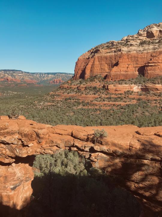
Vultee Arch:

3.6 miles – 580 ft elevation change
Vultee Arch is an interesting hike in one of the less-traveled areas of Sedona. The arch can be accessed via two different trails. The trailhead coming from the West is accessed via a Dry Creek Road, which is a long dirt road that requires 4×4 high-clearance. Or the trail from the East starts in Oak Creek Canyon and climbs via Sterling Pass if that is easier for you.
But for Jake and I, we ended up making the hike just over 10 miles because our van wouldn’t have made it to the West trailhead otherwise.
We parked at Chuckwagon Trailhead, hiked along the trail until we met up with Dry Creek Road. And let us tell you, you truly need a 4×4, high-clearance, short wheel base vehicle to make it here in one piece. But because the trailhead is hard to get to, you will most likely have the place to yourself or only share it with a few other visitors.
Bear Mountain:

4.9 miles – 1,975 ft elevation change
Now this one is a tough climb, but the views from above are stunning. And this is one hike that should not be missed on the 15 Best Breathtaking Hikes In Sedona, Arizona. There is simply not a bad view from the drive in, to the climb up to the stunning panoramic views from the top. But you will want to be in decent hiking shape to make this climb.
Bear Mountain can get busy, but it often deters people because of the intense elevation change. Therefore, it is a great hike to avoid the crowds.
Bell Trail:

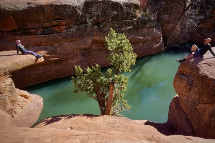
6.9 miles – 587 ft elevation change
This trail is not to be mistaken for Bell Rock, but it is yet another one of those breathtaking hikes in Sedona, AZ. And if the weather is nice, it is a great place to take a dip. Which also means there will probably be more people if the weather is nice. Jake and I were there in winter, so we when it wasn’t quite the desirable temperature to go for a swim.
But the end destination of the hike is majestic. The river forms a pool of water between the canyon walls. It’ s nice to just sit up on a ledge to take in the beautiful view of the water.
Chapel Of The Holy Cross:
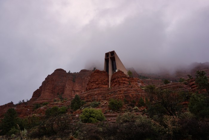
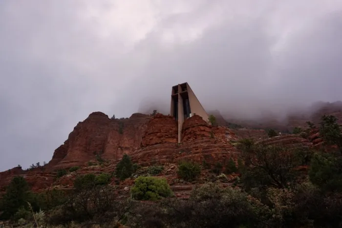
1.3 miles – 144 ft elevation change
Chapel Of The Holy Cross is an easy hike near town. And as you probably could of guessed, one of the sights to see is this stunning church. And you can even go inside most days. It probably has one of the best views out the windows of any church in the world. But even if you don’t want to go into the church, there is a hike around the area to take in the breathtaking views Sedona, AZ.
Accomodation in Sedona, AZ:
Camping near Sedona, AZ:
Like mentioned above, the camping around Sedona is absolutely breathtaking. There are a couple of designated campgrounds in the area such as: Cave Springs, Manzanita Campground (tent only), Rancho RV Park (RV only), Pine Plat Campground, and more. You can make reservations online, but some are seasonal.
But there is tons of primitive campsites (free) around the area that is open year-round. Our favorite campsite is along Forest Road 525. There are tons of great sites along the road. The further you drive on the road, the better the views!
Use our post: 3 Great Websites To Find Free Camping if you are looking for a different spot!
Hotels or Vacation Rentals in Sedona, AZ:
If camping isn’t your style, there are many great hotels or vacation rental homes you can stay at in Sedona. We always compare Kayak, Expedia, and Hopper for the best deals on Hotels.
Sedona also has tons of amazing vacation rentals. Some offering some amazing views of the Red Rock Mountains.
- Mountain View Cottage in Uptown Sedona A Vista Ridge Sedona Collection
- Spectacular Sedona Red Rock And Sunset Views-Honeymoon Escape-Walk To Trails
- 5 Star Luxury Villa with Panoramic Red Rock Views
- Abode on Harmony: A unique Sedona retreat & spa
- Sedona Majestic Unmatched Luxury, 360 Red Rock Views
Related Posts:


Takeaway | 15 Best Breathtaking Hikes In Sedona, Arizona
Honestly, the stunning hikes that surround Sedona don’t stop here. These are just 15 of our favorite hikes from the area. Check out AllTrails if you are looking for more breathtaking hikes in Sedona, Arizona. You really could spend endless amounts of time and still have the scenery take your breath away every time. We hope you enjoy these 15 Best Breathtaking Hikes In Sedona, Arizona. Happy Adventuring!
Save These ‘Breathtaking Hikes In Sedona, Arizona’ For Later


The Ultimate Arizona Road Trip Itinerary - tworoamingsouls
Monday 10th of April 2023
[…] 15 Best Breathtaking Hikes In Sedona, AZ to find the best hikes for you! […]
25 Fun Things To Do In Sedona, AZ - tworoamingsouls
Monday 10th of April 2023
[…] […]
A Review of Full-Time Vanlife in Sedona, AZ - tworoamingsouls
Tuesday 4th of April 2023
[…] Check out our post: 15 Best Breathtaking Hike In Sedona, AZ […]
Top 10 Best Hikes In Arizona | Ultimate Guide - tworoamingsouls
Friday 11th of March 2022
[…] 15 Best Breathtaking Hikes In Sedona, AZ […]
West Fork Trail In Sedona, AZ | Ultimate Hiker's Guide - tworoamingsouls
Saturday 9th of January 2021
[…] […]