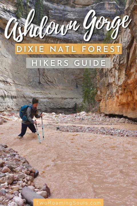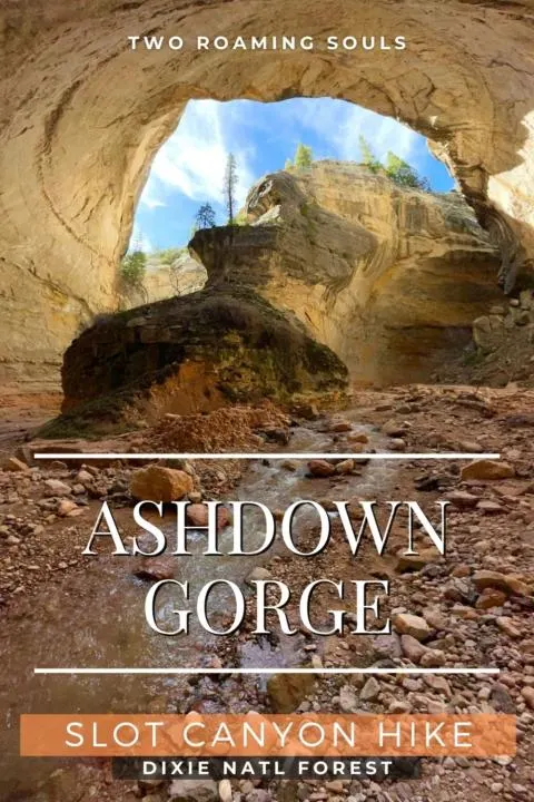
Ashdown Gorge Trail is a rugged and adventurous hike in the Dixie National Forest in Utah. Ashdown Gorge is a massive limestone canyon with towering cliffs, deep overhangs, and a couple of waterfalls. It’s a non-technical route that doesn’t require any rappelling or swimming. But the fast-moving, murky river makes this hike quite challenging yet rewarding for those who attempt it.
Located about 9 miles west of Cedar City, Utah, this canyon is relatively free of crowds. The “trail” is not a maintained route, so natural obstacles can be present.
Possible Routes | Ashdown Gorge Trail
There are two popular routes for completing Ashdown Gorge. One route is an out-and-back hike that starts from the bottom, hiking up into the canyon, and then returning back the same way. This route is more popular for day hiking.
The other route is a point-to-point hike that requires a shuttle between trailheads. This route is more popular as an overnight backpacking trip. Here are the stats for both routes.
Out-And-Back Stats:
Trailhead: Lower Ashdown Gorge Trailhead
Length: 8.8 miles
Elevation Gain: 2,696 feet
Point-To-Point Stats:
Trailhead: Upper Trailhead (Rattlesnake Creek/Mammoth Summit)
End: Lower Ashdown Gorge Trailhead
Length: 12.5 miles
Elevation Gain: 1,827 feet (All downhill)
I personally would not recommend Ashdown Gorge for backpacking. The primary reason is that there is no trail to speak of in the canyon and you need to cross the silty river many times. Navigating miles of loose rocks and taking blind steps through a murky river is not advisable with a heavy pack. This is a recipe for a twisted ankle. I find that being light and nimble is a much better fit for this type of terrain. If you do choose backpacking, I would highly recommend footwear with sturdy ankle support.
We day-hiked Ashdown Gorge as an out-and-back, so the rest of this post focuses on that route.
Beginning Of Trail
The trailhead is really just a dirt pull-off along UT-14 about 7 miles east of Cedar City. There is no bathroom at the trailhead, so plan accordingly. From the parking area, the trail descends a couple of switchbacks down to the creek. Once you reach the creek, head upstream.

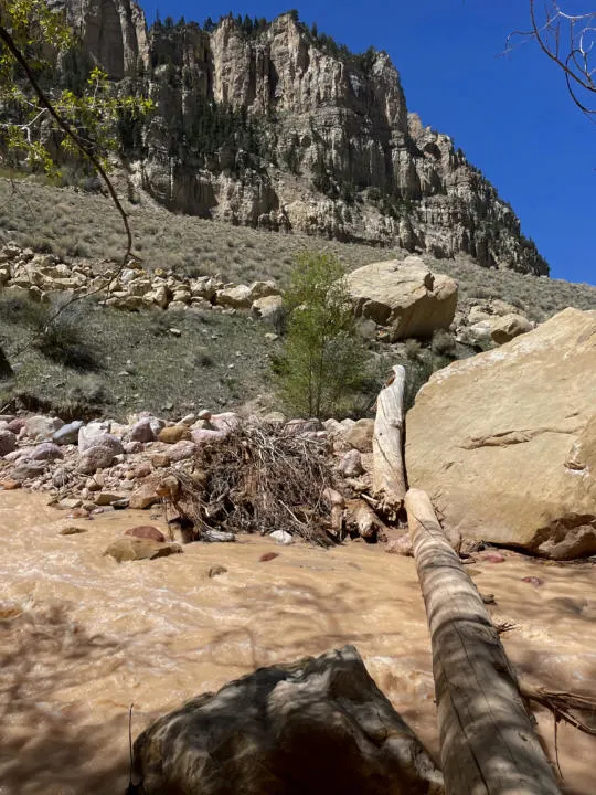
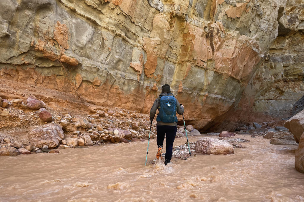
Follow the creek for about a half-mile until you reach the entrance of Ashdown Gorge Canyon. There are a couple unofficial trails that navigate the hillside above the creek and there may be some logs to help with the first couple of crossings. But honestly, you are better off just committing to the river. You may be able to keep your feet dry a little bit longer, but it wastes time and just delays the inevitable. Pretty soon you will have no choice but to cross the river.
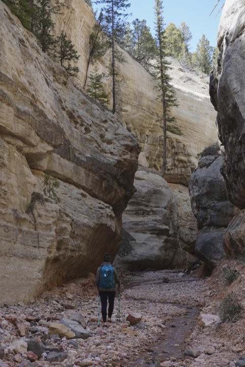
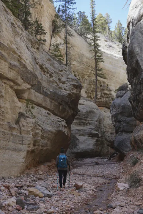
The Canyon Narrows
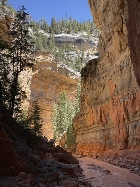
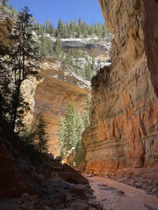
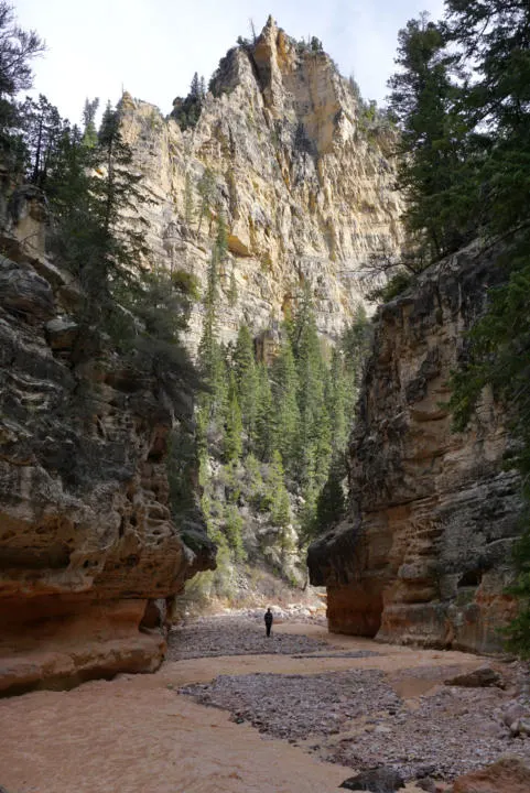
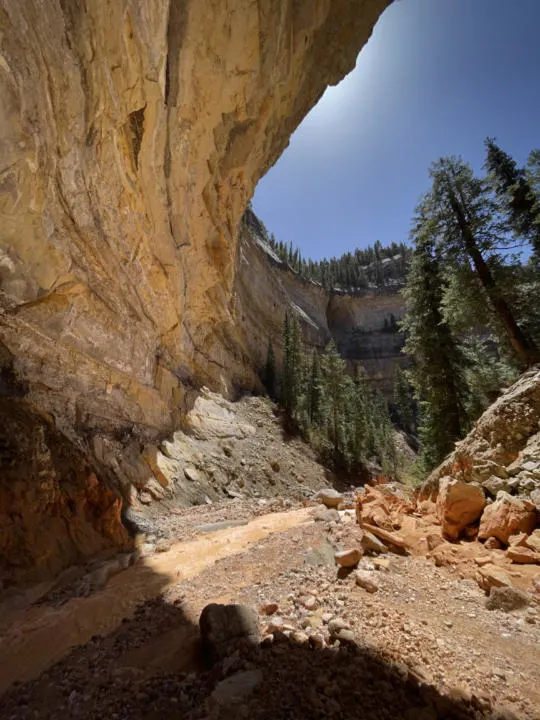
At about 1.2 miles from the trailhead, the canyon finally begins to narrow. From this point, the scenery becomes more dramatic as limestone cliffs squeeze in on the river forming large walls. The river meanders through larger and tighter canyon sections. Bends in the river carve under massive alcoves that seem impossibly large. Each bend in the canyon reveals new scenery as you turn the corner.


And at about 1.5 miles you can see Flanigan Arch high up on the cliffs above the north side of the river. It’s easy to miss. From such a far distance away, it’s admittedly underwhelming, especially for those who have traveled in Utah.
Rattlesnake Creek (Waterfall Detour)
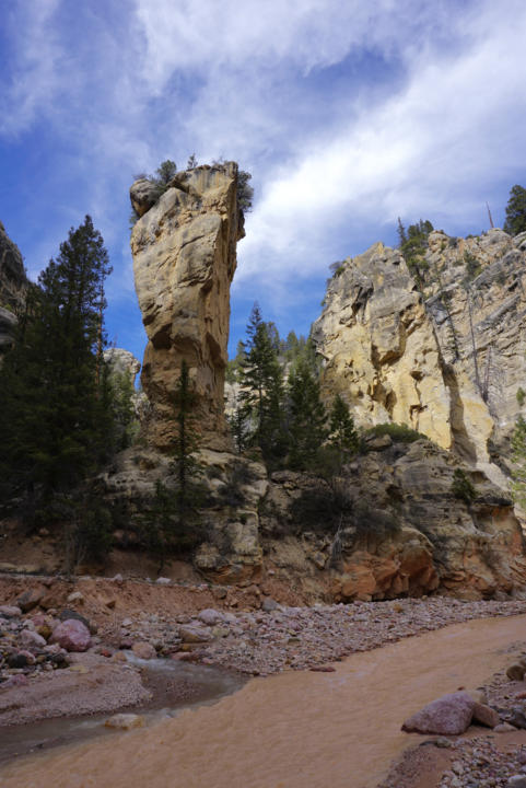

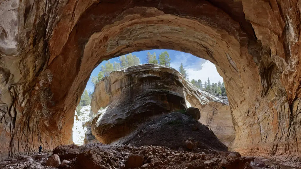
At 2.6 miles you reach the split for Rattlesnake Creek. The spot is easily identifiable by “Tom’s Head”, a giant stone monolith. Rattlesnake Creek is a worthy 1.5-mile detour to see two separate waterfalls. And the calmer clear water of Rattlesnake Creek is a welcomed change from the silty torrent in Ashdown Creek. And it also has narrower canyon hallways that are even more enchanting than the main canyon. We even encountered lingering patches of snow in May, protected from sunlight.
Up Rattlesnake Creek, you find a fork, with the left fork following Lake Creek and the right fork continuing up Rattlesnake Creek. The left fork brings you to Lake Creek Waterfall which is capped by a giant chokestone.

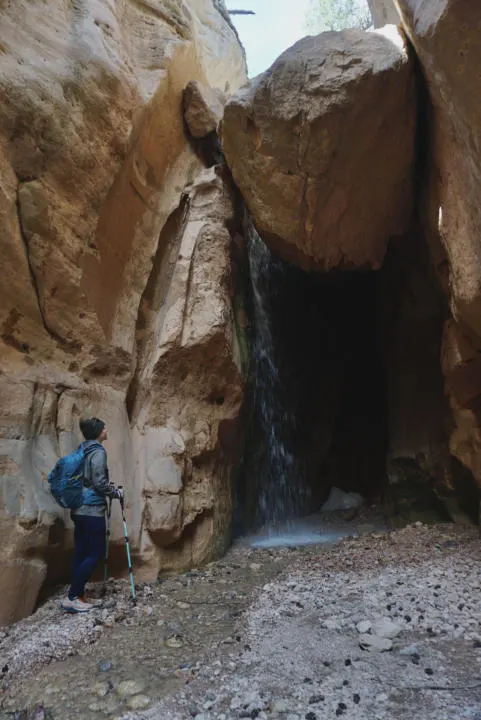

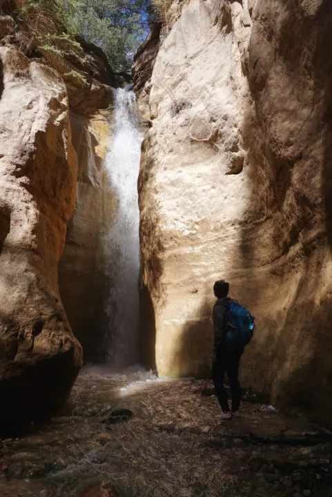
The fork to the right takes you to Rattlesnake Creek Waterfall, which comes down a carved-out chute and is the more traditionally photogenic of the two falls. But be prepared for cold wet spray if you are going to break out the camera.
After seeing the two falls, hike back to the confluence with Ashdown Creek.
Continue Up Ashdown Gorge Or Turn Back
When you get back to Ashdown Creek, you can continue upstream to enjoy another half-mile or so of narrows. Shortly after the narrows end is where you can find the exit trail that connects to the upper trailhead (for the point-to-point hike). The trail exits the north side of the canyon and climbs through the forests and meadows above the canyon to reach the upper trailhead. This trailhead is directly outside Cedar Breaks National Monument (like a mini Bryce Canyon).
Or you can begin the hike back the way you came to the bottom trailhead.
Recommended Gear For Ashdown Gorge Trail
Trekking Poles – Emily and I have a couple seasons on these trekking poles and are thrilled with the quality and performance at such an affordable price.
Neoprene Socks – We use these neoprene socks for river hikes, it’s basically like wet-suit material to keep your feet warmer when hiking in water.
Dry Bag – It’s wise to have a drybag to protect your valuables, in case you fall in the water.
Best River Hiking Shoes – You definitely want closed-toe shoes with ankle support for this hike. I would avoid sandals like Chacos, Keens, Tevas for this hike because of the rugged, rocky water crossings.
Also check out our list of 8 Hiking Essentials, that we bring on every hike.
Crossing The River
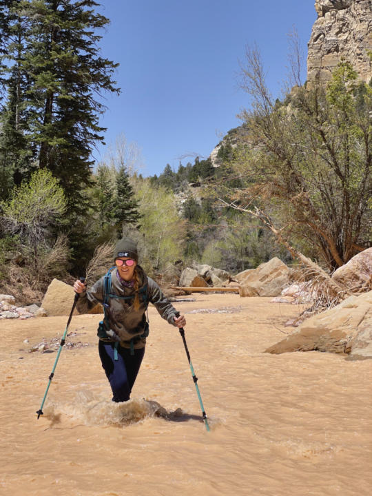
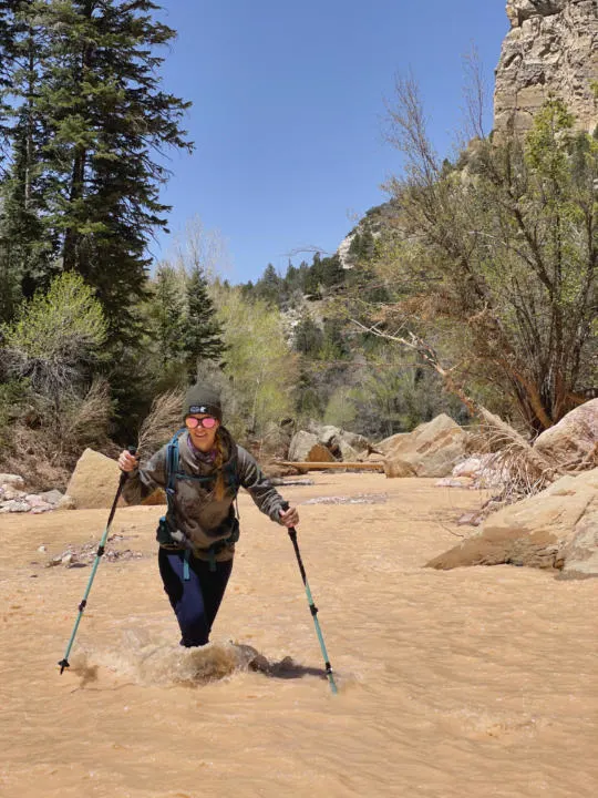
This is a slot canyon, so evaluate the weather forecast, and avoid this hike if any rain is possible. Depending on the time of year, you may encounter varying water conditions. Springtime will typically be the strongest flow. When we visited on May 9th, the water in Ashdown Creek was flowing quite strong, and we were choosing wider sections to cross where the water wasn’t so concentrated in one area. The deepest water we encountered was about thigh deep.
Fall can be one of the best times to hike Ashdown Gorge, because the water isn’t flowing as strong and leaves are changing.
It’s highly recommended to have trekking poles or a walking stick. This is an important piece of gear because Ashdown Creek is very silty, so you cannot see where you are stepping. Trekking poles can help you keep your balance and also test the water depth. Shoes with ankle support are highly recommended to prevent injuries.
To cross a fast-moving river, you want to face upstream and step sideways across. Plant your trekking poles upstream and lean slightly forward to brace on them. Also, secure any gear in a drybag that you don’t want to get wet. Most of the crossings will be between ankle to knee-deep but can vary greatly depending on the season, recent precipitation, and changes to the landscape.
Takeaway | Ashdown Gorge Trail

Ashdown Gorge is a rugged and adventurous canyon hike in southern Utah. We have hiked many of the most famous slot canyons in Utah, and this one is unique for it’s limestone cliffs and heavily forested surroundings. The silty river makes this hike especially challenging and intimidating. But it’s a non-technical route, so it’s a good fit for people without climbing/canyoneering experience. I would recommend this hike for more experienced hikers who are up to the physical challenge of the rocky terrain and murky river crossings.
Share ‘Ashdown Gorge Trail’ On Pinterest!