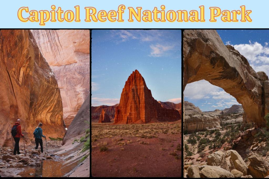

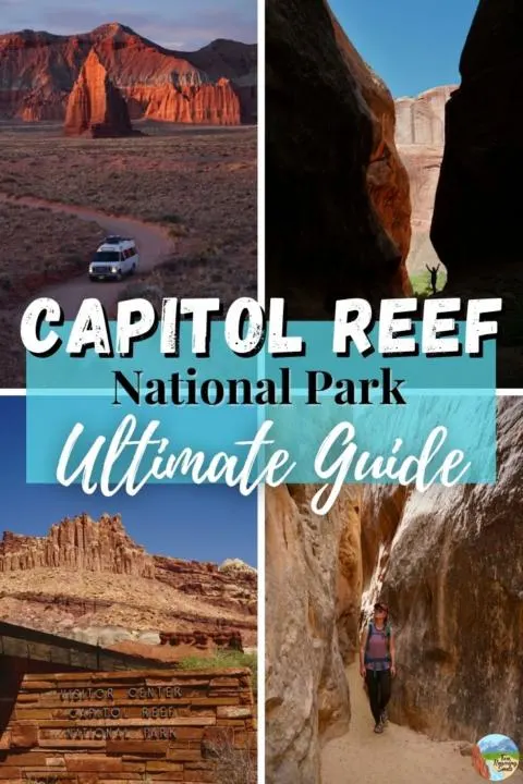
In this Capitol Reef National Park Ultimate Guide we cover all of the most stunning attractions in the park. From rewarding canyon hikes and natural arches, to cultural history and ancient petroglyphs, Capitol Reef National Park has something exciting for everyone.
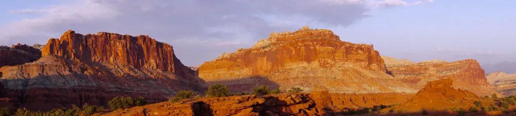
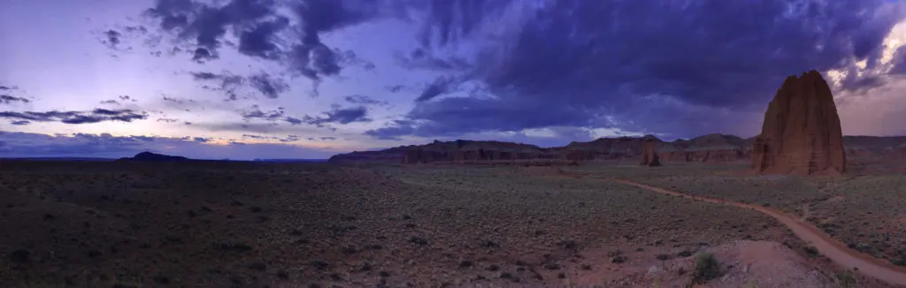
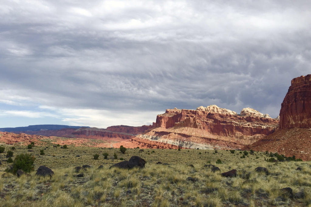
Capitol Reef National Park’s most notable geologic feature is the Waterpocket Fold, a giant spine-like formation that spans nearly 100 miles.
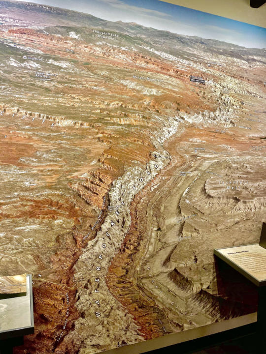
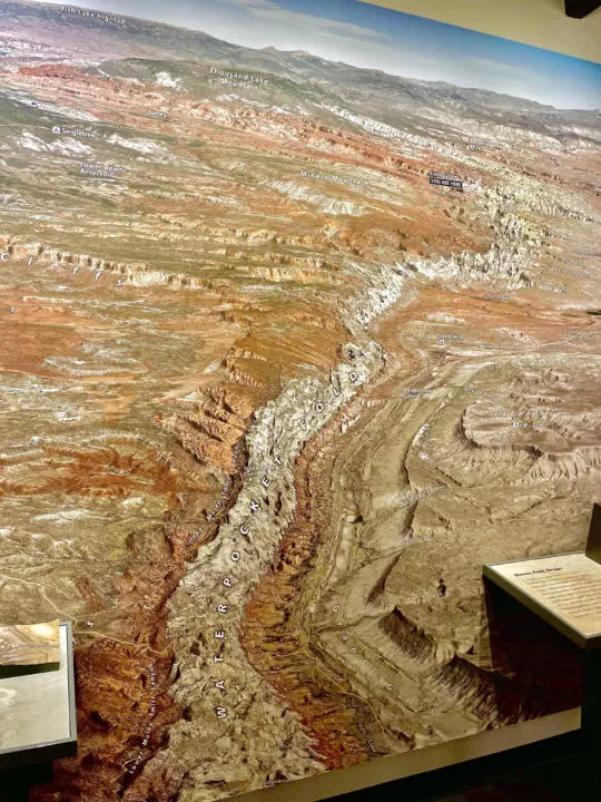
This giant wrinkle in the earth’s crust forms the setting for magnificent cliffs, canyons, arches, domes, buttes, hoodoos, and more. It gets its name from the various pools, tanks, and pockets of water that erode into the porous rock. But this massive park has an amazing variety of incredible geologic landscapes.
By encircling the Waterpocket Fold, Capitol Reef National Park is a very long and skinny park, traversing over 60 miles north-to-south, but averaging only 6 miles wide. Only a small (yet impressive) part of the park can be explored from paved roads. Thus, Capitol Reef can offer lots of solitude for visitors willing to leave the pavement and explore farther on the parks many dirt roads and hiking trails.
This post may contain affiliate links. Disclosure policy.
Getting To Capitol Reef National Park
Most visitors will access the park via Utah Route 24, where you can find the Visitor Center. This paved road slices through the waterpocket fold with the help of the Fremont River. The river provides nourishment to the lush desert oasis of Fruita, with its verdant orchards.
Most of the popular hikes and points of interest are accessed from Utah 24 or the paved Scenic Drive that runs south from Fruita, parallel to the waterpocket fold.
The Scenic Drive | Capitol Reef National Park
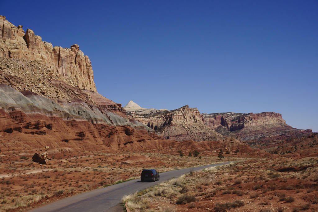
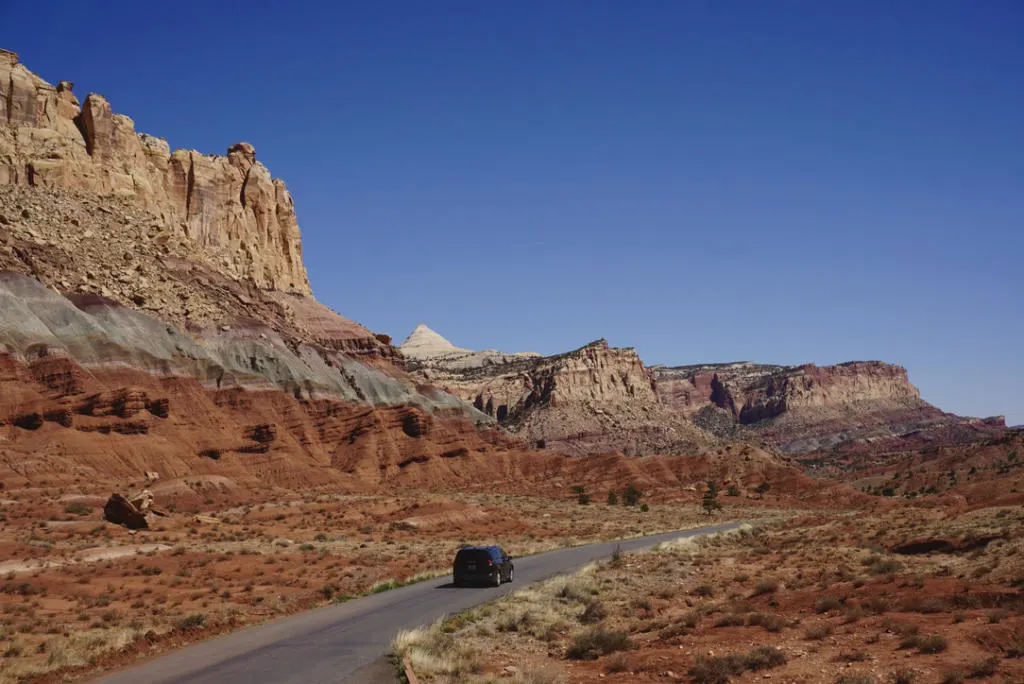
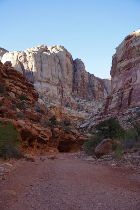
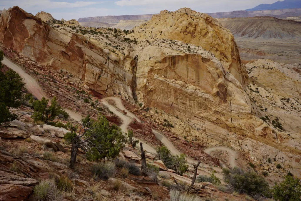
Most visitors will enjoy the 7.9 mile Scenic Drive in Capitol Reef either to sight-see from the comfort of their vehicle or as a means of getting to some popular trailheads or points of interest. The two most notable dirt-road spurs from the Scenic Drive are Grand Wash and Capitol Gorge, both of which provide access to some of the parks most impressive canyon scenery.
These dirt roads are typically suitable for passenger vehicles and RV’s up to 27ft. It’s really cool to drive your car through a canyon. No windshield will be big enough to take it all in. Allow up to 1.5 hours round-trip for the Scenic Drive plus the two spur roads, with a few short stops. (Add additional time for any hiking).
Cost For Scenic Drive:
$20 = one private vehicle
$15 = one motorcycle
$10 = pedestrians & bicyclists
Free with National Parks Pass
We highly recommend an Annual National Parks Pass to anyone that plans to visit more than two National Parks in a 12-month period. It’s $80 for the year and easily pays itself off after visiting just 3 National Parks. The State of Utah alone is home to the “Mighty 5” national parks, not to mention all the National Monuments and Recreation Areas.
Best Hikes In Capitol Reef National Park
A quick note on safety. Many canyon hikes and dirt roads to trailheads may be unsafe when there is recent rain. When in doubt check with the Rangers at the Visitor Center to verify road and trail conditions.
Easy Hikes
Capitol Gorge
- Stats: 2.2 miles, 396 ft
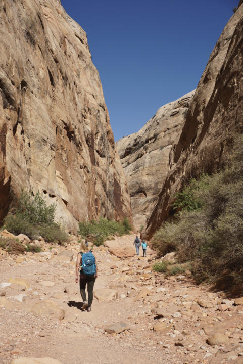
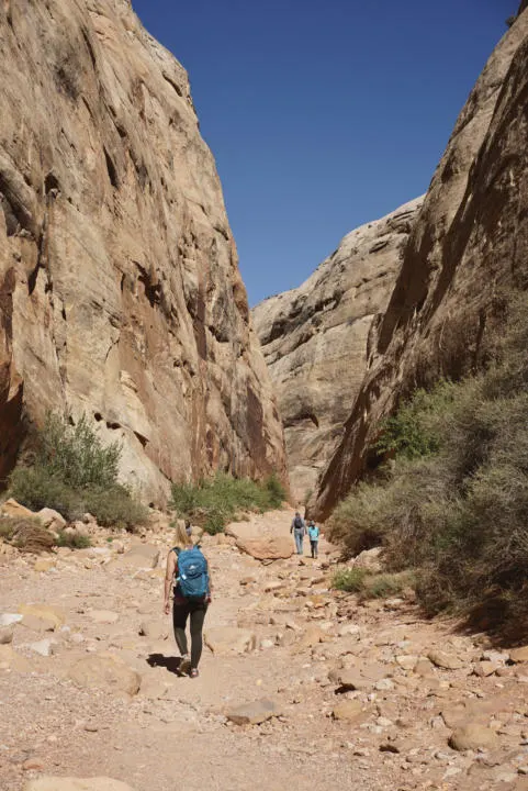
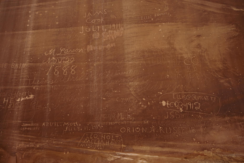
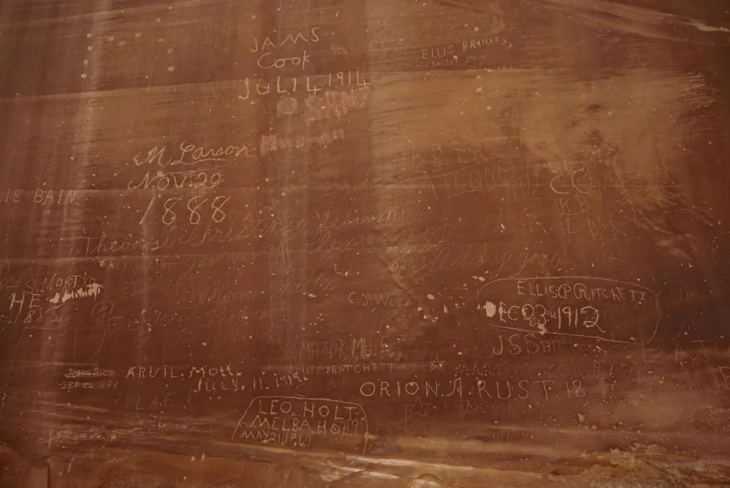
An easy walk on a dry riverbed through the massive walls of Capitol Gorge. This was actually the original “road” through the park until 1962. And the drive to the trailhead is stunning in its own right (but may be closed occasionally). Capitol Gorge Trail has Native American Petroglyphs about 1/4 mile into the trail on the left. And in a bit of mimicry, the trail also has the “pioneer register”, a place where early pioneers carved their names into the walls of the canyon. The carvings are about a half-mile from the trailhead and sit about 20 feet up on the left canyon wall. This may inspire visitors to add their names, but remember, it’s illegal to contribute your own carvings, so take only pictures.
There are some waterpockets or “tanks” on the left after about 1 mile into the canyon. It’s a short climb up to the tanks. Visually, they aren’t necessarily spectacular, but the significance of these rare water sources in the desert cannot be understated. And this short spur offers some incredible views of the massive white domes of Navajo sandstone.
Hickman Bridge Trail
- Stats: 1.7 miles, 416 ft
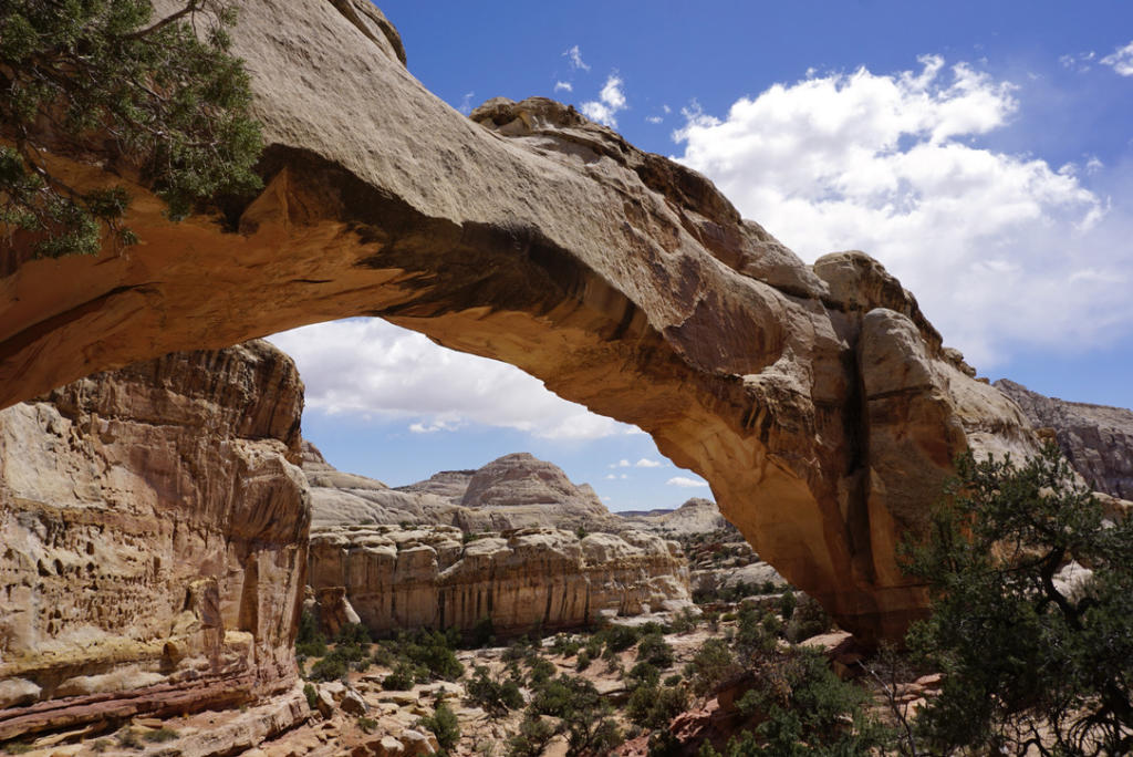
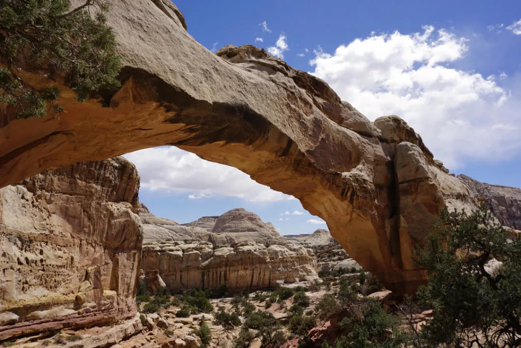
A short hike to one of the park’s most impressive natural rock arches. The trail climbs up into a beautiful canyon surrounded by massive sandstone domes. And in no time you reach Hickman Bridge. A little loop allows hikers to walk under the arch and experience its size right up close.
Sunset & Goosenecks Point
- Stats: 1 mile, 544 ft

This easy hike brings you to two dramatic canyon overlooks, which both make great vantage points to watch a sunset. Goosenecks has a perch right above a horseshoe bend in the canyon below. Sunset Point has the more incredible views of all the layers that make Capitol Reef so special.
Headquarters Canyon Trail
- Stats: 2.2 miles, 4o6 ft
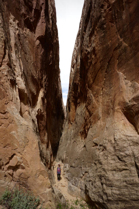
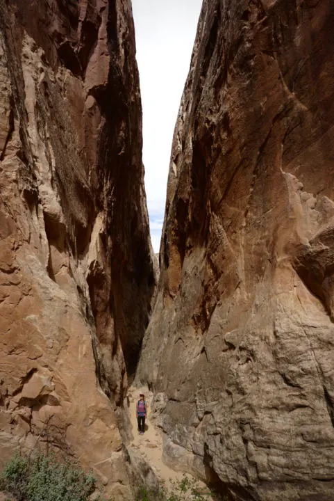
This short and sweet slot canyon hike is an easy introduction to narrow canyons. The slot is just about a mile from the trailhead. It features tall canyon walls and is only about shoulder-width wide at its narrowest point. The trailhead can be accessed via Notom-Bullfrog Road, a scenic drive that takes about 2 hours from the visitor center. The road is typically passable with 2wd vehicles under dry conditions.
Cathedrals Trail
- Stats: 2.5 miles, 345 ft
An easy hike through Capitol Reef’s northern Cathedral Valley. The trail showcases the giant sandstone monoliths that dominate the landscape. But it’s anything but easy to get to this point. The drive to the trailhead requires a 28-mile drive on a rough dirt road that requires high clearance and sometimes 4×4. However, if you are planning on exploring Cathedral Valley, it definitely a worthy stop. More info on exploring Cathedral Valley is below.
Moderate Hikes
Grand Wash (+Cassidy Arch)
- Stats: 6.9 miles, 557 ft

A hike through a dry wash that ushers visitors into a dramatic steep-walled canyon that winds through the waterpocket fold. The hike difficulty is labeled as ‘Moderate’ but only because of the loose gravel that can be tiring. Otherwise, it’s a pretty easy and straightforward walk on a dry wash. The canyon has some narrower sections only maybe 30 feet wide with walls several hundred feet tall. So while not as dramatic and narrow as some other true slot canyons, it’s still a good taste of narrow sandstone canyons.
Grand Wash can be accessed via two different trailheads, one on the Scenic Drive starts at the top and is closer to Cassidy Arch, or on Utah Route 24 starting from the bottom closer to the “narrows”.

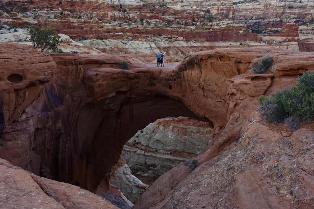
From Grand Wash, you can also access Cassidy Arch, named after Butch Cassidy the famous outlaw who is said to have hid out in the area. The steep hike up to Cassidy Arch adds on about 3 miles and 900 ft elevation climb. Or you can just hike Cassidy Arch on its own.
You can walk out on the arch easiest from the lookers-left side, and it’s surprising not that scary. You can’t even tell you are standing on an arch. We found it was a great place to watch sunset from a perch a couple hundred yards above the arch, but bring headlamps for the hike down.
Golden Throne Trail
- Stats: 4 miles, 730 ft
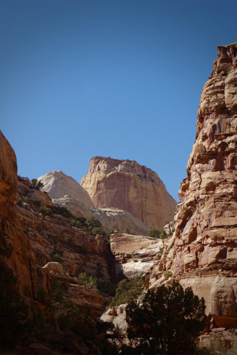

The Golden Throne Trail starts from the same place as Capitol Gorge Trail, but instead climbs up the canyon walls to the Golden Thone Overlook. Golden Throne is the name of the massive sandstone monolith that is one of the parks largest. The trail is a decent climb, but you are treated to spectacular views the entire time.
Strenuous Hikes
Fremont Gorge Overlook
- Stats: 4.3 miles, 1090 ft
This short but moderate climb brings you up to an epic overlook of the Fremont Gorge. From a perch high on the edge, you are treated to a breathtaking view of the massive gorge and the Fremont River snaking through. The hike up the ridge is a steady climb with no shade, so plan accordingly. The difficulty of this hike depends a lot on how hot it is when you go. In cooler weather is it probably more moderate than strenuous.
Rim Overlook Trail
- Stats: 4.1 miles, 453 ft
This trail climbs a steep trail up to a dramatic overlook from the cliffs above Fruita. From the top you get incredible views of the waterpocket fold, Fruita, Fremont Gorge, and more.
Sulphur Creek
- Stats: 5.8 miles with shuttle/hitchhike, 410 ft

Sulphur Creek is a river hike that requires walking in water, unpredictable footing, and some scrambling. This loop hike is for experienced and adventurous hikers, and thus not typically recommended to the masses by the park service. The water is typically ankle/shin deep. But some sections require swimming, especially when water flow is high. River hikes like this require special preparation to deal with conditions. And always check with the visitor center for current conditions, because Sulphur Creek is often closed for safety.
Sulphur Creek has a wide variety of scenery, from wide serpentine canyons to narrower sections with chutes and waterfalls.
The tricky part of completing the hike as a loop is that you either need to shuttle a car, walk the road, or hitchhike. A section of the loop is on Utah 24 from the Visitor Center to Chimney Rock Trailhead. I would not suggest walking the road because the speed limit is 55mph and there is no sidewalk or shoulder.
You can choose to hike upstream from the visitor center as an out-and-back hike. But going against the flow of water isn’t preferable.
Read our full Sulphur Creek Hiking Guide here.
Halls Creek Canyon Backpacking Trip
- Stats: 22.4 miles, 2,828 ft
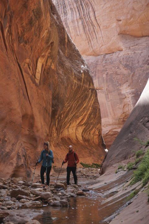
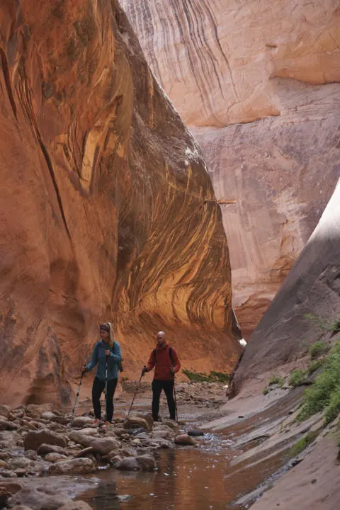
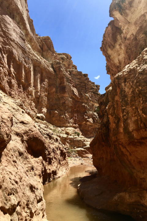
Halls Creek Canyon is one of the grandest adventures at Capitol Reef National Park. The primary attraction is the Halls Creek Narrows which is a spectacular slot canyon in the remote southern tip of the park. The narrows section requires hiking in the river and usually some wading or swimming.
Halls Creek is typically done as a 2-3 day backpacking trip because of the length and difficulty. Hikers typically hike 8 miles to the mouth of the narrows on day one and make camp. Then hike the narrows on day 2 with just a daypack, and hike out on day 3.
To do Halls Creek Canyon you must get a free permit from the Capitol Reef Visitor Center, Bullfrog Marina, Anasazi State Park, or Escalante Interagency Visitor Center. The last 2.4 miles to the trailhead has some rough, rocky inclines. A high-clearance vehicle is pretty essential to reach the trailhead, and 4×4 is helpful but not strictly necessary.
Even More Slot Canyons For Experienced Canyon Hikers!!! -> Adventures in Capitol Reef’s More Off The Beaten Path Slot Canyons
Stargazing At An International Dark Sky Park
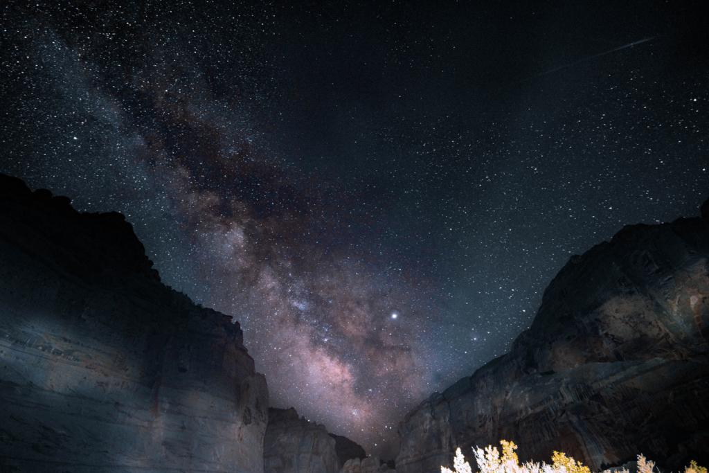
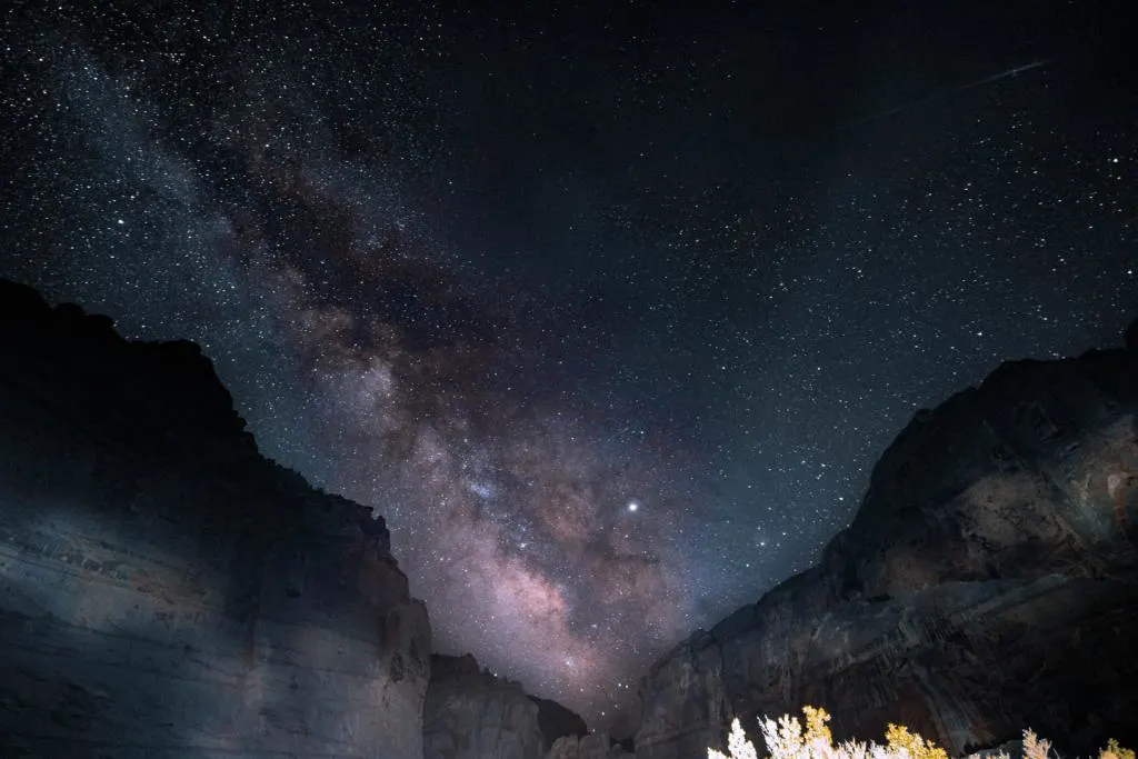
Capitol Reef has received designation as an International Dark Sky Park. It’s a great place to experience incredible starry skies. Through its remote location and efforts to reduce night pollution, Capitol Reef has received “Gold Tier” status. That means you can find the highest quality night skies here. Don’t forget to make some time for stargazing or astrophotography. You can join in any of the guided activities below or simply step outside after dark to experience it for yourself.
Star Talk
Tour the night sky at this International Dark Sky Park. Meet at the Gifford House. Typically offered near the new moon. Check bulletin boards or at the visitor center for dates; 30 minutes.
Full Moon Walk
Enjoy a moonlit, guided walk. Typically offered in the days leading up to the full moon. Check bulletin boards or the visitor center for dates and meeting locations; 1.5 hours.
Annual Heritage Starfest
Annual weekend event, usually scheduled near a new moon in September or early October. Activities often include guest speakers, stargazing, and telescope viewing. See the calendar for more details.
Explore Fruita | Capitol Reef National Park
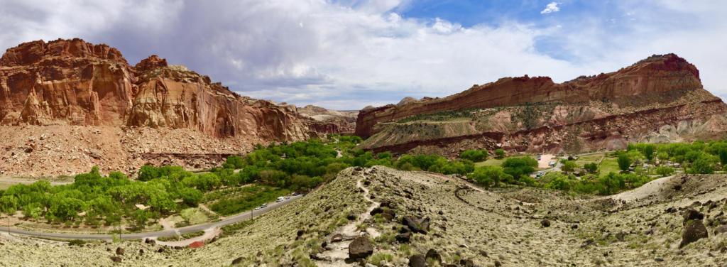
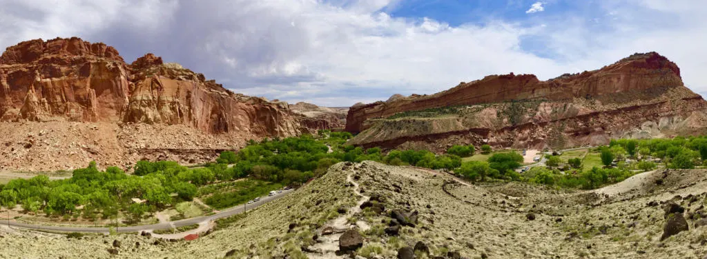
Fruita Historic District is the heart of Capitol Reef National Park. It’s where you will find the Visitor Center, and most of the ranger-led activities. The lush valley at the junction of the Fremont River and the waterpocket fold has been a hospitable home to humans for thousands of years. First for the Freemont Native Americans, and then later to early pioneers. While many other parts of the park don’t have many trees, Fruita is a verdant oasis, home to mature trees and historic fruit orchards.
Explore Fruita’s Orchards

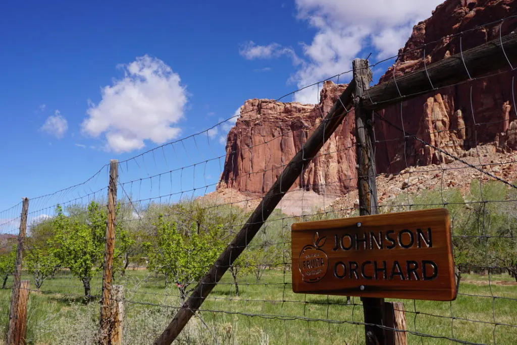
The historic orchards are still actively managed to this day and have over 1,900 trees including cherry, apricot, peach, pear, apple, plum, mulberry, almond, and walnut. Springtime is flowering time for most trees and will treat visitors to a pop of color.
But if you are visiting during the harvest season (summer or fall) you can go into any orchards with a “U-Pick Fruit” sign and pick your own ripe fruits to eat. Any fruit consumed in the orchards is free, or if you want to take some with you, weigh it and pay on your way out.
The estimated harvest timeline is; Cherries: June 11 – July 7; Apricots (early): June 27 – July 22; Apricots (regular): June 28 – July 31; Peaches: August 4 – September 6; Pears: August 7 – September 8; Apples: September 4 – October 17.
The different species ripen at different times, so check this with the Visitor Center or this webpage here for more info. And harvest times may vary by several weeks depending on weather.
Gifford House

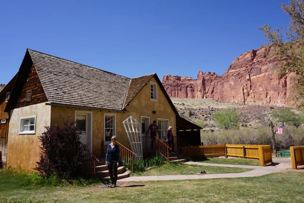
This historic old homestead housed several generations of pioneers who made their living off agriculture in this valley. It now serves as a gift shop for local and homemade items, like jams, preserves, salsas, and more. Stop by to try the homemade pies or ice cream. We were a little bummed to learn that (even when in season) they don’t use the fruit from the Capitol Reef orchards for the pies. But they are from nearby farms.
In addition to the Gifford House itself, the Gifford homestead includes a barn, smokehouse, garden, pasture, and rock walls.
Petroglyphs
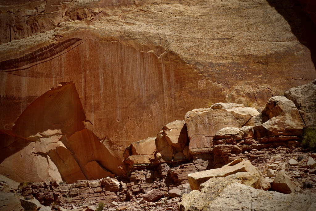
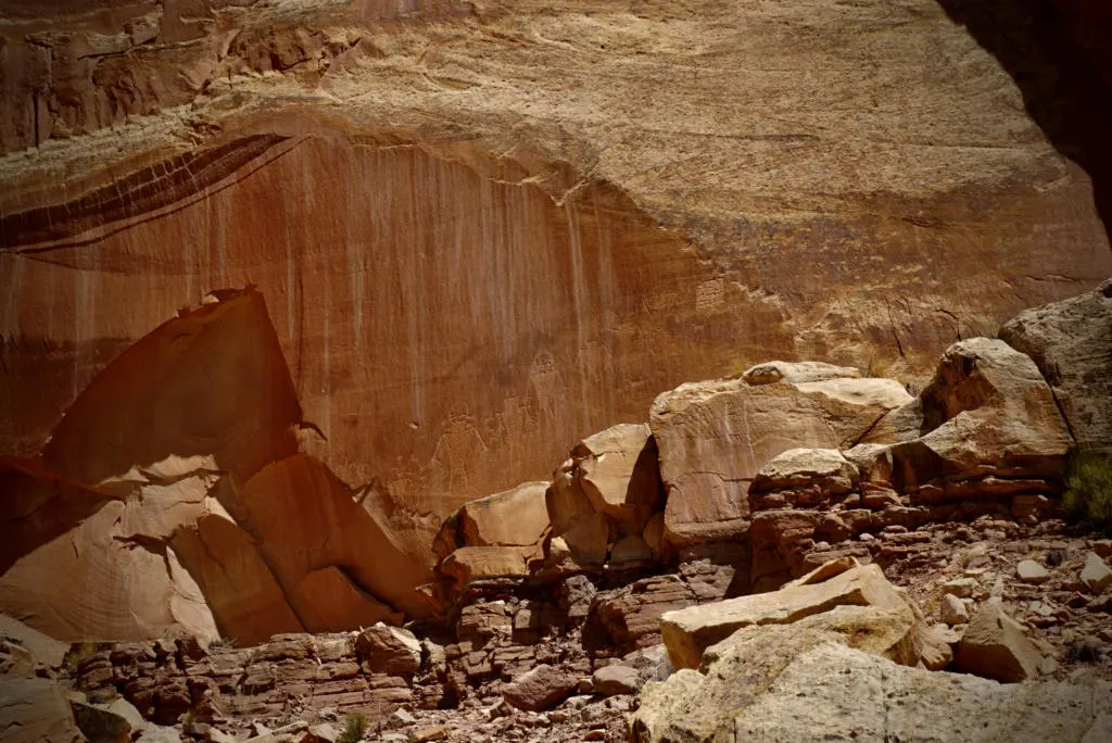
All Native American tribes that inhabited this area have been dubbed “Fremont Culture”, but several tribes including the Zuni and Hopi have identified evidence of their ancestors’ existence here. Tribes left behind petroglyphs on the canyon walls just east of the Visitor Center on Utah-24. A wooden boardwalk gives all visitors a chance to check out these historic carvings. There are human-like figures and bighorn sheep that can be seen up on the wall. Bring a pair of binoculars or a camera with zoom for a closer look.
Looking for Activities For Kids?
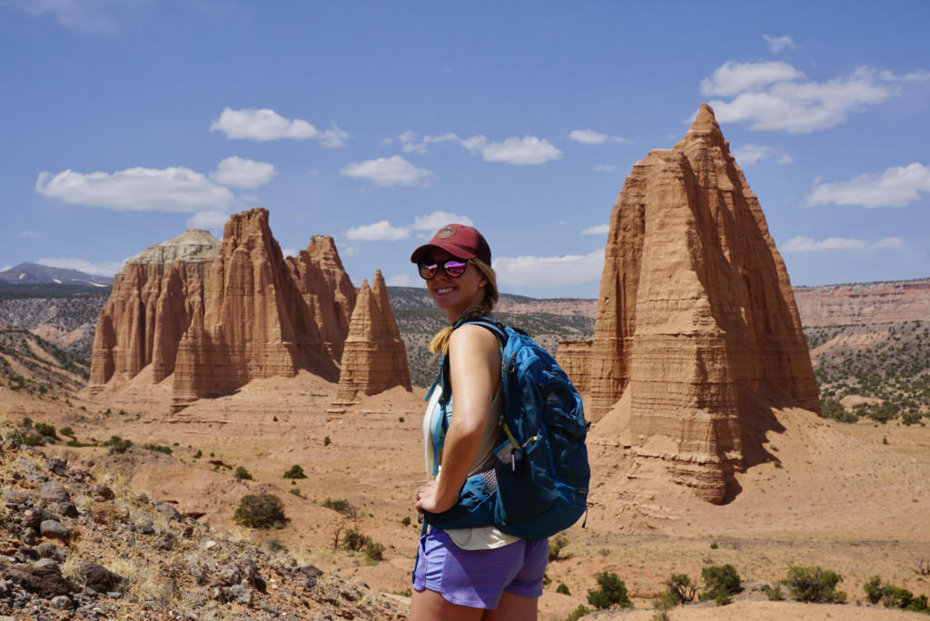
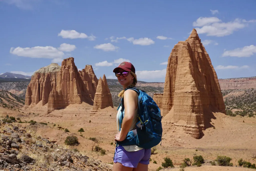
Cathedral Valley (North District)

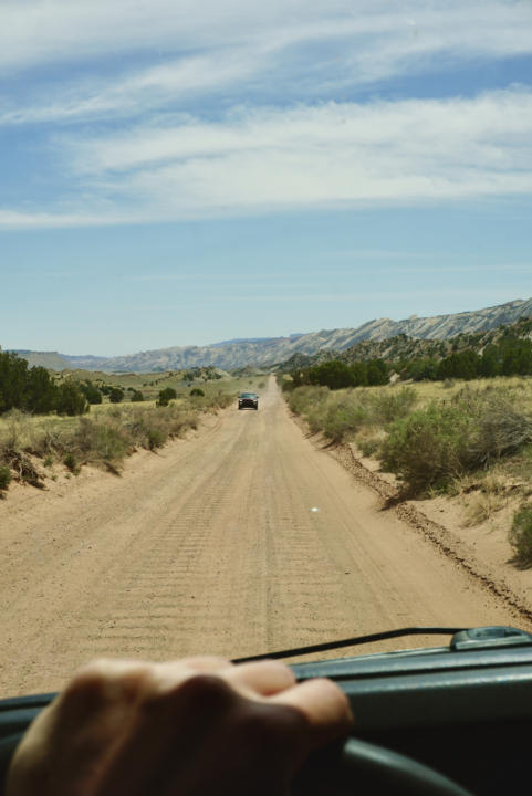
The north part of Capitol Reef National Park is Cathedral Valley. This remote and rugged area is mostly known for its pink Entrada sandstone cliffs and monoliths. The name comes from these monoliths that resemble the architecture of Gothic cathedrals. Cathedral Valley has a handful of short trails, and endless sightseeing from your vehicle and viewpoints.
The two roads that access Cathedral Valley are Cathedral Rd which begins just west of Caineville on Utah Route 24, and Harnet Rd which begins on UT-24 11.7 miles east of the Visitor Center. You can combine the two roads for a wild and scenic 57.6-mile loop around nearly the entire northern part of the park. The complete loop takes about 6-8 hours. Or you can choose to drive either road out and back.
For either route, it is recommended to have high clearance and 4×4 may be necessary after rain or snow. The Hartnet route requires a river ford (driving through the Fremont River). The crossing has a rocky bottom and is usually less than 1 foot deep, but it may be impassable depending on conditions. Check with the Visitor Center or call 435-425-3791 for up-to-date conditions.
Temple Of The Sun & Moon

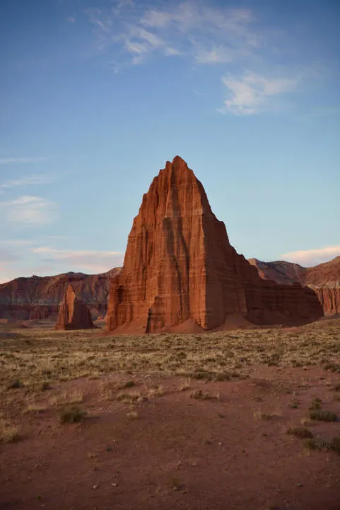
The most iconic monoliths in Cathedral Valley are called Temple Of The Sun and Temple Of The Moon. This area is probably our favorite in the whole park. The wide-open desert views being watched over by the massive sandstone giants is a sight you won’t soon forget. Lighting is usually most impressive during sunrise and sunset.
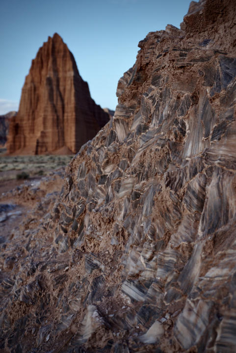
And another unique geologic feature nearby is Glass Mountain. It’s a knoll composed of selenite crystals, a glossy and transparent rock that resembles glass. It almost seems like a meteor stuck in the ground. (Remember, it is illegal to collect any rock, plant, animal, or artifact within the park)

The shortest way to reach the Temple Of The Sun, is by driving the Cathedrals Rd. It’s 17 miles from Utah Route 24.
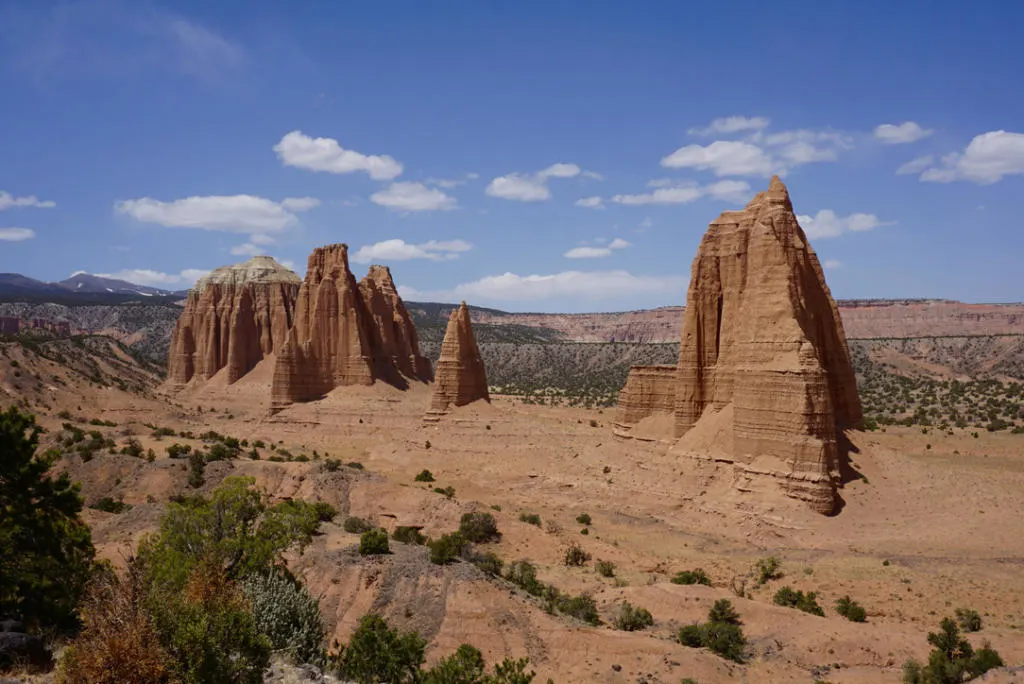
Upper Cathedral Valley

If you travel farther north in Cathedral Valley you reach another cluster of monoliths, dominated by Cathedral Mountain. It can take between 2-3 hours to reach this area, depending on how slow you take it. There may be several stream crossings that may prove difficult for some vehicles. Check with the Visitor Center if you are unsure.
There are a couple of easy trails in the area that bring you up close to these unique rock formations. The Cathedrals Trail (2.5 miles, 324 feet elevation) is the most popular one that hikes a rim right next to Cathedral Mountain. It’s a good way to get out and stretch your legs after a long bumpy car ride.
Or the Upper Cathedral Valley Overlook is a great vantage point to behold the beauty of the entire valley.
Bentonite Hills And Painted Hills

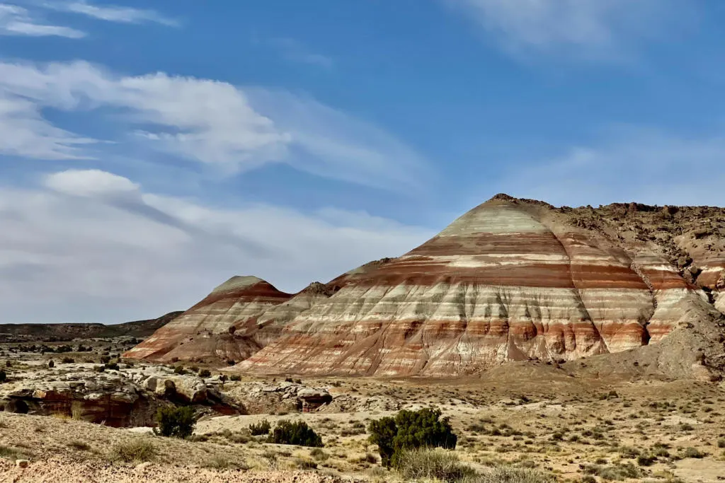
Bentonite Hills (Harnet Rd) and Painted Hills (Cathedrals Rd) are areas of unique geology with colorful banded hills in varying hues of brown, red, purple, gray, and green. They appear like a naturally colored topographic map. Both routes pass through scenery like this, so you will see landscapes like this no matter which route you take.
Camping in Cathedral Valley
Since it’s such a far drive out to Cathedral Valley, it’s common to camp overnight and break up the drive into 2 or more days. There is a primitive campground near Cathedral Mountain called Cathedral Valley Campground. Campsites are six first-come, first-serve campsites with fire pits and picnic tables. There is a pit toilet, but no running water or other amenities. The campground is at 7,000ft so plan for colder temps.
The alternative is boondocking on BLM land outside the park boundaries. There are a couple spots along Cathedrals Rd, especially just outside the park near Temple Of The Sun. But expect absolutely no amenities of any kind. And as always, practice Leave No Trace.
More Information about Cathedral Valley here.
Burr Trail & Notom-Bullfrog Road

One of the lesser-explored parts of the park is Notom-Bullfrog Road and Burr Trail. The Notom-Bullfrog road runs north-south along the east side of the waterpocket fold. It connects Utah-24 with Bullfrog Bay at Lake Powell. And also provides access to many slot canyon hikes on the east side of the park (such as Headquarters Canyon, Surprise Canyon, Burro Wash, Cottonwood Wash, and Sheets Gulch, and Halls Creek)
A large section in the middle of Notom-Bullfrog Road is dirt. Expect at least washboard conditions, but the road can be rougher in sections and washes can make the road completely impassable at times.

The Burr Trail is a road that cuts through the park, connecting Notom-Bullfrog with the sleepy mountain town of Boulder, Utah to the west. The Burr Trail switchbacks are the steep windy section of road that makes crossing the waterpocket fold possible. It makes for a scenic and remote method of entering or leaving the park.
Boulder is a tiny town with only a few stores, restaurants, and gas stations. But if you are coming through, check out Sweetwater Kitchen. It’s a farm-to-table restaurant that is way off the beaten path, but the food was too good not to mention. The dinner menu is expensive but still reasonable given the quality of ingredients. Or getting to-go sandwiches for lunch is a more affordable way to try this place out.
Lodging & Camping At Capitol Reef National Park
Fruita Campground
The Fruita Campground is the only developed campground in Capitol Reef National Park. It has 71 sites for everything from large RVs to tent sites. It’s $25 per night and reservations are required between March 1st and October 31st (available up to 6 months in advance). Campsites book up months in advance so plan ahead if you want to stay here. Between November 1st and February 28th sites are first-come first-serve. There are bathrooms with flush toilets but no showers. There are no individual hookups, but RV dump and potable water fill are available on site.
Primitive Campgrounds
Capitol Reef has two free primitive campgrounds that are first-come first-serve. Cathedral Valley Campground in the north, and Cedar Mesa Campground to the south along Notom-Bullfrog road. Both campgrounds have picnic tables, fire ring, pit toilets, and NO running water. Cathedral Valley nearly always requires high clearance, and Cedar Mesa sometimes does.
Dispersed “Wild” Camping
The other option for camping near Capitol Reef is dispersed camping on BLM or USFS land outside the park boundaries. Dispersed camping, wild camping, or boondocking has no amenities of any kind, be prepared to be completely self-sufficient and Leave No Trace. There are a couple popular spots along Utah-24, near Torrey to the west and near Cainville to the east. And dispersed camping spots can also be found outside the remote areas of the park to the north or south (like near Cathedral Valley, and on Big Thompson Mesa by Bullfrog).
{Read: Beginners Guide to Wild Camping & Boondocking}
Private Campgrounds
- Wonderland RV Park
- Sandcreek RV Park
- Thousand Lakes RV Park
- Sleepy Hollow Campground
Hotels or Vacation Rentals Near Capitol Reef National Park
There are no hotels inside the park, but you can find accommodations outside the park.
We love to compare hotel prices on Booking, Expedia, and Hotels to find the best deals! Or if you prefer Vacation Rentals, use VRBO to find the perfect home away from home.
Capitol Reef National Park | Ultimate Guide

Capitol Reef National Park is such a large and diverse place to explore. We are always mesmerized by how much the landscape changes as you travel through different regions of the park. And there’s always more than meets the eye just below the surface in the many canyons and gorges. Capitol Reef is often overshadowed by the more famous National Parks in Utah. But that often results in fewer crowds and more solitude. And for those who take the time to explore, you are sure to find beauty and wonder.
Save This “Capitol Reef National Park Ultimate Guide” For Later


The Complete Guide To Goblin Valley State Park - tworoamingsouls
Sunday 21st of May 2023
[…] And of course, if you are in the area, you gotta check out Capitol Reef National Park. There are seriously endless trails in the area. Check out our in-depth guide for best things to do in Capitol Reef National Park. […]
The Ultimate Guide To Grand Staircase Escalante National Monument - tworoamingsouls
Tuesday 6th of December 2022
[…] But Grand Staircase-Escalante National Monument offers a similar feel to Capitol Reef National Park. So if you enjoy your time here, you don’t want to miss out on this Capitol Reef Guide. […]
Halls Creek Canyon Backpacking Guide | Capitol Reef National Park - tworoamingsouls
Sunday 8th of May 2022
[…] hikes in all of Utah. This beautiful section of narrow canyon lies at the southern tip of Capitol Reef National Park. The canyon is so remote that it is typically only visited on a 2-3 day 23-mile backpacking […]