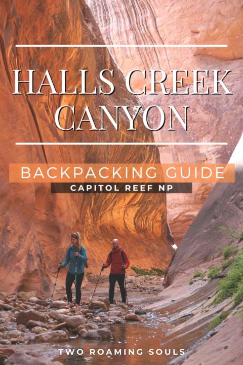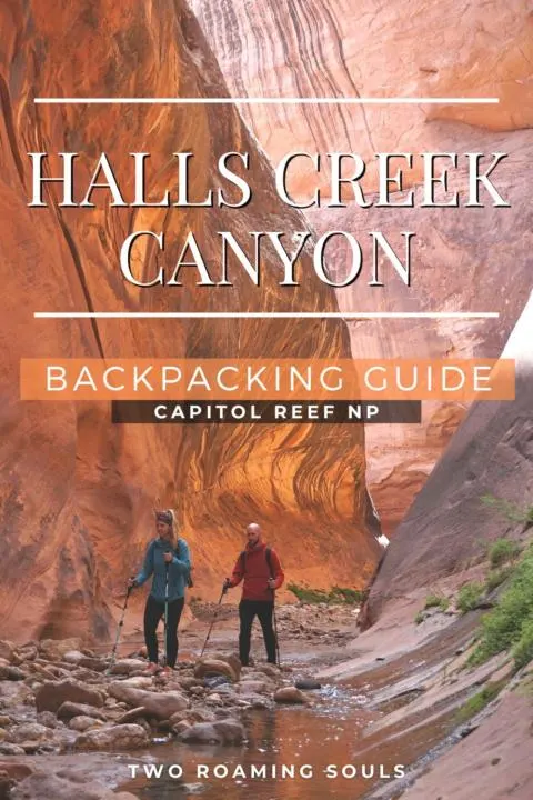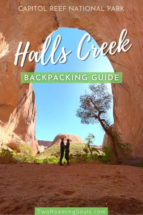

Halls Creek is one of the most spectacular slot canyon hikes in all of Utah. This beautiful section of narrow canyon lies at the southern tip of Capitol Reef National Park. The canyon is so remote that it is typically only visited on a 2-3 day 23-mile backpacking trip. Halls Creek is flowing in the canyon year-round and has shaped the massive serpentine canyon. The majority of the hike is dry, but the narrows requires walking, wading, or sometimes swimming through water.
This Halls Creek Backpacking Trip is best suited to intermediate to advanced backpackers and hikers. The route is scarcely marked and requires good route-finding skills. And hiking in wet slot canyons poses other challenges that may not be suitable for beginner hikers. The NPS does not maintain the route, so natural obstacles may be present. And considering the long drive to the trailhead, this backpacking trip will easily consume 3-5 days of your time and energy to complete.

But those challenges are what provides such amazing solitude, which is increasingly difficult to find in National Parks. Those who choose to embark on this adventure will be rewarded with an incredible sense of wonder amongst the towering canyon walls.
This post may contain affiliate links. Disclosure policy.
Getting A Permit For Halls Creek Canyon
To do a Halls Creek Canyon backpacking trip you must get a free permit from the Capitol Reef Visitor Center, Bullfrog Marina, Anasazi State Park, or Escalante Interagency Visitor Center. It’s nice to have various locations to get a permit, considering that the trailhead is over 2 hours from the Capitol Reef Visitor Center. So depending on which direction you come from, you may be able to secure a permit in a more convenient location.
Getting To Halls Creek Trailhead

The trailhead for this hike is at Halls Creek Overlook. Simply getting to the trailhead can be an adventure in itself. From the main part of the park, it takes about 2.5-3 hours to reach the trailhead.
Notom-Bullfrog Route
The most “direct” route travels 50 miles south on Notom-Bullfrog Road, but certain dirt sections may be impassable at times during the year. It turns into the Burr Trail road about halfway, and that takes you the rest of the way.
Paved Route (UT-24 and UT-276)
Or the almost entirely paved route on UT-24 and UT-276 goes 120 miles way around the park to the east (through Hanksville, and then south to Bullfrog).
Burr Trail Switchbacks (From East)
The final way to reach Halls Creek Overlook is by taking the Burr Trail Switchbacks from the east, if you are coming from Boulder or Escalante Utah. The Burr Trail is mostly paved, except for once you enter the park boundaries of Capitol Reef. Then, the Burr Trail Switchbacks descend steeply as they cross the waterpocket fold. This connects you to Notom-Bullfrog Road and from there continues south as “Burr Trail”.
Big Thompson Mesa Rd
No matter which route you choose, you will have to travel the last 2.5 miles to the trailhead on Big Thompson Mesa Rd. Which is a dirt road with a couple of really rough sections that require high-clearance. 4×4 wasn’t strictly necessary when we visited, but it may prove challenging for certain 2wd vehicles. But of course, in typical fashion, there was like a Subaru Crosstrek and Toyota Rav4 at the trailhead when we arrived. But I would be surprised if they got there without scraping bottom at least once.
Camping Near The Trailhead
Camping is not allowed at the trailhead at Halls Creek Overlook. But you wouldn’t want to anyway because it is not level.
However, the park boundary is very close to the trailhead. And just outside the park is BLM land that allows dispersed camping. There are two viable campsites outside the park that are nearly a stone’s throw from the trailhead.
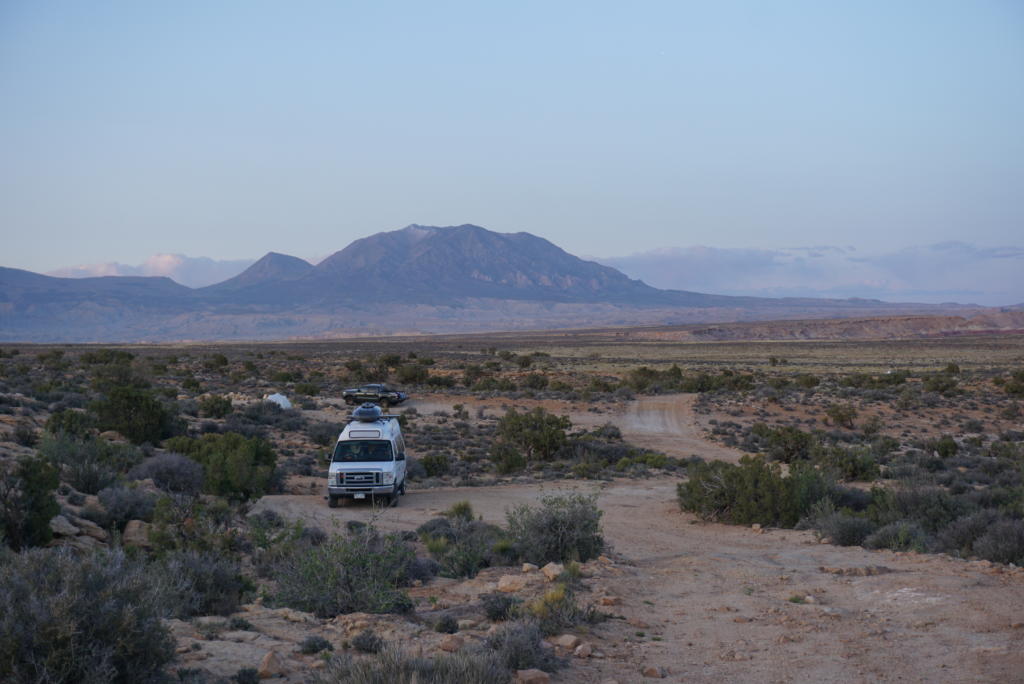

Or just after you turn off onto the final 2.5 miles of dirt road (Big Thompson Mesa Rd), there are a couple campsites on the right site. Otherwise, we saw several possible sites on our drive north on Burr Trail. I cannot speak for north on Burr Trail, since we came from the south.
Planning For Backpacking Halls Creek Canyon
Halls Creek is typically done as a 2-3 day backpacking trip because of the length and difficulty. We would highly recommend 3 days, because completing in 2 days would require one day to be quite challenging. To complete in 3 days, hikers typically use Day One to hike about 8 miles to near the mouth of the narrows and make camp. Then on Day Two, hikers can complete the 6-mile loop through the narrows with just day packs. Finally, on Day Three, break camp and hike back out.
Drinking Water
The most reliable places to find water to filter are at “Fountain Tanks” and from Halls Creek itself. The “Fountain Tanks” are found about 4.4 miles from the trailhead on the east side of the gulch. But we were told that the water from there was not looking very favorable when we visited. Also, most hikers would probably prefer to carry enough water for the entire day, and not have to stop to filter water anyway.
We encountered the first running water in Halls Creek about 1-mile before the entrance to Halls Creek Narrows (about 7 miles in). This is also where most people choose to make camp, so it’s a convenient place to filter water. Our favorite water filter for backpacking is the Platypus Gravityworks (full review here).
The amount of water needed for backpacking Halls Creek varies on the weather. Mostly, the hotter it is the more water you will consume. But a good benchmark for most adults is about 2-3 liters per day.
Weather Conditions
This hike should not be attempted when there is rain forecasted. It is prone to flash flooding that could be deadly to hikers in the narrows. Additionally, rain may also make it difficult to reach the trailhead in the first place. Check here for a weather forecast specifically for Halls Creek Canyon.
The season to hike Halls Creek Canyon is between March and November. But extremely hot temperatures in the summer will make the long exposed section brutal. Spring and Fall will have the most comfortable temperatures for backpacking. If you must go in summer, we highly recommend hiking early in the morning, especially on the way out because the final steep climb to Halls Creek Overlook will have shade only in the morning.
And while it is cooler in the narrows, there is a good mix of sun and shade as you make your way around each corner. Plan for it to be about 5-15 degrees cooler in the shaded sections of the narrows.
In late April (when we visited), the water of Halls Creek was not very cold. We did choose to hike with low neoprene socks, which was appreciated but not 100% necessary. Even in the narrows, you will spend plenty of time hiking out of the water. So your feet and legs have chances to warm up. And there was only one waist-deep section and a handful of knee/thigh-deep sections. But it’s a good idea to check with the Visitor Center, or read recent reviews about water levels when you visit.
No Fires, No Pets
There are no campfires allowed anywhere along the Halls Creek Canyon Backpacking route. And pets are also not allowed.
Trail Description | Halls Creek Canyon
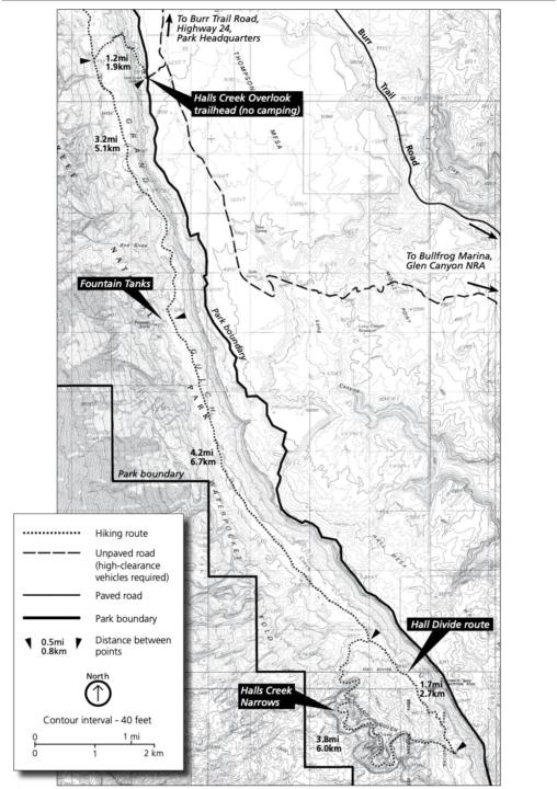
Descend from Halls Creek Overlook into Grand Gulch (1.2 miles)
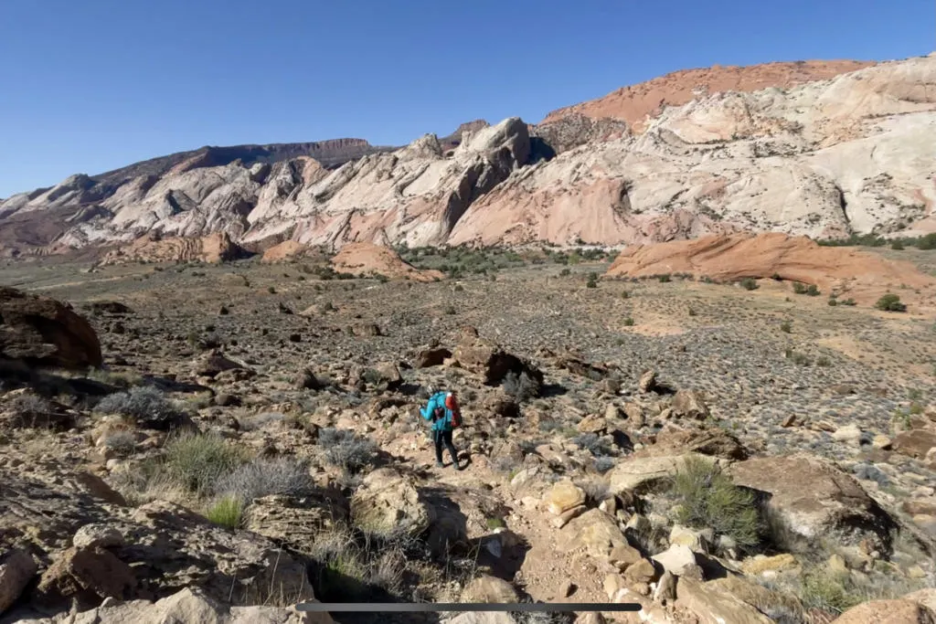
The beginning of the trail descends the steep cliffs from Halls Creek Overlook. The trail drops about 800ft in the first mile. Then you are in Grand Gulch, where a (usually) dry Halls Creek wash makes its way down the gulch.
The first time you hit the wash, take a left and follow the wash. It appears as though you should continue with the trail on the other side of the wash, but that takes you on a spur trail to the entrance of the canyon for Brimhall Arch. If you want to avoid this detour, turn left the first time you hit the wash.
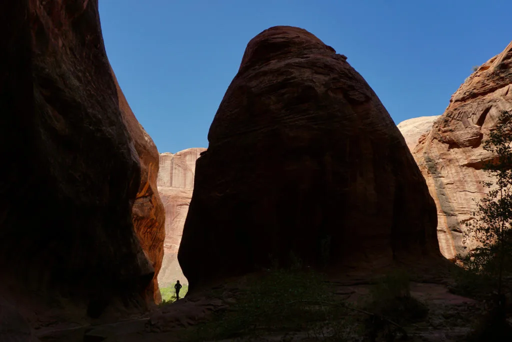
There is also no sign for the turn off to climb up to Halls Creek Overlook. So be sure to memorize some landmarks so you don’t miss the turn on the way back. There are a couple of fairly recognizable cone-shaped mounds of red sandstone protruding from the valley floor. I should note that they only appear cone-shaped from in the gulch. Viewing from Halls Creek Overlook reveals that they are more spine-like.
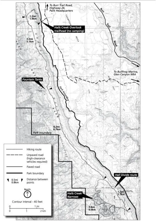
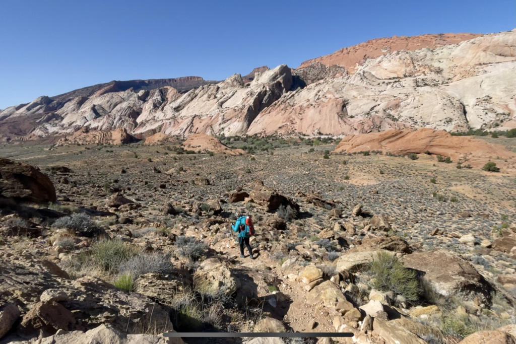
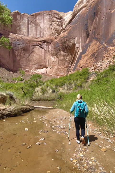
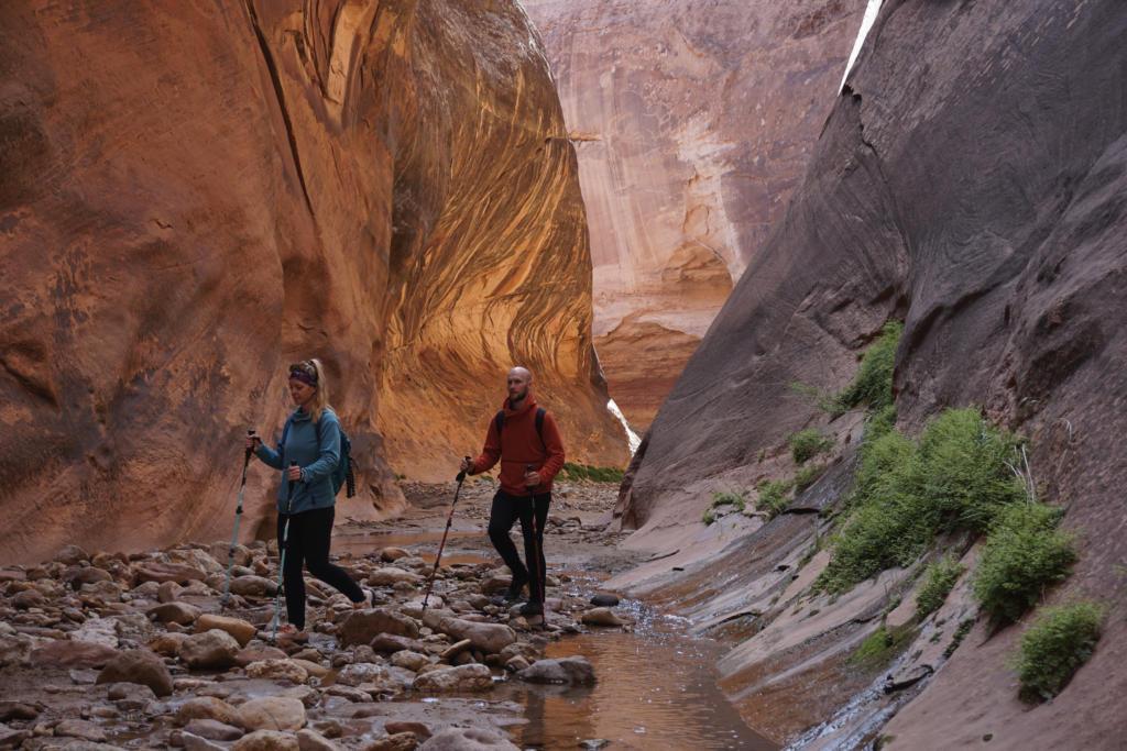
Hike along Halls Creek Wash in Grand Gulch (7.3 miles)
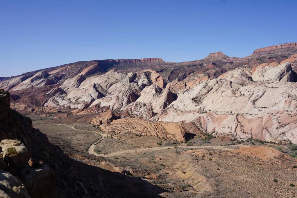
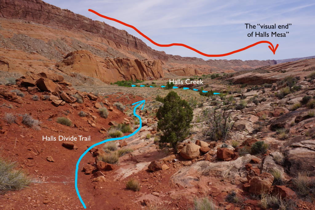
This next section makes up the longest section of the hike. The Grand Gulch is sandwiched between the waterpocket fold on the right and the cliffs of Halls Mesa on the left.
Halls Creek Wash meanders down Grand Gulch, but is likely completely dry until shortly before you reach the narrows. Luckily, there are well-established trails that cut straight down the valley, periodically crossing the wash as it snakes back and forth. These trails shorten the trail considerably compared to following the meandering wash the whole way.
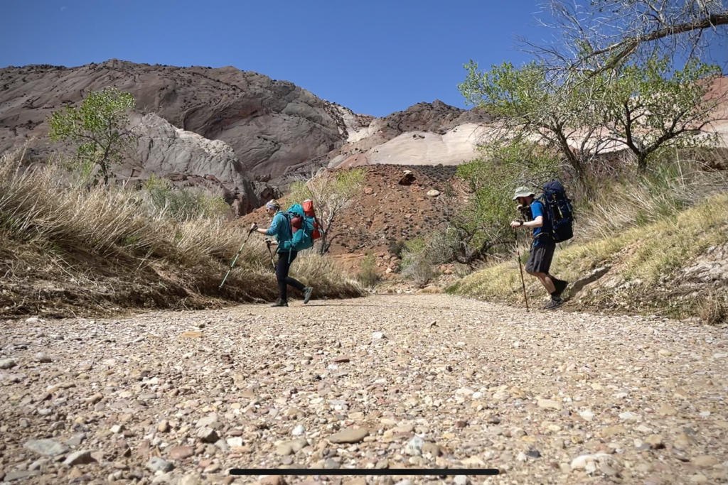
There is very little shade in this entire section so plan accordingly.
Camping near the entrance of Halls Creek Narrows
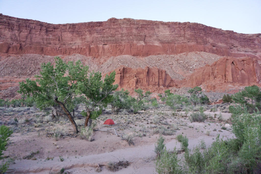

Water typically begins flowing about a mile before the entrance to Hall Creek Narrows. Most people will hike to around this point on their first day, and make camp close to the entrance of the narrows. There are several viable campsites in this area. NOTE: You are not allowed to camp in the narrows.
Hiking Halls Divide (1.7 miles)
The Halls Divide and Halls Creek Narrows combine to create a 5.5 mile loop. You can complete the loop in either direction. But if the weather is hot, then it’s beneficial to go clockwise and complete the Halls Divide connecting trail first. This 1.7-mile section is completely exposed and you may appreciate getting it out of the way in the morning before it gets too hot. However, you will be hiking Halls Creek Narrows upstream. But there isn’t really a strong flow, so it’s not like you are battling current to hike upstream.
There is no signage marking the place to turn into Halls Creek. But there are two reasonably identifiable landmarks to look out for. One is a chimney-shaped rock on your right protruding above the waterpocket fold. The turn into Halls Creek is shortly after you pass that chimney.
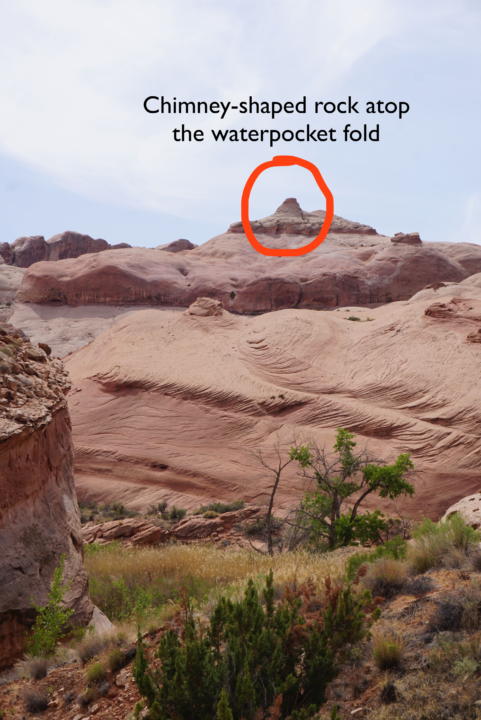

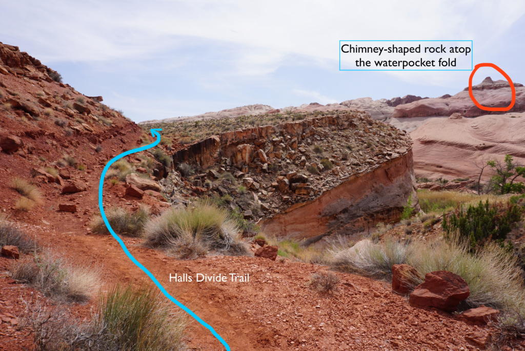

Or two, you will finally see (in the distance) what looks like the end of Hall Mesa (the massive cliffs that have been on your left the entire hike). If you identify either of these landmarks, you are very close to the sharp right turn that heads upstream into Halls Creek.

And as a last resort, eventually, you will run into Halls Creek, and at that point you can just turn upstream and follow the creek. But that will not be the shortest route.
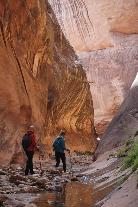
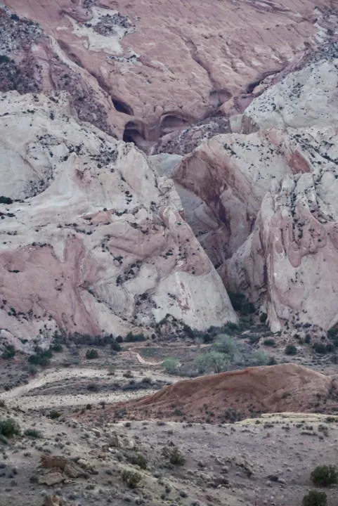
Halls Creek Narrows (3.8 miles)
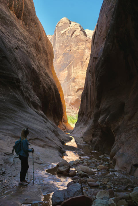

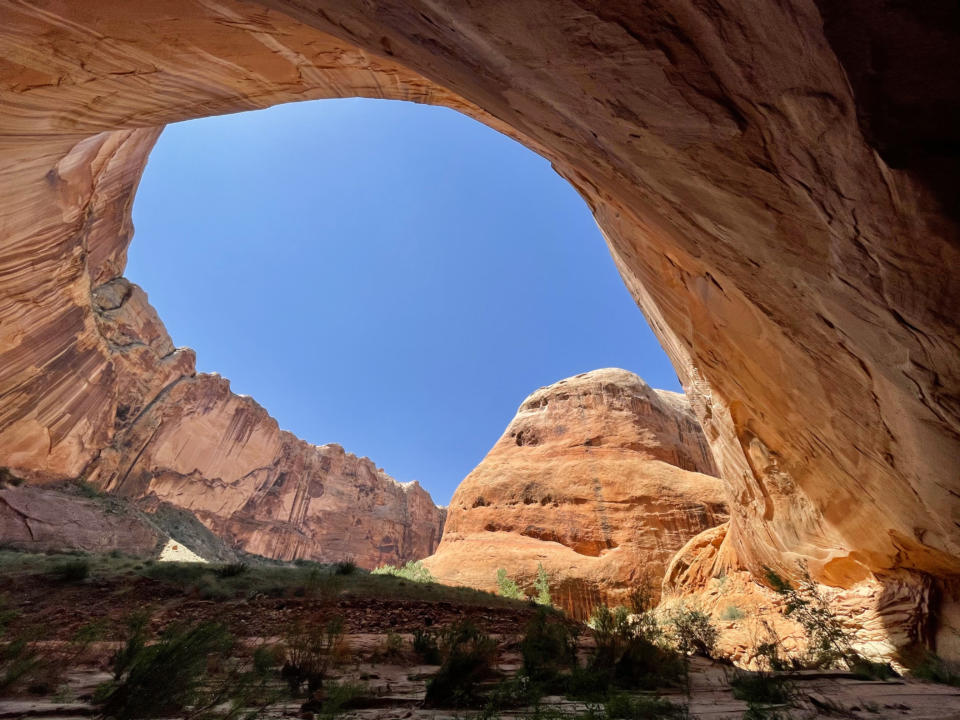
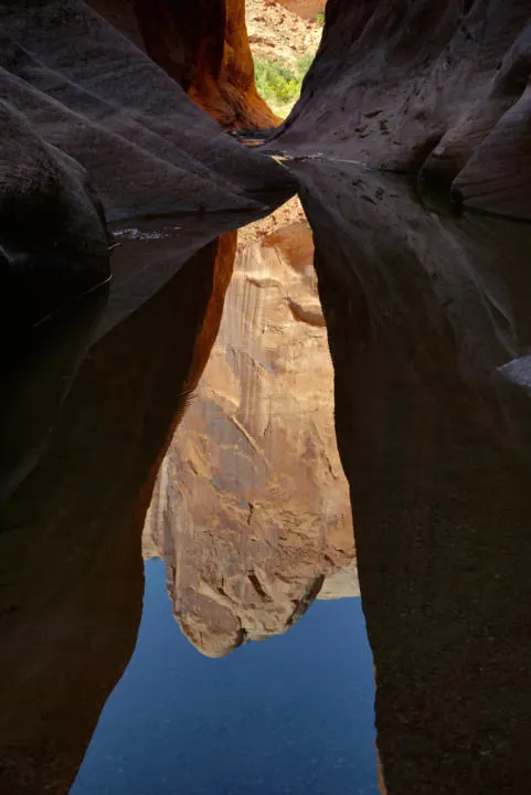
And now, the main event, Halls Creek Narrows! You get to enjoy the wonderfully impressive scenery through the tall and winding Halls Creek Canyon. In the midday sun, there is still a good balance of shade and sun as you make your way around each corner. One of my favorite parts is enjoying how the water makes mesmerizing reflections of the canyon walls. And massive carved-out walls tower over you, forming incredibly large alcoves.

There is an abundance of plants and animals thriving in the lush areas along the creek. We saw tons of toads, minnows, birds, and insects.
The narrows section of the hike will typically involve many off-and-on sections of ankle-deep water. Depending on the water level (and your height) you may find some waist-deep sections or even some that require swimming.
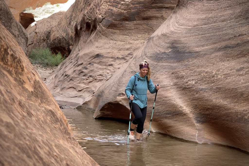
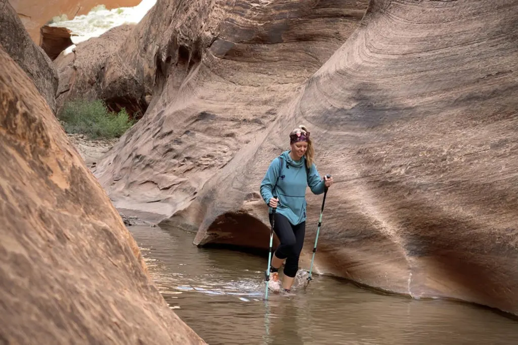
The deepest water we encountered (in late April 2022) was just below waist deep (I’m 5’8”). This section was found towards the furthest downstream part of the narrows. So it may be the first thing you encounter, or the last, depending on which direction you hike the loop. But keep in mind that flash floods can often flush out sediment or bring new deposits. So water depth can change dramatically over time.
We hiked the loop counter-clockwise, going downstream the narrows first. We chose this because it was only about 65 degrees, and the Halls Divide section was totally bearable in the afternoon sun. But if it was any hotter, we probably would have hiked clockwise instead.
When you complete the loop, you should be back in the vicinity where your campsite is. Take this opportunity to dry out your wet gear with whatever sunlight you have left.
Hike back to Halls Creek Overlook (8.6 miles)
Finally, pack up camp and complete the hike back to the trailhead at Halls Creek Overlook. Sadly this backpacking trip concludes with the steep climb up to the trailhead. So to avoid heat and lots of sun exposure, the earlier you start the cooler it will be when you attempt the final climb.
The “Airport Route” Shortcut
There is a shortcut for this backpacking trip called the “Airport Route”. Instead of beginning at Halls Creek Overlook, it begins at an old airstrip a few miles south of Halls Creek Overlook. It turns a 23-mile hike into a 15-mile hike, but it’s a steep class-3 scramble down the cliff face.
I honestly can’t recommend this “route” to most people. It would still be a really long and challenging day hike, so most people will still have to backpack. And carrying a heavy pack down a class 3 scramble is not ideal. Nearly all visitors would be better off hiking the established trail from Halls Creek Overlook. But if you are interested, this post covers more details about this unofficial route.
Don’t Bust The Crust!
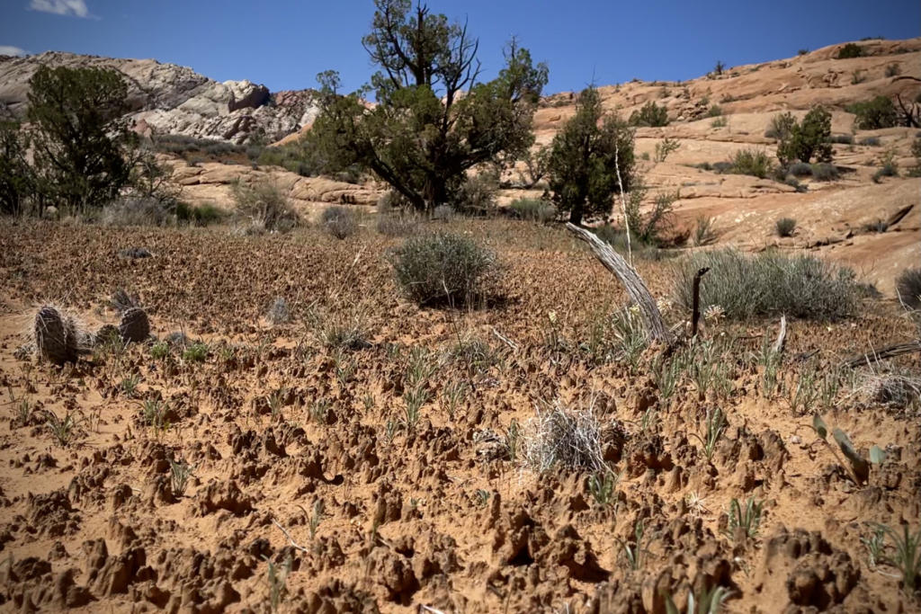
Desert soils are home to a subtle biological soil crust. This black crusty surface forms over hundreds of years and is vital to the health of the ecosystem. The crust is delicate and decades of growth can be destroyed with a single footstep. And it also keeps the sand blowing in your face to a minimum.
It’s great to see that there is so much healthy crust along much of the trail. But it does make it challenging to find places to take a break off the trail. If you must go off-trail, limit your travel to washes or solid rock.
What To Bring To Halls Creek Narrows
Check out our Ultimate Backpacking Checklist for all essentials for any backpacking trip. But in addition, river canyon hikes, such as this, sometimes call for special pieces of gear.
Neoprene Socks are an alternative to regular socks, basically like wet-suit material. They will keep your feet much warmer as you hike through cool or cold water. And help prevent blisters.
Best Footwear For River Hiking – You probably want to bring an additional pair of footwear for hiking the narrows. That way you won’t have to hike out with wet shoes.
Dry Bag – Depending on the water depth, you may want to carry a dry bag for your valuables.
Takeaway | Halls Creek Canyon Backpacking Guide

Backpacking to Halls Creek Canyon is one of the grandest adventures we have ever been on. But spreading out the 23 miles over 3 days makes this big trek more manageable. We would highly recommend copying that timeline so you can enjoy the Halls Creek narrows at a leisurely pace.
The narrows in Halls Creek Canyon are perfect for those craving a hiking adventure beyond the ordinary. As you turn each corner, you are continuously met with incredible views.

One second, you are in a dark slot admiring the golden reflections on the water. And the next second you are marveling at a massive sandstone alcove that seems impossibly large. The sun-soaked areas between slots are a vibrant oasis for all kinds of plants and animals. And the time and energy it takes to reach Halls Creek Canyon results in very few visitors. Take time to enjoy this natural, unspoiled wonderland.
Help Share ‘x’ On Pinterest!