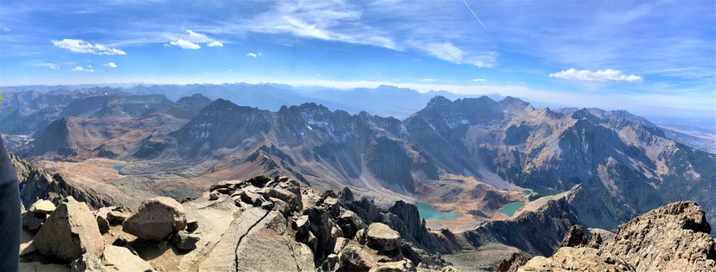
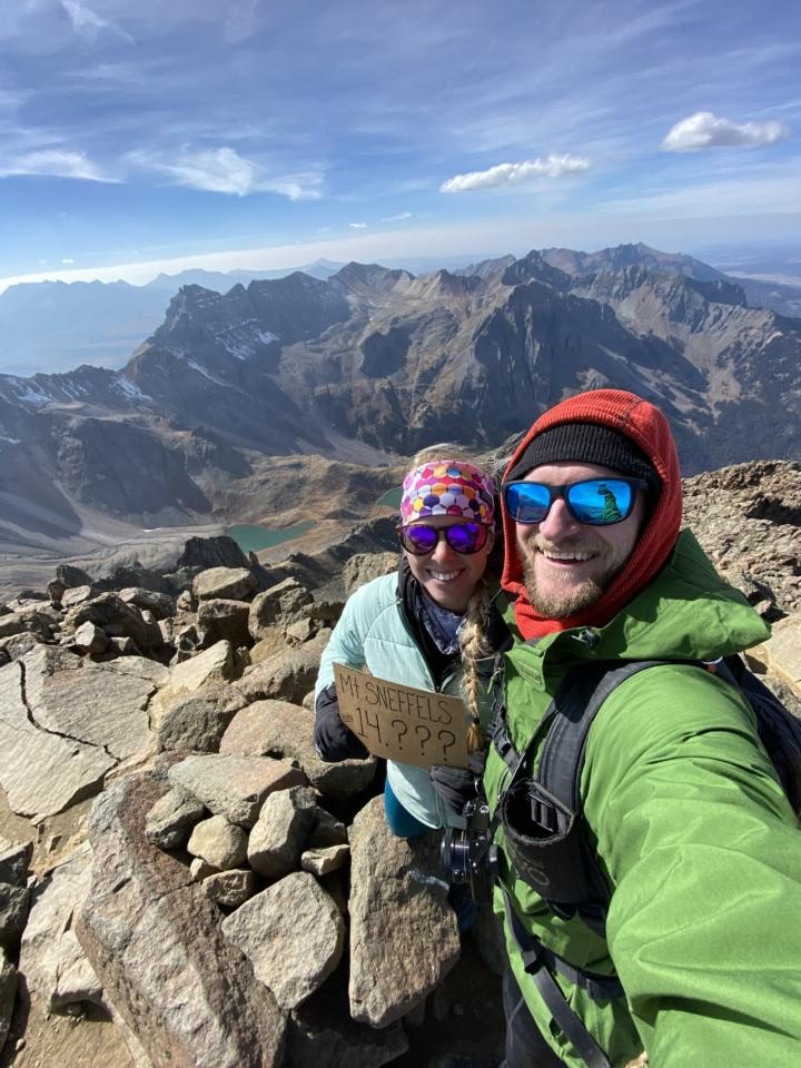
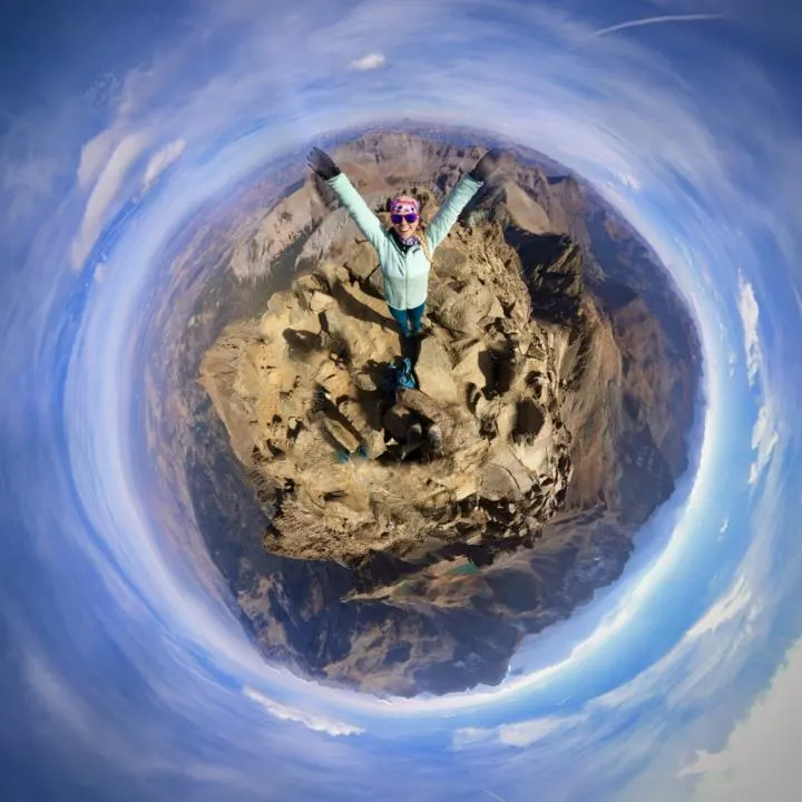
Summiting Mt. Sneffels offers some of the best views in Colorado. Climbing 14,150 feet high, you truly feel like you are on top of the world.
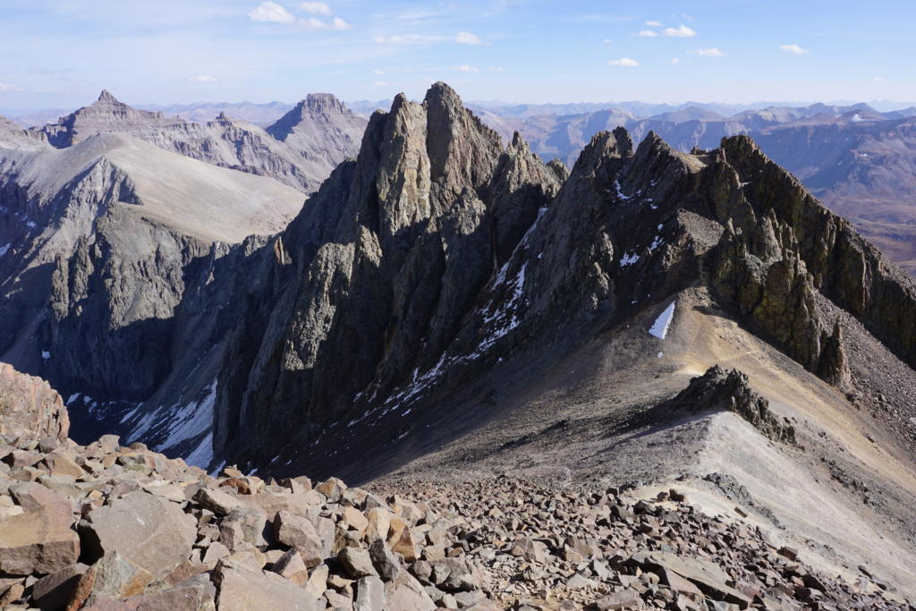
At the top, you get blessed with having visibility of many miles in the distance of the Mount Sneffels Wilderness Area to see the surrounding peaks and beyond. It is truly an unforgettable experience.

But, summiting Mt. Sneffels is not for beginner hikers, or people afraid of heights. It requires a class 2 or class 3 scramble to get to the peak of Mt. Sneffels (depending on route) and is a tough climb to the top.
If you want to summit Mt. Sneffels, you should have a moderate amount of hiking experience and acclimate to elevation if coming from sea level.
There are a couple of different ways you can reach the top of Mt. Sneffels. But each of them is difficult in their own way. Once you reach the summit, it will all be worth the trek!
Here is everything you need to know about summiting Mt. Sneffels in Ouray, CO.
This post may contain affiliate links. Disclosure policy.
Stats For Summiting Mt. Sneffels:
Distance & Elevation:
- Yankee Boy Basin (7.1 miles with 3,320 feet elevation)
- Blue Lakes Trail (13 miles with 5,501 feet elevation)
- Upper Blue Lakes Trailhead Parking Lot (1.9 miles with 1,765 feet elevation)
Difficulty: Hard
Type: Out & Back
Permit: Not required
Bathroom: Yes
Dogs: Yes
Trailheads For Summiting Mt. Sneffels:
Depending on where you are traveling from, one trailhead might make more sense than the other. If you are traveling from the South then Yankee Boy Basin might be the easier route. If you are traveling from the North, Blue Lakes Trail might be the easier route.
Yankee Boy Basin Trailhead:
Getting to the trailhead for Yankee Boy Basin is just Southwest of Ouray, CO. Off the main road 550 (Million Dollar Highway), you will turn onto Camp Bird Rd (County Rd 361).
The road is a well-maintained dirt road. Then stay right when the road splits at Camp Bird Rd and Yankee Boy Basin Road. We parked at the split between Yankee Boy Basin and Governor Basin Road. (Use these coordinates: 37.980113, -107.759274) You can reach this part in just a passenger car.
But, if you have a true off-road vehicle that has 4×4, high clearance vehicle, and short wheelbase, you can make it to the official Mt. Sneffel’s Trailhead. From this trailhead you will get a view of the sneffels range of which you are about to summit.
Do note, the road to the upper trailhead is narrow and rough. So if you don’t want to beat up your car, we suggest parking down at the lower trailhead at the Yankee Boy Basin and Governor Basin Road split.
There is limited parking at both trailheads, so it is advised to show up early if you want to ensure a parking spot close by.
Upper Blue Lakes Trailhead Parking Lot:
Upper Blue Lakes Trailhead Parking Lot is located at the end of Yankee Boy Basin Road. The naming is confusing since Upper Blue Lakes Trailhead is not even in the same basin as the Blue Lakes themselves. It’s because this trail climbs up and over Blue Lakes Pass to get to the Blue Lakes. So just be aware of this quirky naming.
The road up is only 2.5 miles long, but will be a slow and steady drive up to the parking lot.
You will need a 4×4, high clearance, short wheel base for this route. It is on extremely rough terrain. But if you have an off-road vehicle that can make the trek, it will cut out a large portion of this hike. But seriously, the road is gnarly, your average 4×4 pick-up truck is not going to be enough to drive this section of road.
Once you reach the parking lot, the hike is .95 miles (one way) to the summit of Mt. Sneffels.
But, don’t be fooled as the hardest part of this summit is the last mile. As you climb 1,765 feet in less than 1 mile.
Blue Lakes Trailhead:
This might be the prettier route of this summit because Blue Lakes are a stunning hike just on their own. But it is a much longer hike with more elevation climb. If you have an interest in backpacking along this journey, then we highly suggest this route!
The trailhead is located Southwest of Ridgeway, CO. Turn off Hwy 550 in Ridgeway, then follow CO-62 for 4.8 miles to CO Rd 7. County Road 7 is a 9 mile, long dirt road. A high clearance, 4×4 vehicle is recommended, but still accessible by 2wd. But just note, that you might need to take the road slow and dodge a few deep potholes and large ruts/rocks.
There is limited parking at this trailhead, so if you want to get a spot we suggest starting early, or avoiding peak season.
Start Of Hike For Summiting Mt. Sneffels:

Boy Yankee Basin:
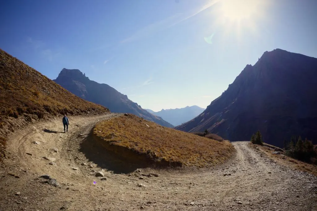
If you start at the Yankee Boy Basin and Governor Basin Road, then you have quite a climb from here. You will be hiking along the Yankee Boy Basin Road for 2.6 miles. On the way up, it is a gradual climb to the Upper Blue Lakes Trailhead Parking Lot.
During peak season you may need to watch out for vehicles traveling up to the Upper Blue Lakes Trailhead Parking Lot. But there are plenty of spots where you can step off the road to get out of their way.
If you were like us and didn’t make it up to Mt. Sneffels Trailhead via car, there is an outhouse where you can relieve yourself before the assent.
Upper Blue Lakes Trailhead Parking Lot:
From the Upper Blue Lakes Trailhead, you cut out much of the distance of this hike. But from this trailhead, you are in for a real adventure.
Refer to Summiting Mt. Sneffels section below for the remaining details!

Blue Lakes Trail:
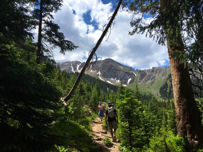
For the start of this hike, you begin your elevation gain early on. The hike will guide you through thick forest and vegetation along a maintained narrow trail.
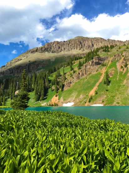
First, you will reach the lower lake which is simply stunning on its own. But to continue to the summit of Mount Sneffels, you will need to continue to the upper lake. Again, once you reach the Upper Blue Lake you will be offered amazing views of the surrounding area.
For more details on hiking up to Lower Blue Lake, check out our post: Blue Lakes Hike Near Telluride, CO.
Along The Mt. Sneffels Trail:
Yankee Boy Basin:
Continue to follow the dirt road to the Upper Blue Lakes Trailhead Parking Lot. There are no major river crossings along the route.
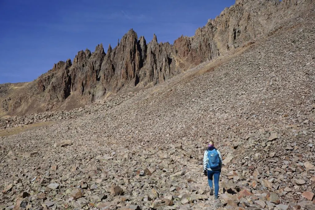
You will notice when you get to the parking lot, because the road ends and there are 3 signs with information about summiting Mt. Sneffels.
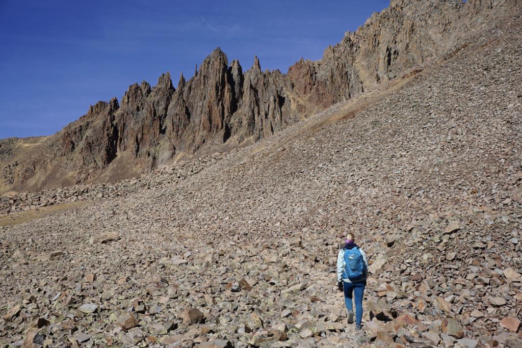
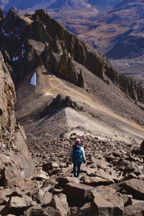
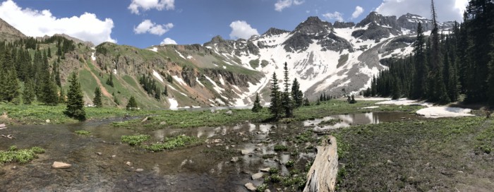
You will then follow the dirt hiking path which quickly turns into a rock path. (pictured above). Follow the rock path for about .5 miles and you will see the path up to your right leading you to the summit. There will be a sign that indicates right toward the summit and left toward Blue Lakes Pass.
Blue Lakes Trail:
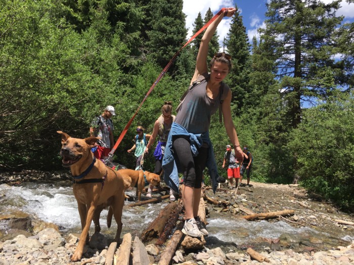
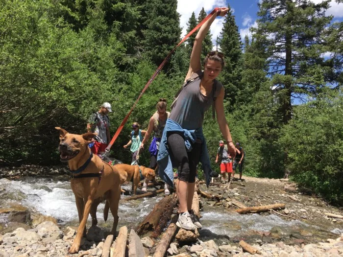
About 1.5 miles into the hike you will encounter a river crossing. The river crossing has rocks and logs in place for you to keep your feet dry, but you will want to make sure your valuables are tucked away in your backpack just in case!
Continue on the dirt path to Lower Blue Lake. There is one major river crossing on the left just before Lower Blue Lakes. Much of the area surrounding Lower Blue Lake is marsh. Cross the river and you are on the path that will lead you up to middle and upper Blue Lakes.
Summiting Mt. Sneffels:
There are two different routes you can take to summit Mt. Sneffels. The Yankee Boy Basin is a class 2 and Blue Lakes Pass (Southwest Ridge) is a class 3.
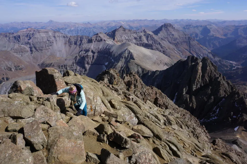
Class 2 scrambling is loose rock where you will occasionally need your hands to help you up the climb. If you lose your balance and slip, you will most likely glide down a steep section, potentially causing serious injury.
Class 3 scrambling is a notch up from class 2. You will most likely need your hands and feet for most of the scramble. If you lose your balance you could cause yourself serious injury or possibly death.
This hike is no joke and you should have a decent amount of hiking experience. This hike is not for beginners!

Yankee Boy Basin/Upper Blue Lakes Parking Lot:
From here both Yankee Boy Basin and Upper Blue Lakes Parking lot begin its ascent to the summit of Mt. Sneffels. And where the toughest part of the hike begins.
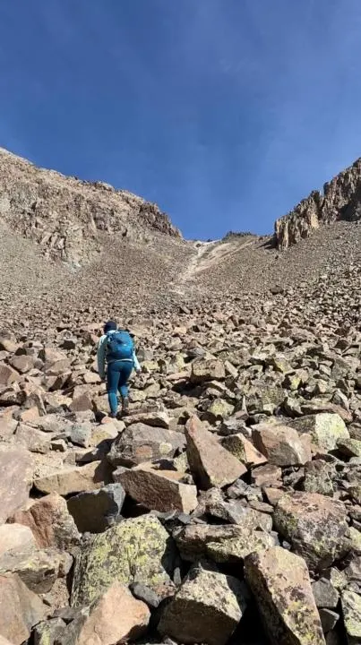
You will first travel along a maintained dirt trail from the trailhead. It will shortly turn into a rock path that has gradually been flattened out from fellow hikers. If you have a hard time finding the trail, follow the GPS on AllTrails.
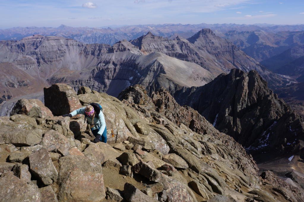
About .5 miles in you will notice a steep yet climbable section to your right. Aim for the top of this saddle, where you can see the lightly colored sand (pictured above). It will be loose rock surrounded by many medium-sized boulders. This is where you will begin scrambling up class 2 rocks. There is no “one way” path to the top of the couloir, as it is a big rock pile, so choose the path that best suits your style.
Jake and I found that climbing up the bigger boulders was better than climbing up the loose rocks. But, others found that climbing up the loose rocks to be better. But you will slide back down a bit with every step. Either way, take your time and take every step with caution.
Beware that rocks can/will come rolling down the trail. So try to stay out of someone’s direct path. And call out to other hikers if you accidentally send a rock tumbling downhill. Or some people have advised wearing helmets.
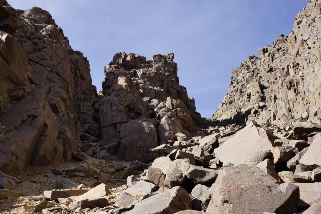
Once you reach the top of the saddle, take a left up the couloir (gully, crack, chute).

Don’t Make The Same Mistake As We Did When Summiting Mt Sneffels!
When summiting up Yankee Boy Basin, we assumed there was one way, but be sure to check the GPS. We stayed in the larger couloir (gully), on the right and followed it to the top.
This was a mistake because you cannot easily get to the summit from there. We missed another crack on the left that forks from the main couloir. SO DON’T MISS THAT COULOIR ON THE LEFT. From there you can reach the true summit (14,150 feet).

Blue Lakes Trail:
Jake and I have not officially summited Mt. Sneffel’s from Blue Lakes Trail. We only hiked to Lower Blue Lake, but have heard from fellow hikers, that the class 3 scramble section is much shorter, than the longer class 2 scramble on Yankee Boy Basin.
So that route can feel easier, because more of the route is a hard-packed dirt trail, with a shorter scramble section.
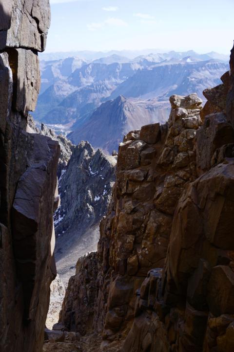
For summiting Mt. Sneffels from Blue Lakes Trail, you will climb the Southwest ridge. This is the class 3 scramble section with large cliffs on each side of the ridge. Check out Telluride Mountain Club for more information about climbing the Southwest ridge.
If you would rather climb the class 2 scramble up to the summit, you can bypass the Southwest ridge, continue down Blue Lakes Pass, and continue on to Yankee Boy Basin Trail. (though this route would be very long, because you have to cross Blue Lakes Pass twice).
Hike Back Down:

The hike back down for each hike is just as dangerous, if not more! Again, we suggest to try and find the bigger boulders so you don’t slide down the loose scree.
There are a handful of times where you might need to use your arms to slowly lower yourself down. Be extra cautious when hiking back down, and plan every step.

Backpacking Mt. Sneffels:
If you are looking to backpack along this trip, we would suggest the Blue Lakes Trail. You could hike up to Lower Blue Lake where there are many great spots to set up camp for the night.
Be sure to camp at least 200 feet from the lake and follow leave no trace principles.
You are not allowed to backpack along Yankee Boy Basin as it is privately owned property.

Don’t forget all the backpacking essentials. Check out our post:
Camping At Blue Lakes:

Yankee Boy Basin Camping
Like listed above, most of Yankee Boy Basin is on private property. Therefore, camping is not allowed on the property, unless you have permission from the owner.
But, if you want to get an early start on this hike, there is dispersed camping in Canyon Creek (Camp Bird). During peak season, the campsites are probably hard to snag.
Blue Lakes Trail Camping
If you are traveling from Blue Lakes Trail, then you can park in designated campsites along County Road 7. During peak season, designated campsites might be hard to come by.
Hotels or Other Accommodation:
If camping isn’t your thing, use Kayak.com to find a hotel nearby! Or consider booking a vacation rental on Vrbo.
Or one of our personal favorite options is to rent a campervan or RV from Outdoorsy or RVezy.
For more information about Outdoorsy & RVezy, check out our post: Outdoorsy Vs. RVezy Review | Which Rental Service Is Better

Takeaway | Summiting Mt. Sneffels: Ouray, CO | Everything You Need To Know:
Summiting Mt. Sneffels is rewarding but an absolute adventure to get there. If you are at all scared of heights, then this might not be the right adventure for you. But, after summiting Mt. Sneffels, I can truly say it is breathtaking and well worth the trek.
After the hike, be sure to relax in the nearby town of Ouray. Which is known as the Switzerland of America and will have amazing views of the surrounding peaks.
We hope you find this guide for Everything You Need To Know For Summiting Mt. Sneffels useful! If you are looking for more hikes in the area, check out one from the list below!
Blue Lakes Hike Near Telluride, CO | Ultimate Hiker's Guide - tworoamingsouls
Thursday 1st of April 2021
[…] You can even access Mt. Sneffels from Blue Lakes Trail. But be prepared for an absolute climb as the total hike ends up being 13 miles roundtrip with 5501 feet elevation change. For all the detail about climbing to Mt. Sneffels via Blue Lakes Trail, check out our other post: Summiting Mt. Sneffels: Ouray, CO | Everything You Need To know […]
8 Fun Things To Do In Ouray, CO - tworoamingsouls
Saturday 9th of January 2021
[…] For the full details on summiting Mt. Sneffels, check out our post: Summiting Mt. Sneffels, Ouray, CO […]