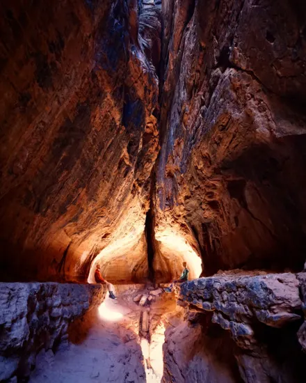
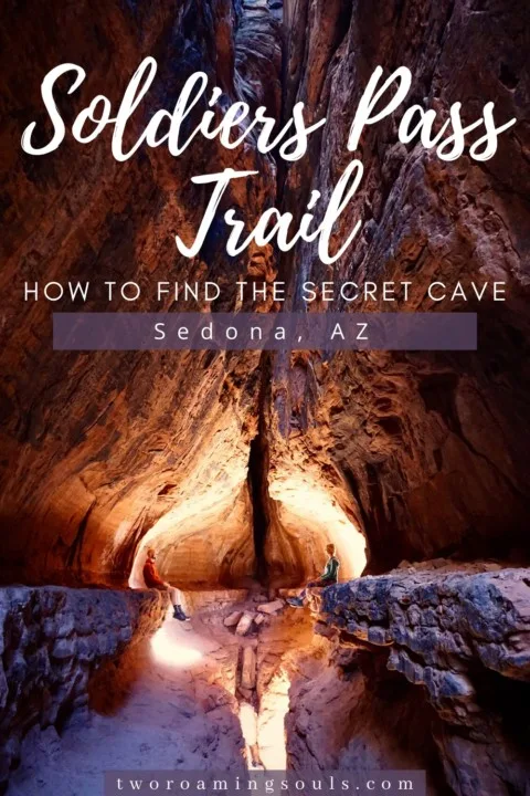
Soldiers Pass hike is definitely one of the most popular hikes in Sedona, AZ because it offers stunning views from the beginning of the hike all the way to the end. But in addition to the views, there’s a really unique cave off a spur trail that is easy to miss if you don’t know about it. It’s a deep crack in the cliffs that forms a multi-level cave that is fun (and a little scary) to explore. Below are all the details for hiking Soldier’s Pass Trail and how to find the secret cave.
Please practice strict Leave No Trace principles when visiting Soldier’s Pass Trail (and everywhere you hike in the area). Pack-It-Out! This includes Toilet Paper! This area sees a high volume of tourists, and the landscape and plants are very fragile, so it’s critical to preserve the area.
If you are not familiar with “Leave No Trace” principles yet, please take the time to learn them. It would break our hearts to find out that readers of this post are not doing their part to protect these beautiful areas. Thank You!
Stats For Soldiers Pass Trail
Distance: 4.1 miles
Elevation: 620ft
Difficulty: Moderate
Type: Out & back
Permit: Yes
Bathroom: No
Dogs: Yes, but must be kept on leash
This post may contain affiliate links. Disclosure policy.
Permits For Soldiers Pass Trail
In order to park at the trailhead you will need either a Red Rock Pass or a National Parks Pass. You can purchase a Red Rock Pass at a ranger station, vending machines at popular trailheads (but not Soldiers Pass, unfortunately), or local grocery stores/gas stations, etc.
You can just purchase a daily pass for $5, a weekly pass for $15, or an annual pass for $20. Or of course, a National Parks Pass is only $80 and gets you into all National Parks and National Forest Areas for the year.
You can find a list of local places to purchase a Red Rock Pass here. Once you have a permit, then place it visibly in your windshield so rangers can clearly see it.
Trailhead For Soldier Pass & Important Parking Information
The start of Soldier Pass Trail is at Soldiers Pass Trailhead. It’s important to note that the parking lot is gated and is only open from 8am to 6pm.
Getting to the trailhead is quite simple. Turn onto Soldiers Pass Road off Hwy 89A (the main highway that runs through town). Follow Soldier Pass Road for 1.4 miles. Take a right at Shadow Rock Rd, and follow for .2 miles. Lastly, turn left on Forst Service Road 9904. Here you will run into the small dirt parking lot.
There are only about 14 parking spaces in the lot. In order to grab a parking spot, plan to get here early, or later in the afternoon when hikers are leaving. Some people even line up around 7:30am before the gates open during peak seasons (spring & fall).
Note, that vehicles over 20 feet long are not permitted to park in the lot.
Parking is NOT allowed directly outside the trailhead in the residential neighborhood. There will be signs clearly stating the areas where parking is prohibited.
If you are lucky to snag a spot in the parking lot, be aware that the gate closes at 6pm. Be sure to have your vehicle out of the gate before then or you will be ticketed and unable to get your vehicle out until the next morning.
Taking The Sedona Shuttle To Soldier Pass Trailhead
There is an alternative way to get to the Soldiers Pass trailhead parking lot if you are unable to snag a parking space.
The Sedona Shuttle runs Thursday-Sunday weekly to the trailhead. Except for Spring Break (from Mar 1 – Apr 17), the shuttle runs daily.
The route is referred to as Route 14.
In order to grab the shuttle, park at the Posse Grounds Park and Ride. Shuttle rides start at 7am and the last shuttle back to the Posse Grounds Park and Ride from Soldier Pass Trailhead is at 5:08pm. The distance from the Posse Grounds Park and Ride is about 1.3 miles and less than a 5 min ride.
But if you miss the shuttle, note you will need to walk an additional 1.3 miles along the road.
Find out more information about the Sedona Shuttle to Soldier Pass Trailhead.
Beginning Of Soldiers Pass Hike
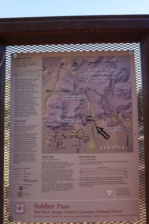
After getting to the trailhead either by car or shuttle, the hike starts along Soldier Pass Trail #66. You will notice a gate that is for off-road vehicles. The hike starts just to the right of that. There will be signs with safety rules and information that should be followed.
Cairns Along Soldiers Pass Trail
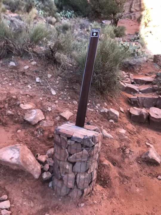
Along the hike, you will notice cairns (stacks of rocks) strategically placed to help keep you on the trail. If there is ever a spot where you aren’t sure what direction to go, look out for a cairn.
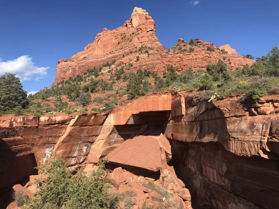
Devil’s Kitchen Sinkhole
About ¼ mi along Soldiers Pass Trail you will run into Devils Kitchen Sinkhole. Sinkholes are created by water eroding the rock underneath the top crust and eventually the ground giving out creating a sinkhole.
The big rock that fell in the back middle is said to have fallen from a California earthquake in 1989. You also might hear local hikers call this place the “Grand Piano”.
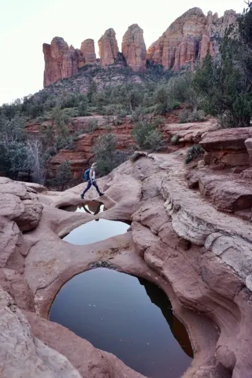
Seven Sacred Pools
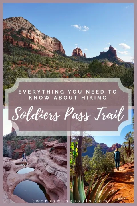
About a ½ mi along Soldiers Pass Trail, you will come across the Seven Sacred Pools. This is known to be a sacred gathering place for the indigenous people. We found the best time to photograph the pools is in the morning, or evening when the sun has dipped behind the rocks

How To Find The Secret Cave Along Soldier Pass Trail
Shortly after passing the Seven Sacred Pools, there is a crucial turn to find the Soldier Pass Cave.
To make things ultra easy, plug in these coordinates. This is the location that will lead you to the exact spot you need to turn off the trail to head toward the secret cave.
There will be a spur dirt trail to the right. There is one small wilderness sign posted on the tree (it can be very easy to miss).
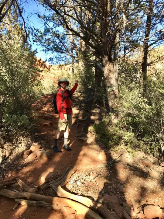
After turning off, the beginning of the dirt path will be easy to follow from previous foot traffic.
You will then come to a big area of slick rock which can make the trail easy to lose. But just follow the left edge of the rock until you run into another dirt path on the far left side. There are often self-made cairns to help guide you.
Then the dirt path resumes and starts climbing the hill up to the rock walls above.
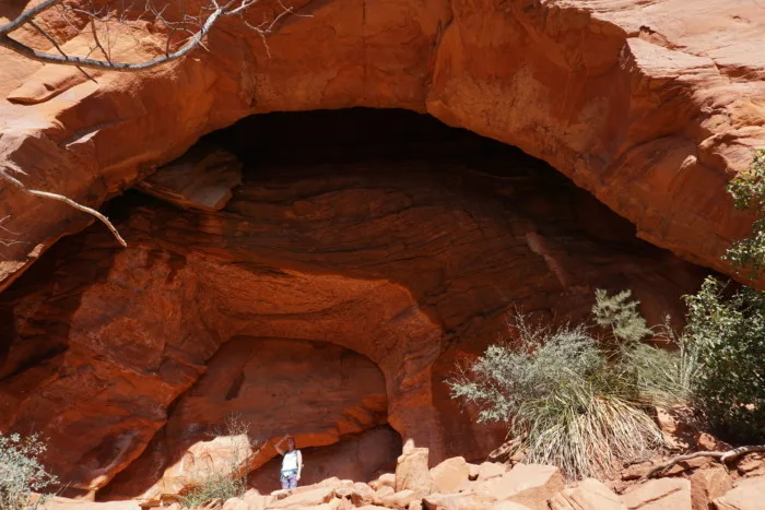
At this point, you should start to see two arches in the rock wall (they’re not completely free-standing aches). The left arch is bigger and easier to spot as you approach. There isn’t a clear path up to the arches, but try to find one that already has heavy foot traffic.
The right arch will be somewhat hidden by some trees and bushes, but it’s where you can enter the cave. There will be two different areas that you can explore. A large portion of carved-out rock that you can walk under and another where you can climb up into the cave.
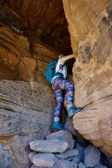
There will be rocks strategically placed to climb up into the cave. But, be careful as some rocks may be wobbly.
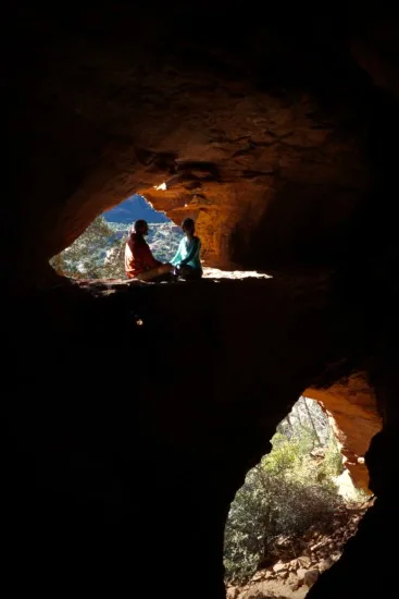
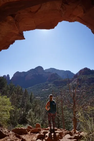
Continuing On The Trail Past Soldiers Pass Cave
After visiting the cave, you should hike back down to the original trail by retracing your steps. You can continue on Soldier Pass Trail as it makes its way up and over Soldiers Pass.
The well-maintained path will guide you with carefully placed cairns, ensuring you stay on the right course. As you ascend to the summit, your effort will be handsomely rewarded with a breathtaking panoramic view of the valley.

Trail Closed
The trail is closed for the last 1/2 mi, so please respect the rules of the area, and turn back where the trail closes.
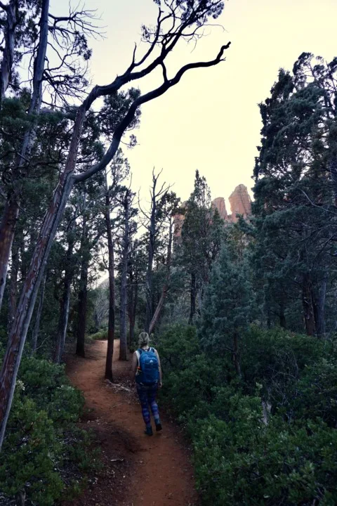
Heading Back Down Soldier Pass Trail
The hike is an out-and-back trail, so getting back is just retracing your steps.
Alternative Routes Along Solider Pass Trail
An alternative route to the Soldier Pass trail is from the Jordan Road Trailhead (aka Jim Thompson Trailhead). You can either take Jordan Trail, Cibola Pass Trail, or Brin Mesa Trail which will meet up with Solider’s Pass Trail.
Jeep Tours Along Soldier Pass
There is one other unique way to experience Solider Pass and this is on a Jeep Tour. Do note the ride is pretty bumpy, rugged, and can have your adrenaline pumping at certain areas.
Red Rock Western Jeep Tours is the only tour company permitted by the U.S. Forest Service to take guests along the Solider Pass Trail.
Note, if you have your own jeep and have experience rock crawling along slick rock, you can drive the road yourself. You will need to obtain a permit up to 72 hours in advance.
If you don’t have 4×4 experience, I would stick to a tour company to keep your mind at ease and the drive more enjoyable.
Map For Soldier Pass Trail (Parking & Alternative Routes)
Here is a helpful map for where to find the Soldier Pass Trailhead, Posse Ground Park & Ride, Brins Mesa Trailhead, Jordans Trailhead, and more.
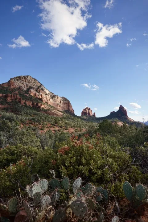
How Long Does The Soldier Pass Trail Take
The Soldier Pass trail is 4.1 miles with 620 ft elevation gain. Obviously, people hike at different paces, but on average the hike will take 1.5 to 2 hours in duration with added sightseeing stops.
Takeaway | Soldiers Pass Trail
Soldiers Pass hike is very rewarding for all the beautiful stops along the way and ending with a stunning panoramic view at the end. This quickly became one of our favorite stops in Sedona because the Soldier Pass cave was like nothing we had ever seen before. There are many spectacular hikes in Sedona, but this one is a must-do if you are in the area!
Don’t miss some of our other favorite hikes and things to do in Sedona, AZ
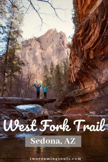
If you are looking for a more ambitious adventure, then another hike you might enjoy in the area is West Fork Trail. Check out our article West Fork Trail for more details!
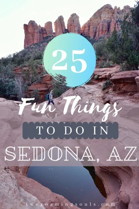
Or check out our post 25 Fun Things To Do In Sedona, AZ for more awesome adventures in the area. We talk about more of our favorite Sedona outdoor adventures as well as breweries, restaurants, and even helicopter tours.
If you are looking for more breathtaking hikes in the area, be sure to check out our post: 15 Best Breaktaking Hikes In Sedona, AZ
Help Us Share ‘Soldiers Pass Trail’ On Pinterest:

The Ultimate Arizona Road Trip Itinerary - tworoamingsouls
Monday 10th of April 2023
[…] of our favorite hikes are West Fork, Fay Canyon, Soldiers Pass, and Birthing […]
Top 10 Best Hikes In Arizona | Ultimate Guide - tworoamingsouls
Tuesday 24th of January 2023
[…] are many different scenic stops along the way. There is Devil’s Kitchen, Seven Sacred Pools, Soldier’s Pass Cave, and the breathtaking views at the […]
West Fork Trail In Sedona, AZ | Ultimate Hiker's Guide - tworoamingsouls
Saturday 9th of January 2021
[…] […]
25 Fun Things To Do In Sedona, AZ - tworoamingsouls
Tuesday 5th of January 2021
[…] Not to mention great views of the surrounding area. Soldier’s Pass hike is 4.1 miles with 620ft elevation change. Be sure to check out our post: Soldiers Pass: How To Find The Secret Cave | Sedona, AZ […]
15 Best Breathtaking Hikes In Sedona, Arizona - tworoamingsouls
Monday 4th of January 2021
[…] Soldier’s Pass Trail: How To Find The Secret Cave | Sedona, AZ […]