Death Valley National Park in Southern California is like exploring another planet. The park is famous for its extreme weather and for having the lowest point in North America. But the desert landscape in this park is anything but flat and boring.
You will surely be impressed with the views Death Valley National Park offers, as there are massive mountains, whispy sand dunes, enchanting slot canyons, unique rock formations, and much more.
Jake and I spent many days roaming through Death Valley, feeling like we got to see many of the great wonders of the park. But Death Valley National Park covers 3 million acres of wilderness and backcountry roads, so there’s always more to discover. It’s the largest National Park in the continental US.
Death Valley is the lowest, hottest, and driest National Park in the United States. With the lowest point being 282 feet below sea level, the hottest recorded day being 134 degrees Fahrenheit and average precipitation around 2.36 inches per year.
This makes Death Valley an attractive escape in the winter for those seeking warmer temperatures. Many different attractions will be sure to draw your attention at the park!
For less active travelers, many viewpoints don’t require much hiking to experience the sights and beauty. And for ambitious adventurers, there’s plenty of long and challenging hikes as well as miles of backcountry roads for off-roading.
Note: Death Valley has “Death” in its name for a reason. Be sure to pack plenty of water along on any hike or adventure you do because it’s hot and dry most months! There are only a few spots where you can fill up water within the park, so be sure to plan accordingly!
This post may contain affiliate links. Disclosure policy.
Refer to our custom map for help locating our favorite Death Valley attractions
Golden Canyon:
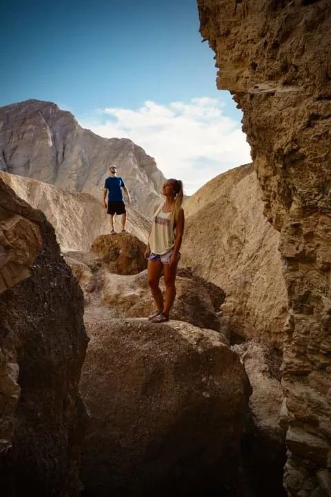
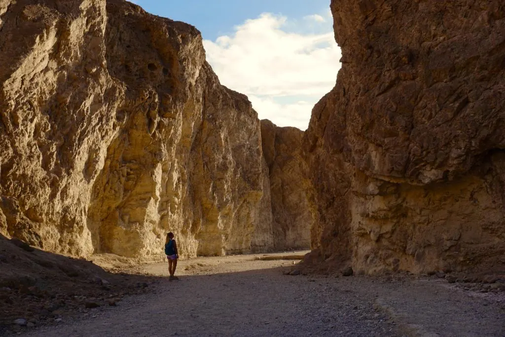
My favorite hike in Death Valley National Park is Golden Canyon. It was a great surprise when first entering the park. It first starts out as a wide gold canyon and quickly approaches a beautiful red cliffs (aka The Red Cathedral).
The hike from Golden Canyon to Red Cathedral is 2.9 miles with 574 feet of elevation change. The hike can feel like a maze, where you just want to continue taking turns through long windy canyon walls.
The canyon begins right from the trailhead, so even if you’re not up for the whole hike, it’s still cool if you only make it a few minutes into the trail.
But if you have the energy to explore more, there are a few really cool side canyons that you should consider exploring. (but be sure to stay on the valley floor so that you Leave No Trace).
Be sure to add this to your Death Valley Bucket List as it will surely take your breath away. You can even extend the hike to Zabriskie Point, but you will need two cars if you want to make the hike a one-way.
Zabriskie Point:
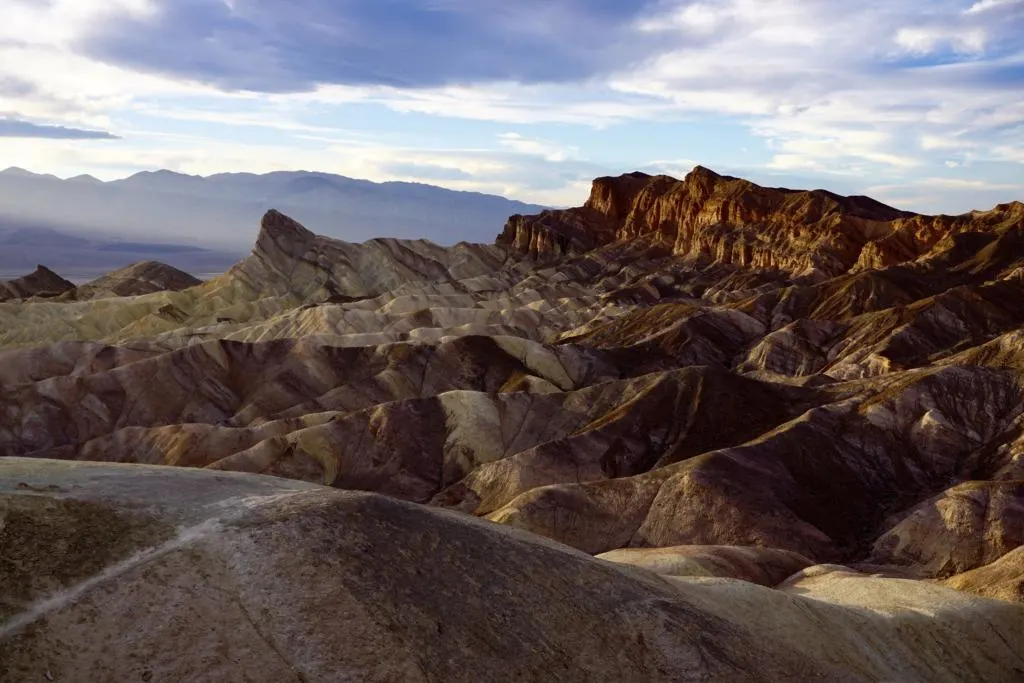
Simply one of the most stunning views in Death Valley National Park is Zabriskie Point. It is a short ¼ mile up a paved hill to the viewpoint. And from the parking lot, you might not know what you are in for, but the views from the top are unreal!
Layers of rocks and beautiful contrast surround the area.
Jake and I set up a blanket and enjoyed a nice sunset overlooking the crater. But this spot is also great for sunrise as the sun shines over the beautiful sand and rocks!
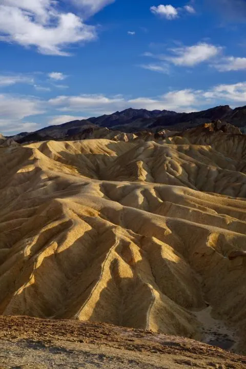
Artist Palette:
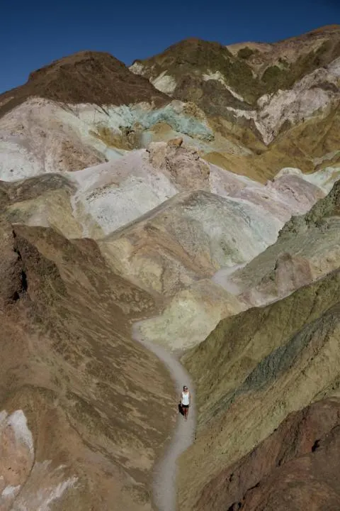
If you enjoy beautiful colors, then, Artist Palette is a great viewpoint for you! It reminded me of ice cream with the dark brown, white, pink, and teal colors swirled around in a beautiful formation.
Artist Palette is part of a 9-mile long drive called Artist’s Drive with the main viewpoint in the middle. But the drive is an adventure in itself as it winds around the Amargosa Mountains.
Artist Palette is another viewpoint where you can enjoy the view from the parking lot, or dive a little deeper and hike amongst the colorful rocks.
And knowing us, we left little to be desired and walked deep amongst the colorful rocks! The hike among the rocks is as short or as long as you would like it to be. And meanders many different directions, so choose your own adventure!
Dante’s View:
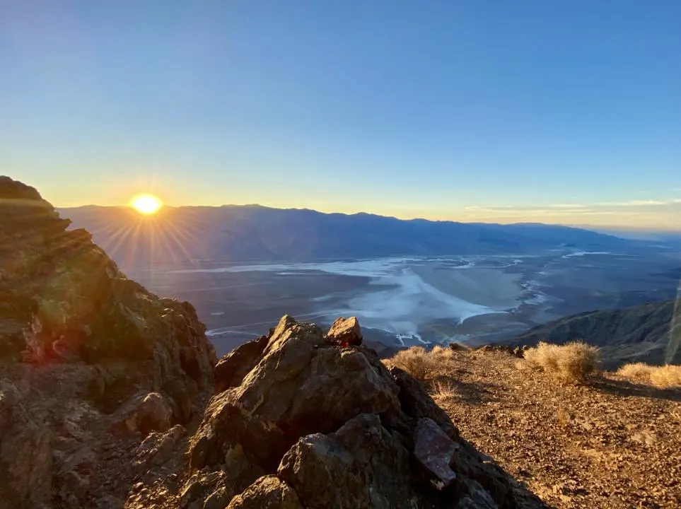
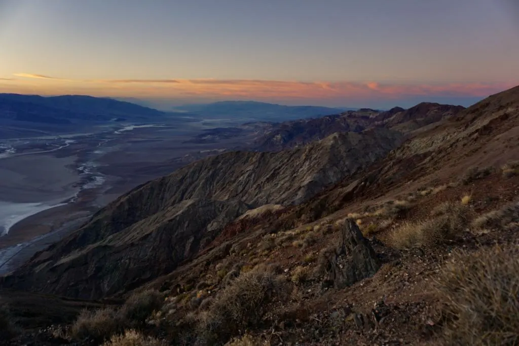
A close second favorite spot in Death Valley is Dante’s View. You really get the feeling that you are on top of the world, looking down upon the valley floor.
A paved road winds up the Black Mountains to a dramatic lookout over Death Valley. It is quite the drive up to the top, but it will be well worth it in the end! (Vehicles over 25ft aren’t allowed).
When you reach the parking lot, you can either enjoy the view from the railing or you can hike either North or South to nearby peaks. Jake and I were there for sunset and walked down the path about a ¼ mile from the parking lot.
Do note that it can get very windy up top, but we found a nice rock mound to hide away from the wind to enjoy the sunset.
The top of Dante’s view is around 5,484 feet high. And laying before you is the valley floor of Badwater Basin at -282 feet below sea level, and simultaneously the highest point in the park, Telescope Peak standing at over 11,000 feet tall.
The massive scale of this valley is something that can hardly be appreciated from a photo.
If you are up for more of an adventure then you can check out Dante’s Ridge hike which is 8 miles roundtrip with 1200 feet elevation change. You follow along the North path toward Mt. Perry which offer some of the best views of the valley floor. The trail is said to be a bit unclear, but the views are very rewarding.
Badwater Basin:
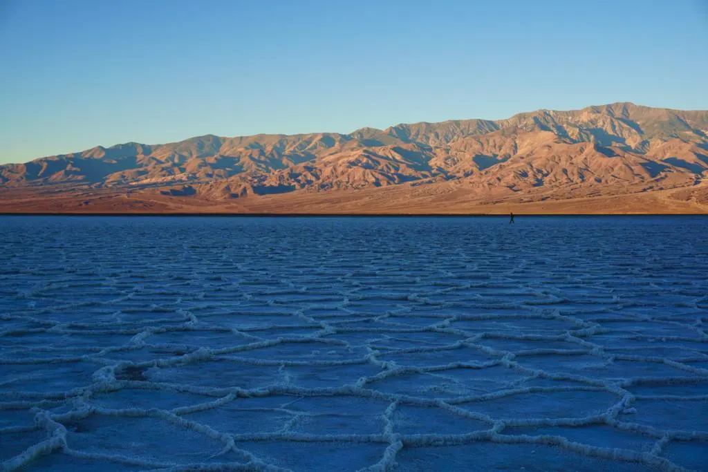
One unique stop in Death Valley National Park is the Badwater Basin Salt Flats. The Badwater Basin Salt Flats is located 282 feet below sea level which makes them even more spectacular.
It’s another hike that can be as short or as long as you want to make it.
There is a pretty beaten-down path from human traffic from the parking lot, but once you get about a ½ mile down the path, you will get into really cool salt deposits. But be careful as the deposits can be a tripping hazard. And who would want to damage these delicate structures anyway?
But the unique formation of salt deposits is something you shouldn’t miss. They form unique geometric shapes that are a sight to see. You also may notice an inconspicuous sign high up in the mountains above the parking lot that indicates sea level.
This was another spot we got up early to enjoy a nice sunrise for, but I’m sure it is also an amazing location for sunset! Adding some golden hour colors amongst the white salt flats is truly beautiful!
Sidewinder Canyon:
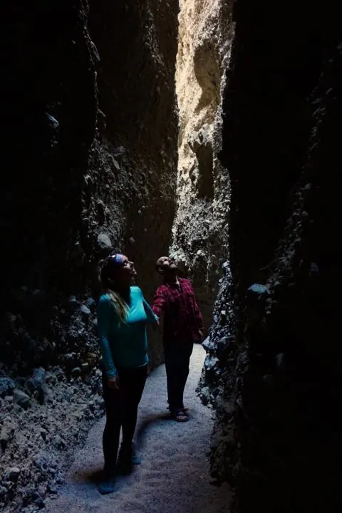
You might not see this one on most travel guides through Death Valley National Park, but Sidewinder Canyon is a true hidden gem in the park. The hike can be as little as 2 miles to 4+ miles depending on how many slot canyons you want to see on your journey.
Jake and I decided to just do 2 slot canyons along the way. The one pictured above was our favorite with its narrow passages and high walls. The entrance to this slot is right at 1.1 miles if you follow the GPS tracking on AllTrails.
And don’t forget to look up, as that is where some of the true art lies. We have been to a lot of different slots, but this one was different as it has grey and tan sedimentary walls that swirl high above you.
You will want to try and do this one in the morning or evening, as the hike up is in direct sun, with little to no breeze. We were sweating at 8:30am in late November. But it is nice and cool in the slot, so you can enjoy a little break from the sun and cool off!
If you are interested in doing this hike, we would suggest stopping in the visitor center to grab a map, so you know exactly where it’s at. They also show you where all the different slots are.
Mesquite Flat Sand Dunes:
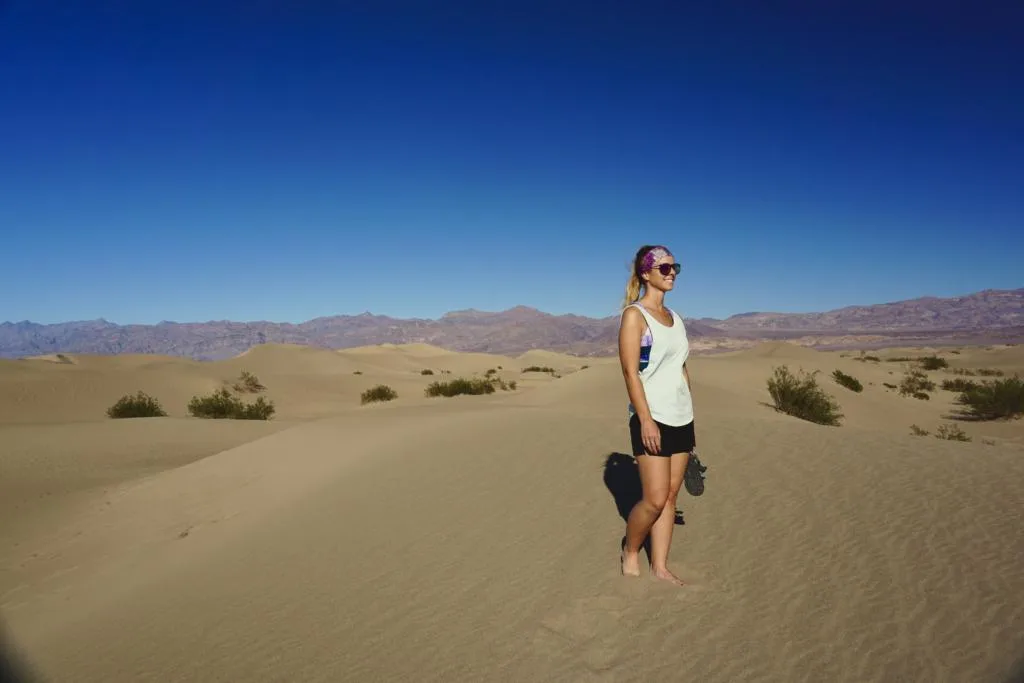
Another cool location within the park is the Mesquite Flat Sand Dunes. You can climb on the dunes with beautiful mountains surrounding the area.
They are named after the mesquite trees that grow in the area, which provide essential shelter and food for wildlife.
The views from the sand dunes are nothing short of spectacular. Choose your own path, as there is not a true “right” path. You can climb to the highest dune or just enjoy the smaller dunes near the parking lot.
What makes this area especially cool, is the dunes constantly shift and change due to the strong winds which creates new patterns and ripples in the sand. At times it will look like you were the first person to climb a specific dune.
If you enjoy sand dunes, you might also consider visiting the Panamint Dunes which are located on the west side of the park.
Ubehebe Crater:
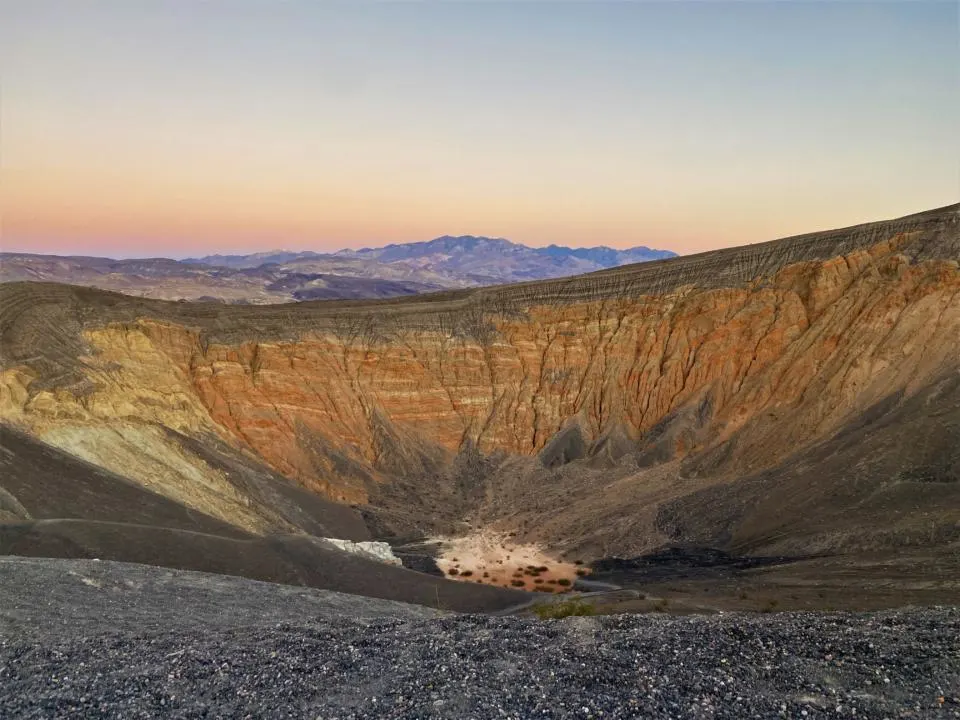
Ubehebe Crater is like nothing else in the park and is estimated to be over 2,000 years old. You can either take in the view right from the parking lot or hike around the crater and even down to the floor of the crater.
If you decide to hike around and down into the Ubehebe Crater, the hike is around 2.2 miles with 725 feet of elevation change. But the Ubehebe crater is definitely one of the places in Death Valley National Park where pictures simply don’t do it justice. You need to see it for yourself to truly have your jaw dropped!
It is said that the magma from a volcano came in contact with groundwater, resulting in a steam and gas explosion that left a 600 foot crater. There is also a mini crater along the rim that you should also check out if you are in the area.
The Ubehebe Crater is a far drive North of Death Valley National Park, but will be well worth the trek if you have the time! To make the sunset viewing easier, we stayed at The Mesquite Springs Campground (first-come, first-serve) that is only 15 minutes away.
Mosaic Canyon:
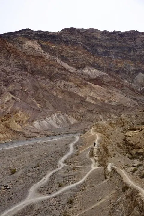
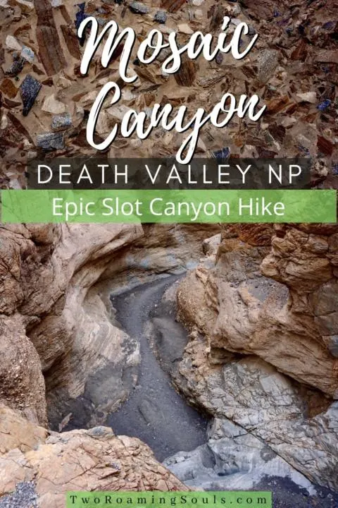
Mosaic Canyon took us by surprise and is definitely a sight to see when when visiting Death Valley National Park. It truly feels like you are walking through nature’s art museum. And, luckily the coolest part of the hike is near the beginning ¼ mile.
The drive to the trailhead does require a 1-mile drive on an unpaved road. It tends to get very washboarded, but any two-wheel-drive vehicle should have no trouble in dry conditions.
But if you are up for more of an adventure, we strongly encourage you to continue hiking, and take in much more of what Mosaic Canyon has to offer (some scrambling required).
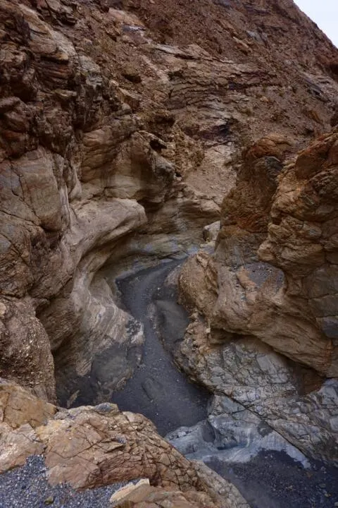
Much of the canyon walls replicate a mosaic art piece, which is how it got its name. It is one of the prettiest canyon walls we have ever seen!
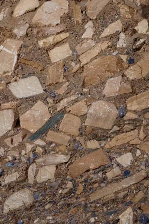
If you choose to do the full hike, it is 4 miles long with 1200 feet elevation change. But you can cut it as short as you would like after the first ¼ mile. But, like mentioned above, I think you should at least try to make it a mile or so, to really capture how truly beautiful Mosaic Canyon is.
For the full detail on the hike, check out our post: Mosaic Canyon Ultimate Hiker’s Guide | Death Valley National Park
Darwin Falls:
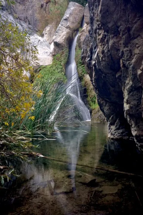
If you are feeling a little deserted out, and need a little bit of a wetter climate, check out Darwin Falls. It is one of the less populated spots in the park.
Plus Darwin Falls flows year-round, so you don’t have to worry about missing the waterfall at “peak season”.
Darwin Falls is a 2-mile hike, out and back with 450 feet of elevation change. You will meander along a dry wash, into a narrowing canyon. The green vegetation keeps increasing until you arrive at a lush oasis with Darwin Falls.
The water is used as drinking water in the nearby town of Panamint Springs. Therefore, swimming is not allowed near the waterfall. Personally, I don’t think it is really that inviting for a swim. But I’m sure in those hotter months, having a place to cool off, does look appealing.
This waterfall is just for the views, so sit back and enjoy one of the only water sources you can hike to in Death Valley National Park.
The road to the trailhead is somewhat rocky, but usually passable with 2WD.
Titus Canyon:
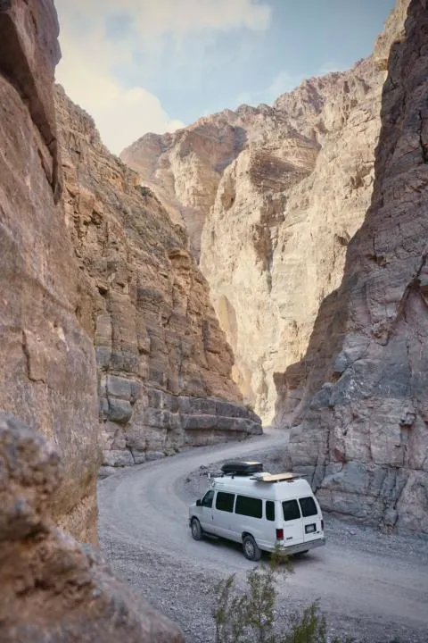
One of the most sought after back country roads in Death Valley National Park is Titus Canyon. A one-way, 27-mile drive encompasses you between tall canyon walls, colorful mountains, and even a ghost town (Leadfield) in between.
You can pass this dirt road in a 2wd, high-clearance vehicle when road conditions are dry. If road conditions get wet, you may need a 4×4 vehicle. But Death Valley is known for being the driest National Park, so it happens on rare occasions.
Check with a ranger if you question the road conditions. But you should definitely add this scenic drive to your Death Valley National Park Road Trip if you have the time. {Read our Complete Titus Canyon Guide Here}
Death Valley Itinerary Idea:
Here is an ideal itinerary for Death Valley that would work great for someone visiting the park looking to visit the best attractions.
This road trip is designed to start from Death Valley Junction Area (this will likely be where you enter if you fly into Las Vegas).
Day 1
- Zabriske Point
- Golden Canyon
- Artist Palette
- Badwater Basin
- Sidewinder Canyon (optional)
- Dante’s View
- Accomodation:
- The Inn at Death Valley (or The Ranch at Death Valley)
- Furnace Creek Campground (or Texas Springs Campground or Sunset Campground)
Day 2
- Keane Wonder Mine (optional)
- Rhyolite Ghost Town
- Titus Canyon Scenic Drive (high-clearance required)
- Red Pass
- Leadfield
- Titus Canyon
- Ubehebe Crater
- Accomodation:
- Stovepipe Wells Village Hotel
- Mesquite Spring Campground (north) (or Stovepipe Wells Campground (central))
Day 3
- Mesquite Flat Sand Dunes
- Mosaic Canyon
- Darwin Falls (optional)
- Panamint Dunes (optional)
- Accomodation:
- Panamint Springs Resort
- Panamint Springs RV Park
If you feel you need more assistance for your Death Valley road trip, consider getting this self-guided audio tour. It will inform you of the history of the park and popular stops along your route.
Visitor Centers & Resources:
Due to the massive size and remoteness of Death Valley, visitors need to be aware of the very few locations within the park for supplies like water, gasoline, food, and accommodation.
Consider the travel distance between attractions and services.
Ideally, you stock up on supplies in one of the few larger towns nearby, like Pahrump Nevada to the east, or Ridgecrest California to the southwest, or Lone Pine California to the northwest.
The two main areas with services in the park are the Furnace Creek Visitor Center and the Stovepipe Wells Ranger Station. They both have park rangers from the National Park Service available to answer any questions about current conditions and more. Both are located along Route 190 and have gas and potable water.
Be aware the gas within the park is exceptionally expensive.
Where To Eat In Death Valley National Park:
Food can be found at just a few places around the park (read for updated hours).
- Stovepipe Wells Village (Tollroad Restaurant, Badwater Saloon, General Store)
- Furnace Creek (Visitor Center Bookstore has grab-n-go foods)
- The Ranch At Death Valley (General Store, The Last Kind Words Saloon, The 1849 Buffett)
- The Inn At Death Valley (Inn Dining Room)
- Panamint Springs Resort (Dining & Bar, General Store)
Where To Stay In Death Valley National Park:
Refer to this helpful map of the different accommodations within Death Valley National Park.
Key: Red (hotels & resorts), Blue (established campgrounds), Green (primitive campsites with limited facilities), Yellow (backcountry roads that allow overnight camping, permits required)
Hotels in Death Valley National Park
- Stovepipe Wells Village Hotel (Central)
- The Inn at Death Valley (Central-southeast)
- The Ranch at Death Valley (Central-southeast)
- Panamint Springs Resort (West)
There is also a handful of great vacation rentals located around the National Park.
Campgrounds in Death Valley National Park
There are many campgrounds in the area if you plan to camp inside the park. In order to explore much of the vast landscapes of Death Valley National Park, you will need to spend multiple days here.
Here are some great established campgrounds within the park:
- Furnace Creek Campground
- Texas Springs Campground
- Sunset Campground
- Stovepipe Wells Campground
- Emigrant Campground
- Wildrose Campground
- Mesquite Spring Campground
Here are some FREE primitive campgrounds in the park:
- Thorndike Campground
- Mahogany Flat Campground
- Eureka Dunes Campground
- Homestake Campground
- Saline Valley Campground
Additionally, here are some backcountry roadside camping options within the park:
Note, these may require high-clearance and/or 4×4.
Also, we highly suggest renting a campervan, RV or off-road camping rig to enjoy your stay at Death Valley National Park. Temperatures can be VERY HOT during the day, and actually cool off to below freezing temperatures at night. So having a temperature regulated vehicle will make your camping experience much more enjoyable.
Check out our list of awesome campervan rental companies. Or one of our personal favorite options is to rent a campervan or RV from locals in the area from Outdoorsy or RVezy.
The Best Time To Visit Death Valley National Park
The best time of year to visit Death Valley National Park is in the Spring, Fall, or Winter. This is when temperatures are most comfortable for outdoor activities.
But even in cooler months, visitors should always carry an ample supply of water. Consider that vehicle breakdowns can strand visitors in remote areas with no cell service.
It’s not recommended to visit in the summer, because Death Valley is famously one of the hottest places on earth. It is possible to visit in the summer, but special precautions are essential for your safety.
And even in the shoulder seasons, daytime temperatures can still reach up to 100 degrees Fahrenheit (38 degrees Celcius).
Visitors can plan their outdoor activities during the mornings, and avoid the extreme heat common in the late afternoon.
Watch our Death Valley Vlog as we explore this amazing National Park in our vanlife vlog series.
Some other viewpoints that aren’t listed in this Travel Guide are the Devil’s Golf Course, the Charcoal Kilns, Scotty’s Castle, Salt Creek Boardwalk, and Natural Bridge.
Those all stuck out to us as interesting viewpoints, but there just isn’t enough time in the day to check out every amazing attraction within the park. So if you have more time, be sure to check out these cool locations. Enjoy your trip!
Check Out Our Tips For Hiking and Camping In Desert Climates
Or looking for other awesome National Parks to visit, check out our National Parks Page, with tons more great travel guides.
Save This Post For Later
Trona Pinnacles | A Wild & Unique Geologic Feature - tworoamingsouls
Thursday 6th of April 2023
[…] […]
Titus Canyon | Ultimate Guide To Death Valley's Epic Canyon Road - tworoamingsouls
Wednesday 31st of March 2021
[…] […]
How To Plan An Epic Road Trip In The U.S. - tworoamingsouls
Tuesday 9th of March 2021
[…] quick google search like “what is the best time of year to visit Death Valley National Park?” can give you a little guidance. For example, if you visit Death Valley in the summer, […]
Mosaic Canyon Ultimate Hiker's Guide | Death Valley National Park - tworoamingsouls
Sunday 28th of February 2021
[…] […]
Ultimate Guide To Red Rock Canyon State Park | California - tworoamingsouls
Saturday 9th of January 2021
[…] […]