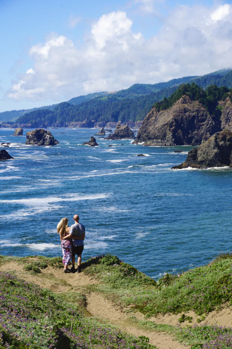
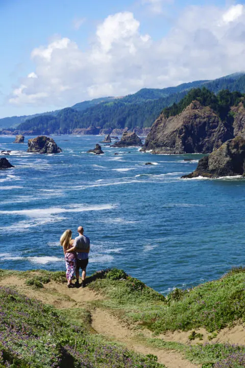
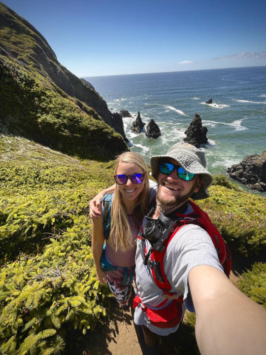
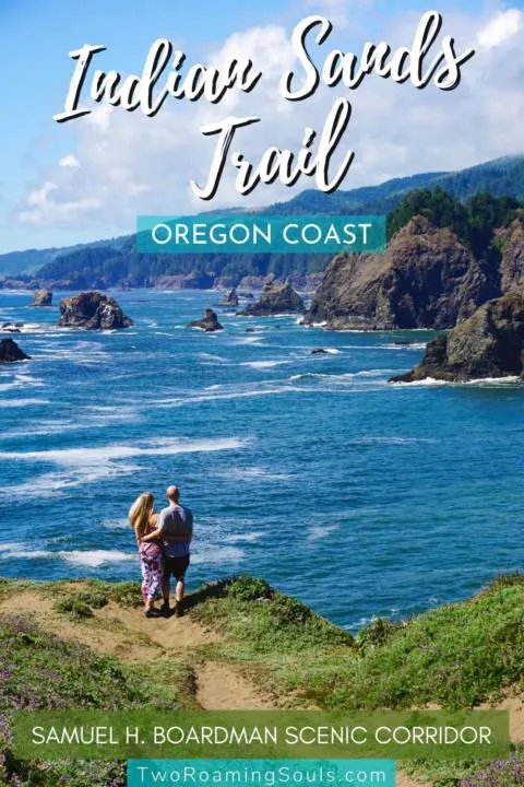
Indian Sands Trail is a stunning hike on Oregon’s Southern Coast in the Samuel H. Boardman State Scenic Corridor. The loop hike shows the incredible diversity of Oregon’s southern coastline.
There’s rocky islands, dramatic cliffs, pine-covered mountains, colorful flowers, sandy bluffs, and endless Pacific Ocean vistas. There’s even a great view of a natural rock arch.
This one-mile loop trail is a little more difficult than it might seem on paper. The trail is at times steep, sandy, poorly marked, and sometimes dangerously close to the cliff’s edge. But we think this hike is a must-do for anyone prepared to deal with those challenges. A little bit of patience and route-finding will be rewarded with beautiful views!
Trail Details | Indians Sands Trail
Distance: 1.1 miles
Elevation: 282 feet
Difficulty: Moderate
Type: Loop
Permit: No
Bathroom: No
Dogs: No
This post may contain affiliate links. Disclosure policy.
Trailhead
The trailhead begins along Highway 101 at Indian Sands Trailhead. The two signs in the parking lot indicate the two entrances to the trail, and you can start the loop going either direction. But we personally think the counter-clockwise direction is the most impressive. Because when you come out of the thick forest, you are instantly greeted with lush cliff faces that drop down to the ocean.
I will explain the trail going counter-clockwise, but if you choose to go clockwise then just reverse the directions.
Beginning Of Indian Sands Trail

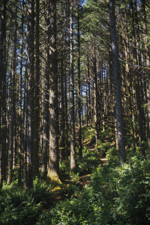
Going counter-clockwise is a little tricky to follow because the trail starts out by going towards the highway instead of towards the ocean like you would assume. You can tell it has confused others too because there are lots of social trails in the thick forest.
We recommend using GPS guidance from the AllTrails app to keep you on track. But eventually, when you pop out of the forest you are greeted with dramatic coastline scenery.
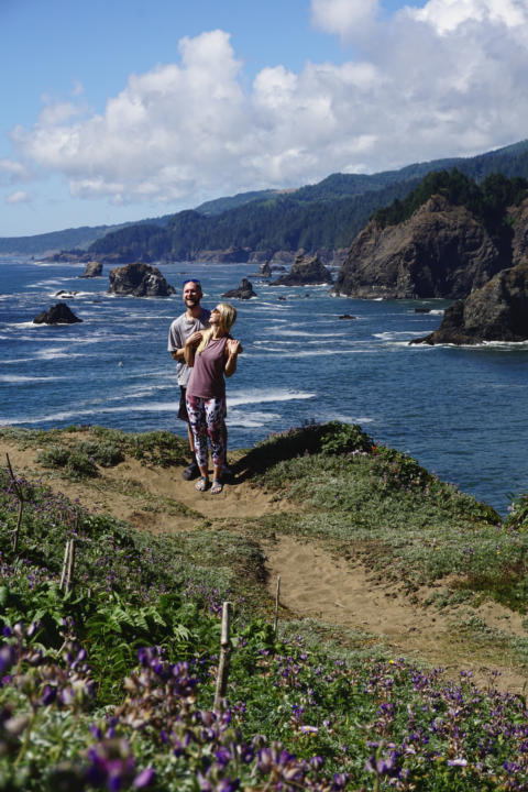
This is the northernmost part of the hike with a few little viewpoints that make for spectacular photo-ops.

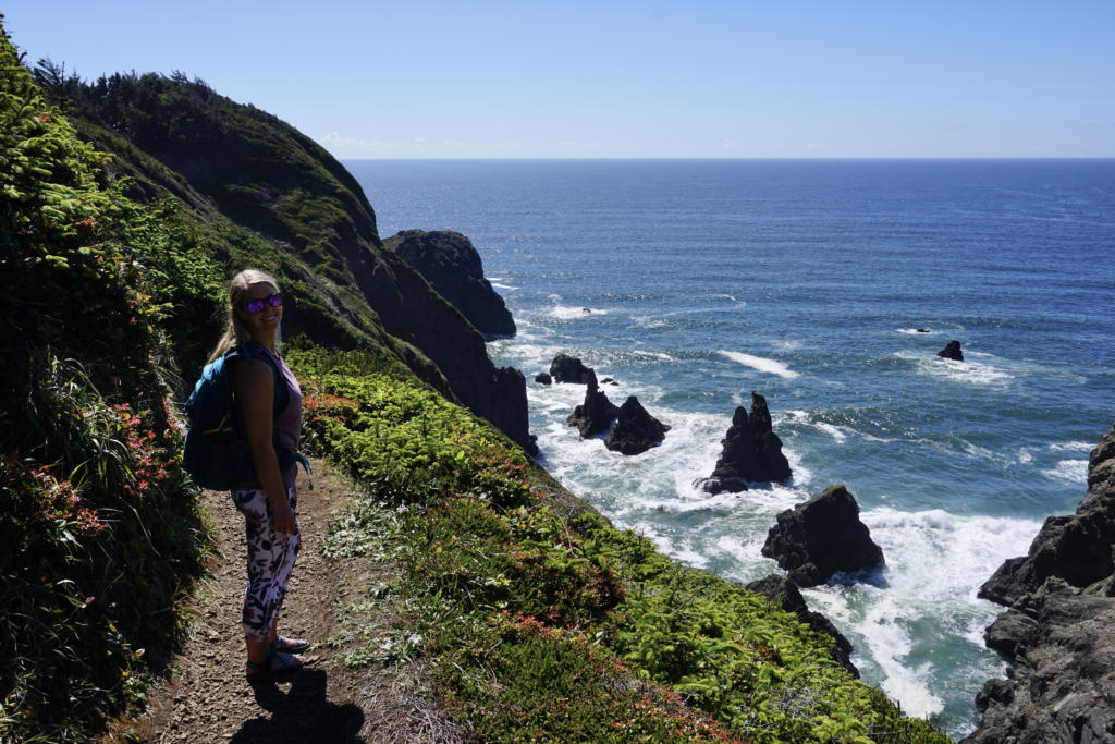
The Sand Dunes
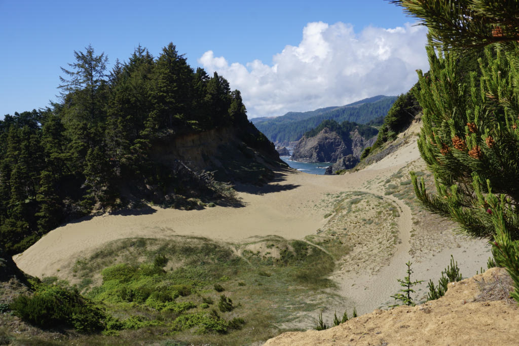
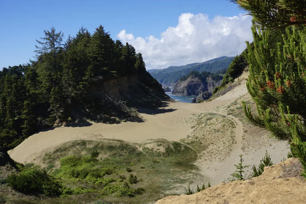
The trail then climbs up a sandy saddle into the dunes. This section of sand dunes (for which the trail gets it’s name) cuts between two sections of forest as you make your way south.
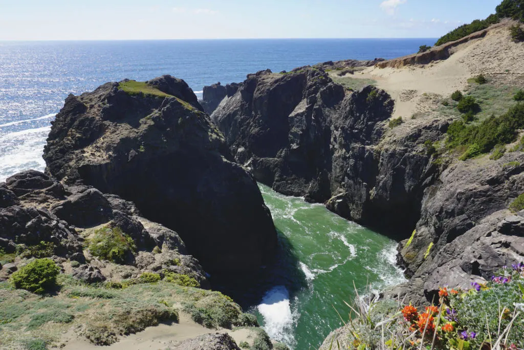
Once you’ve passed it, looking back on the saddle forms a nice window down the coast (pictured above). If you follow the sand towards the ocean, you will come to this epic lookout above this massive cove.

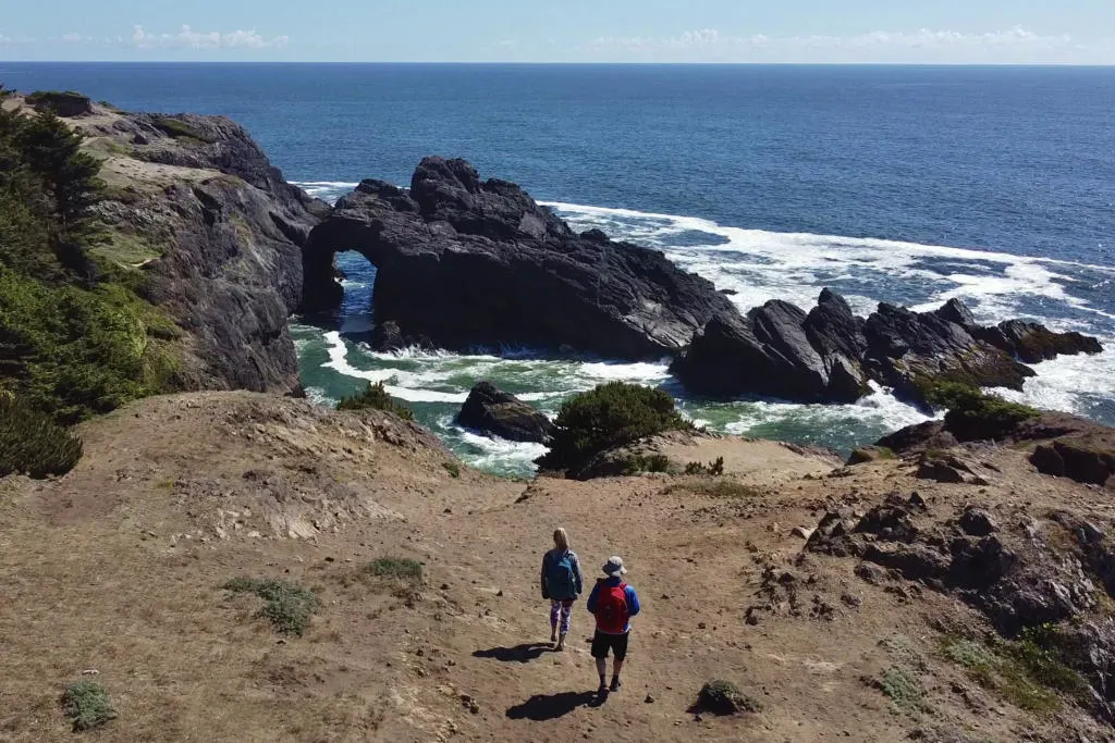
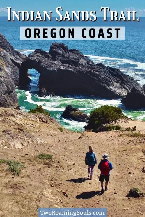
The Natural Rock Arch | Indian Sands Trail
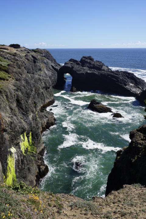

Continuing on, the last really impressive landmark is a rock arch towards the south end of the loop. If you keep an eye towards the coast you should see it pop into view. There are a couple of great viewpoints for viewing the arch if you descend the slope towards the edge.
Finding Your Way Back To The Trailhead

After the arch, the trail continues uphill into the forest again. There is a critical split, where taking a left brings you back up to the trailhead, and going straight will keep you on the Oregon Coast Trail. This is a good time to use GPS tracking to make sure you don’t miss the turn. It’s as acute angle, so it’s easy for hikers going either direction to miss the abrupt turn.
Things To Know About Indian Sands Trail
As I’ve mentioned, the trail is poorly marked and there are many social trails that can confuse you. We highly recommend downloading the offline map from AllTrails, so you can find your way back on track if you get confused, or go check out some viewpoints.
Wear footwear with good traction because there are many steep, sandy, and possibly muddy sections of trail. And some trail sections are close to steep cliffs, so always be mindful of cliff edges.
Leave No Trace. There are no bathrooms or trash facilities at the trailhead or along the trail. So pack out everything you bring. The closest public restrooms are at Lone Ranch Picnic Area to the South, or Arch Rock Picnic Area to the north. And don’t trample plant life, stick to trails, sand, or solid rock.
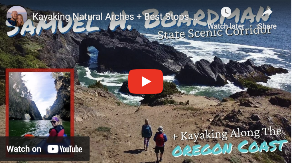
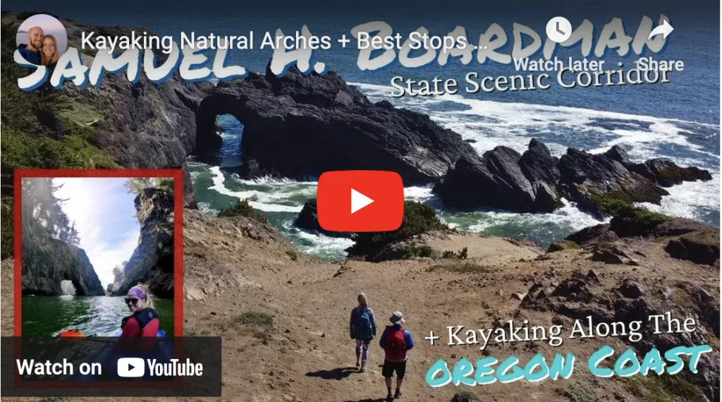
Join Us As We Hike Indian Sands & Drive Up The Coast:
What To Pack On The Indian Sands Hike: :
Now, what to pack on these fun hiking adventures? Depending on the time of year, the suggested clothes might change. Although we always suggest a merino wool layer, such as Unbound Merino or Isobaa.
Check out our favorite hiking gear, here! We include our favorite hiking poles, backpacks, rain layer, snacks and more!
Takeaway | Indian Sands Trail

The Indian Sands Trail is a short but stunning hike in Oregon along the Samuel H. Boardman State Scenic Corridor. The incredible diversity of the trail will impress even the most well-traveled hikers.
There’s ocean views, rocky islands, dramatic cliffs, pine-covered mountains, colorful flowers, sandy bluffs, and a natural rock arch. At only 1 mile, the trail still manages to challenge hikers with some steep and varied terrain. But it’s a worthy stop for those looking to get out and explore this amazing section of Oregon’s south coast.
Don’t forget to check out the other best stops along Oregon’s Southern Coast.
Help Share ‘Indian Sands Trail’ On Pinterest!


Easy Guide to Samuel Boardman Scenic Corridor - Pechluck's Food Adventures
Thursday 3rd of November 2022
[…] By going south initially on the trail loop, you save yourself a steep ascent if you had gone north (counterclockwise basically) on the loop – though it does mean you will have a descent on the way back. We did not do this hike because trails were muddy and slippery during the day of our visit, and this trail either way includes , but I wanted to include traversing steep slops. But it is a stop I had on my wishlist – for photos of what you might see check out this blogpost from Two Roaming Souls. […]
Easy Guide to Samuel H Boardman Scenic Corridor - Pechluck's Food Adventures
Thursday 3rd of November 2022
[…] By going south initially on the trail loop, you save yourself a steep ascent if you had gone north (counterclockwise basically) on the loop – though it does mean you will have a descent on the way back. We did not do this hike because trails were muddy and slippery during the day of our visit, and this trail either way includes , but I wanted to include traversing steep slops. But it is a stop I had on my wishlist – for photos of what you might see check out this blogpost from Two Roaming Souls. […]
Top 5 Best Stops on Oregon's Southern Coast | Samuel H. Boardman - tworoamingsouls
Monday 21st of June 2021
[…] […]