
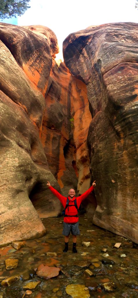
You won’t want to miss Kanarra Creek if you are coming from the East of Zion National Park. Jake and I came across this hike randomly and so glad we did!
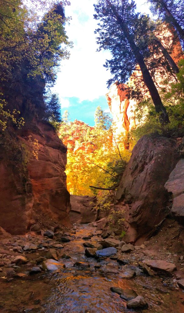
Kanarra Creek is located in Kanarraville, UT. It is a super rad hike meandering through a river to an epic waterfall in between tall canyon walls.
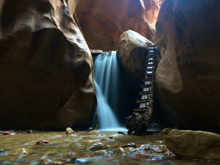
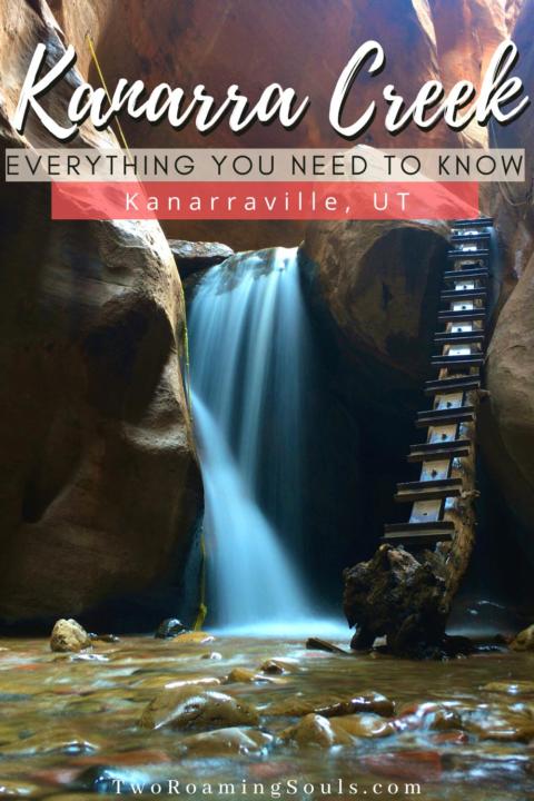
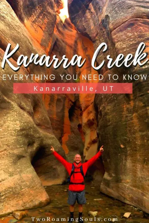
You might notice this famous picture above with the man-made ladder. But the hike is relatively easy and very rewarding. So here is everything you need to know about hiking Kanarra Creek to Kanarra Falls.

Hiking Stats For Kanarra Creek To Kanarra Falls:
- Distance: 3.8 miles
- Elevation: 600 feet
- Difficulty: moderate
- Type: out & back
- Permit: yes
- Bathroom: yes, at trailhead
- Dogs: no
Trailhead For Kanarra Creek:
The trailhead for Kanarra Creek is located just East of Kanarraville, UT off E 100 N St. The trailhead is pretty easy to find and a rather big lot. There are picnic tables, bathrooms and water to clean off your shoes after the hike.
Permits For Kanarra Creek:
A permit is required to hike Kanarra Creek. The town only allows 150 hikers per day to explore Kanarra Creek. You can purchase a permit online at Kanarrafalls.com or at the Kiosk in the parking lot. The cost is $12 per person.
Start Of Kanarra Creek Falls Hike:

You will start by climbing up a dirt road for the beginning of this hike. At the top of the incline of the road you will encounter the river which you will cross various times before you reach the canyon.
You can avoid crossing the river at the beginning as there is still a trail that leads you around and you can cross on rocks. But you will eventually have to get your feet wet later in the hike.
If you choose to keep your feet dry for the beginning of this hike there will be a trail to the left of the second river crossing where you have to balance on a metal pipe because soil eroded on top of the pipe. If you don’t have good balance, I would suggest just walking through the river.
After another ½ mile you will come to a third river crossing, and if your feet are still dry, stop delaying the inevitable. Just get them wet already, you’ll be back to your car before you know it.
From this point on you will see two different trails on either side of the river. Stay on one of the established trails to help preserve vegetation.
Along The Kanarra Creek Hike:


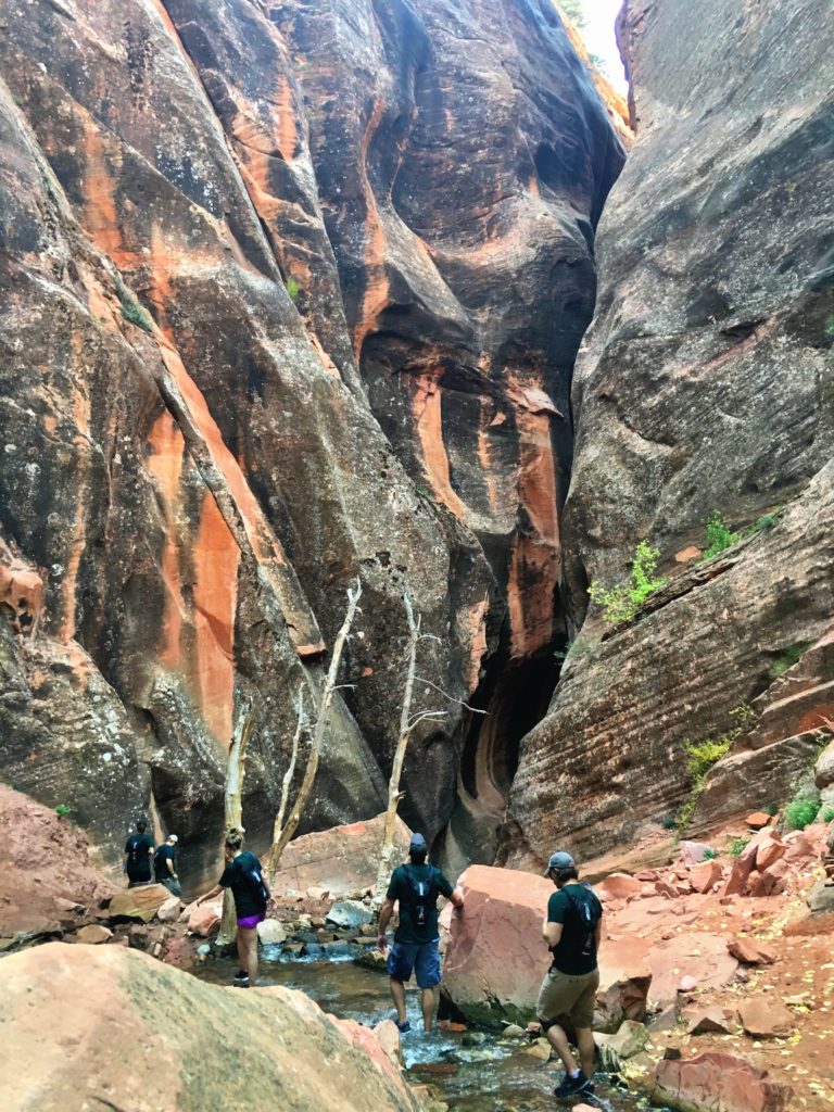
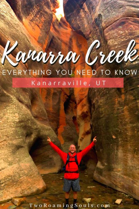
After you cross the river multiple times for another ½ mile you will soon reach the narrow canyon walls. This is where the fun begins!
It is common to experience a 10-20F degree drop in temperature, so it’s a good idea to bring layers. You will be walking through cold water from this point on.

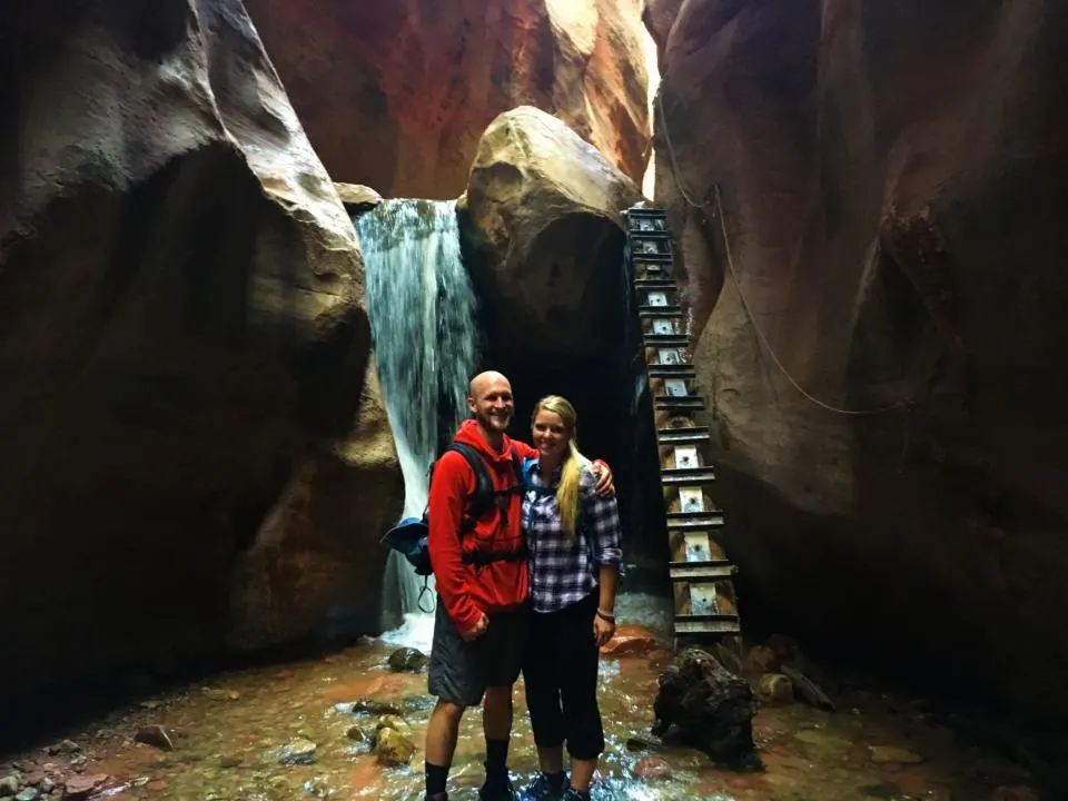
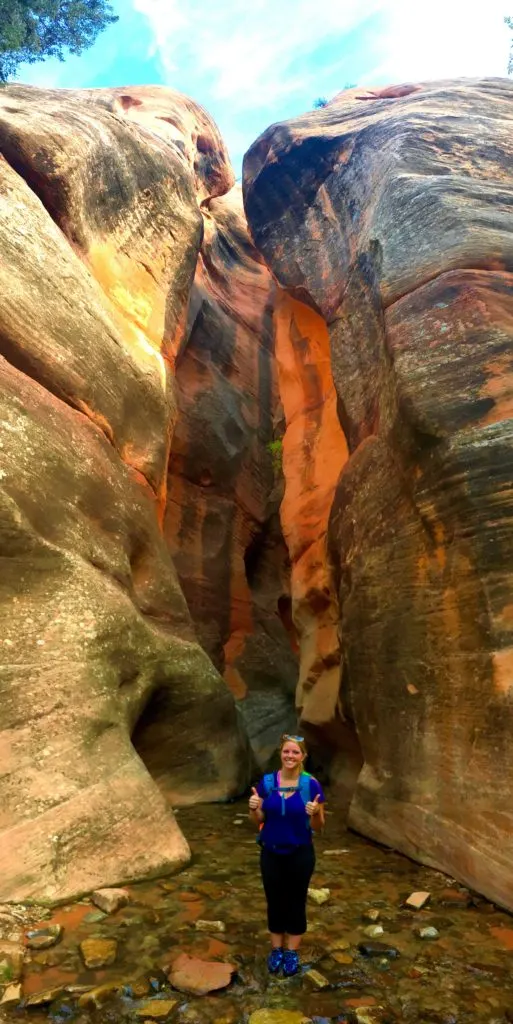
Shortly after walking through the tall canyon walls, you will reach the first waterfall. This is where many people snap a long-exposure photo. Many people turn back after reaching this point.
Continuing On Further Than Kanarra Falls:
There is a man-made ladder placed next to the waterfall for you to climb up if you plan to continue on. Climb the ladder at your own risk because it is slippery and not necessarily well-maintained. Once you make it up the ladder the canyon opens up a little and it’s a great place to have a snack and enjoy the flowing water. We made it to this neat little baby waterfall.


Due to timing, Jake and I decided to turn back here. But if you continue on, there is a second decent-sized waterfall. You might have to go through waist-deep water at times to get to the second waterfall.
There will be a ladder to climb up over that waterfall as well. Again, take at your own risk as it is not regularly maintained. The canyon does go on after that and some people decide to continue on but there won’t be any more iconic waterfalls along the way. It all depends on how much time you have and how much you want to adventure on!
But generally, the hike is 6 miles roundtrip if you walk much further into Kanarra Canyon.
Flash Flood Warning For Kanarra Creek:

Kanarra Creek goes through a slot canyon, so be sure to check if there is a possibility of rain. Even if it is miles away, the watershed in the desert transports water quickly because it does not absorb well. So if any rain is remotely close the safe bet is to go a different day.
Takeaway | Hiker’s Guide To Kanarra Falls

The difficulty-to-beauty ratio of this hike is off the charts! That’s probably why it has become so popular. You will be hiking through water so a dry bag and ziploc bags are a good idea to keep valuables dry.
The town has been polite enough to let tourists come and explore this hike, so please be respectful in the parking lot and along the trail. And remember “Leave no trace!”
Don’t Forget To Check Out These Amazing Hikes In Zion National Park Nearby:


Help Us Share ‘The Ultimate Hiker’s Guide For Kanarra Falls’ On Pinterest:

Best River Hiking Shoes - tworoamingsouls
Tuesday 4th of April 2023
[…] Kanarra Creek […]
Angel's Landing VS Observation Point | Which Hike Is Better - tworoamingsouls
Monday 13th of June 2022
[…] […]
Top 12 Best Hikes In Utah | Ultimate Guide - tworoamingsouls
Wednesday 14th of April 2021
[…] Kanarra Creek […]
The Ultimate Southern Utah Road Trip - tworoamingsouls
Wednesday 12th of February 2020
[…] To learn more details about this hike check out our article: Kanarra Creek. […]