One place in Southern Utah that is often overlooked because of all the other amazing wonders of the state is The Grand Staircase Escalante National Monument. But boy are there TONS of stunning hikes in the area.
Grand Staircase-Escalante National Monument is protected by the Bureau of Land Management. While this specific guide covers the areas near Escalante, Utah, Grand Staircase spans nearly 1.87 million acres. Making it the largest National Monument.
You can simply spend weeks if not months or years exploring the endless possibilities of hikes or off-road adventures.
But, it can definitely get hot out there, and there isn’t much shade, cell-service or water. So if you do decide to go adventure out this way, be sure to plan ahead.
Pack at least a gallon of water per person per day. And let someone know where you are going because there isn’t much service out there.
Hole In The Rock Road
Hole in the rock road is the main dirt road that takes you down to Lake Powell. As you drive you will parallel Kaiparowits Plateau.
Also, as you continue the long dirt road, you will cross over into Glen Canyon National Recreation Area.
Some hikes on this guide do highly suggest 4×4 and/or high clearance vehicles. This road is known to take a few tires if you aren’t prepared. So make sure you have a spare!
Also, it’s a good idea to air down your tires if you plan to go many miles down this road. It is very washboarded and will make much of your car rattle for miles.
But it is a rather scenic road, so it’s best to take your time.
If it recently rained/snowed or rain/snow is in the forecast, then having 4×4 is basically a necessity. The road turns into a clay mess, and many visitors claim to have gotten stuck.
And getting a tow out of this remote area can cost up to $1,000.
Therefore, be sure to check the weather forecast or with a ranger at the visitor center before venturing on Hole In The Rock Road.
Jake and I went as far as the Reflection Canyon Trailhead (50 miles) on this road in our 2010 Ford E350 campervan.
It was late spring, so rain was not in the forecast and the road was very dry when we ventured through. There were some tough sections that we wouldn’t have been able to do if we didn’t have off-road tires and high clearance toward the end of our adventure.
We don’t suggest going much further than hurricane wash in a 2wd sedan (33 miles).
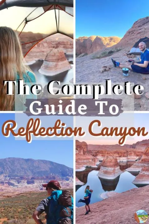
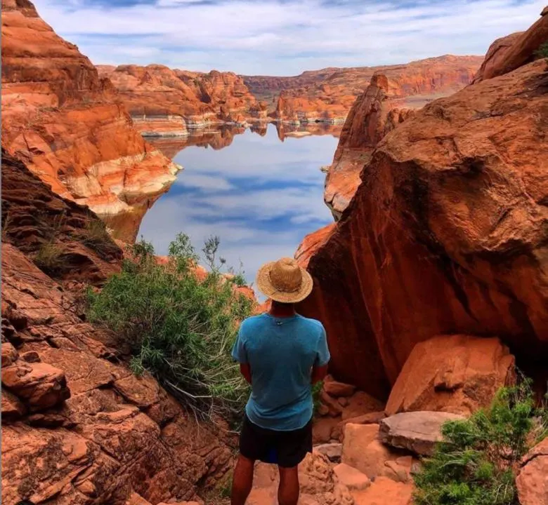
Reflection Canyon:
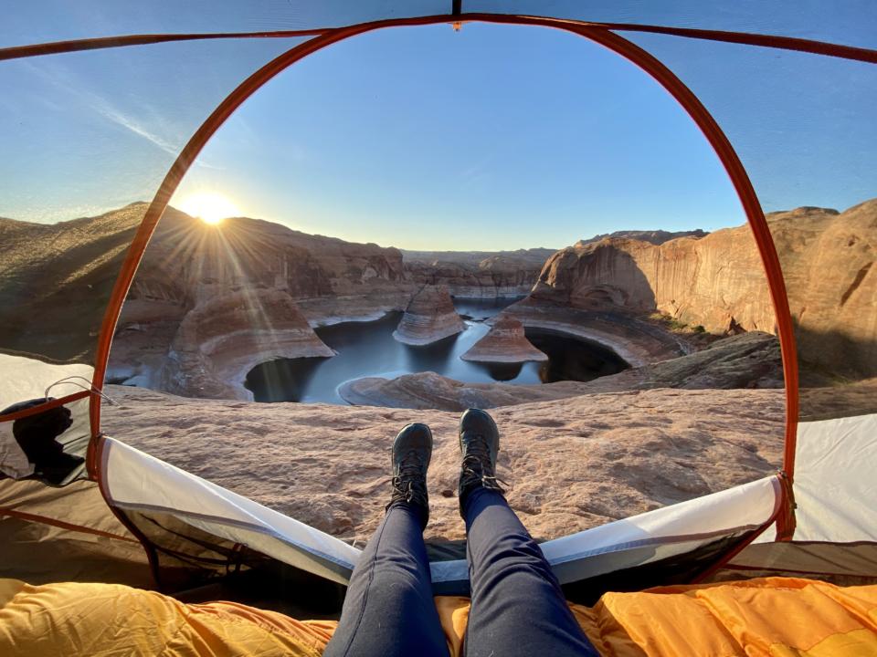

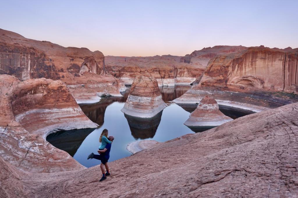
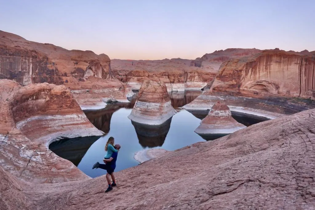
First, I am going to start with one of the coolest hikes in the area, Reflection Canyon.
I always saw pictures of this place but never knew how truly beautiful it was until I saw it in person. Lake Powell is one of Jake and I’s favorite places on this earth, and to be able to see this stunning sight from up above on the rim was breathtaking.
This is one of the hikes where 4×4 and high clearance is strongly suggested in order to get to the trailhead. But it is still possible in just a high clearance vehicle, if the road conditions are dry.
This hike is no joke as it is around 18 miles round trip. The hike is exposed the whole route, so it can be brutal during the hot summer months.
Plus, it is highly suggested to backpack, so you also have to carry all your gear plus all your water along on the hike. It can be done as a day hike, but will be very physically demanding.
Definitely pick up your free permit from the visitors center near the town of Escalante.
For more details about Reflection Canyon, check out our post:
Hole In the rock:

Another popular destination in The Grand Staircase Escalante is Hole In The Rock, which is the furthest destination on Hole In The Rock Road.
The hole in the rock is a small crack in the western rim of Glen Canyon.
It was used as a way for mormon settlers to cross the Colorado River from the northside of the Glen Canyon Rim, instead of having to travel all the way around Lake Powell. For more history on Hole in the Rock click, here.
As hikers are no longer crossing Lake Powell as a means to get to the other side, many hikers still venture to the rim and climb down to Lake Powell.
It is one of the only hikes in the area that will lead you down to the water of Lake Powell.
The hike is only .6 miles with 223 feet elevation change. But the trail can be a bit of a scramble up and down, so be extra cautious!
In order to make it to the trailhead of Hole In The rock, 4×4 and a high clearance vehicle is strongly encouraged. The drive to the trailhead is 55 miles but will most likely take you over 3 hours.
Hurricane Wash:

One stunning place out in the Grand Staircase Escalante National Monument is Hurricane Wash. There are many different trails that can lead you into this area, but some are for different levels of hiking abilities.
There are also many destinations along this hike such as: Jacob Hamblin Arch, Coyote Gulch, Coyote Natural Bridge, Steven’s Arch, Cliff Arch, etc.
Hurricane Wash will meet up with Coyote Gulch Trail and can lead you down to the Escalante River which flows into Lake Powell. The hike to the Escalante River is 26.7 miles with 4,104 feet.
There are miles upon miles of hiking back in this area, but we highly suggest taking a GPS tracker so you know how far you’ve gone and know when to take the right turns back!
But for the most part you will be hiking between tall canyon walls, so the trail will take you one direction.
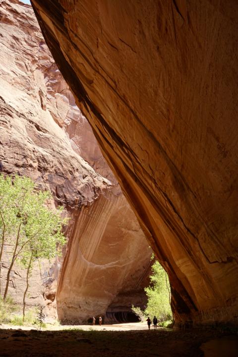
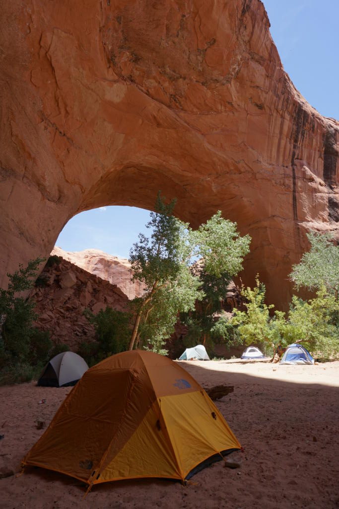
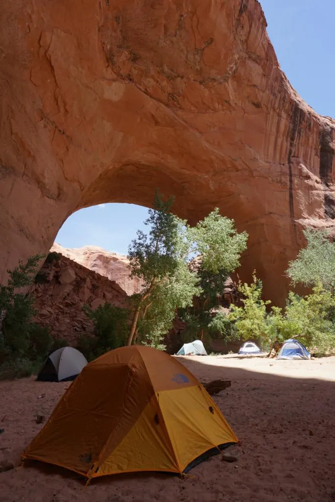
Jacob Hamblin Arch:
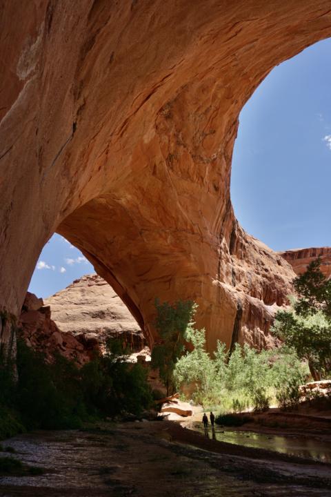

Like listed above Jacob Hamblin arch is one of the more poplar destinations in The Grand Staircase Escalante National Monument.
We did this as a day hike, but we would highly suggest doing it as a backpacking trip. The hike to the Arch is around 15 miles (round trip) and exposed most of the route.
The first portion of the hike is through loose sand. About half way you will come to your first river crossing, which is where I would switch to a pair of river shoes.
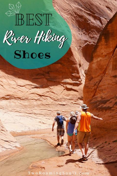

Don’t forget to pick up some River hiking shoes for roaming around the Escalante River.
The hike will then wind through the tall canyon walls til you get to a big arch in the canyon walls. This is where many people set up camp. You can then venture on down the creek to the Escalante River where you will see Coyote Natural Arch.
There is a shorter trail to Jacob Hamblin but it is much more dangerous and requires a rope down a steep section. If you are interested in trying this route, check out AllTrails.
Zebra Slot:
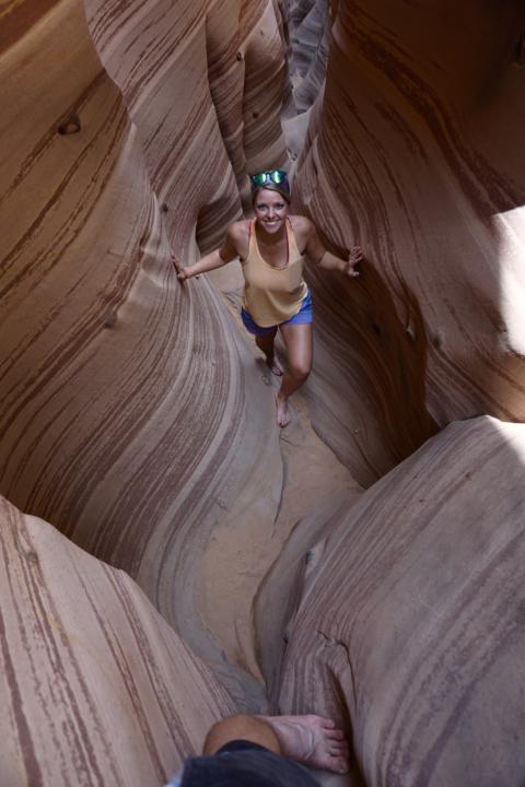
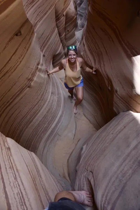
There are a few different small slot canyons in the area, but Zebra Slot is one of the coolest slot canyons we came across. But, if you are at all claustrophobic, this is not the hike for you because of the narrow canyons.
I am not going to lie, there were a few spots where I almost didn’t fit through the slot, or at least had the feeling I might get stuck. So be prepared for a real slot canyon adventure on this one.
There were also many spots where water was built up from rain, making some places harder to travel through. Therefore, I would suggest having a second pair of sandals or shoes, unless you prefer to go barefoot.
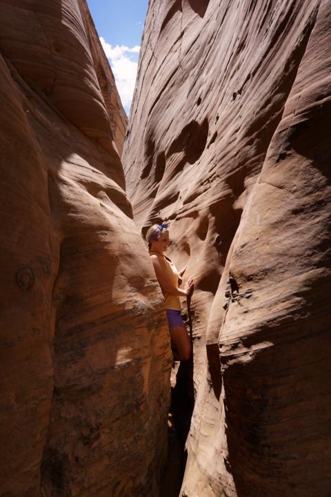

It is super important to check the weather before going on this day hike because of the nature of a slot canyon. Flash floods are a real hazard in slot canyons and the tall canyon walls can fill up extremely fast with water.
If you see rain in the forecast skip this hike.
Some other popular slot canyons in the area are Red Breaks Slot Canyon and Dry Fork Narrows, Peekaboo and Spooky Slot Canyon. Both are further down the road making it a little more difficult to get to. If slot canyons interest you, these should be on your Grand Staircase Escalate hike list.
Golden Cathedral:

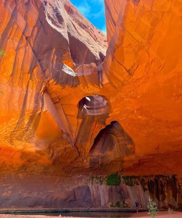
Golden Cathedral trail leads to a very cool rock formation. The rock wall towers over Neon Canyon Creek with three unique holes in the rock wall.
The hike is 9.1 miles (roundtrip) with 1581 feet elevation change. The hike is very exposed for a large portion of the hike. Check the weather and make sure you bring extra water along for the hike.
You will also encounter a few river crossings along the hike. Depending on the time of year the water can be calf to knee-deep.
If you have canyoneering experience and the appropriate gear, then there is a different route you can take. Check into Atlas Calling’s Blog for information on canyoneering into the Golden Cathedral.
Lower Calf Creek Falls:

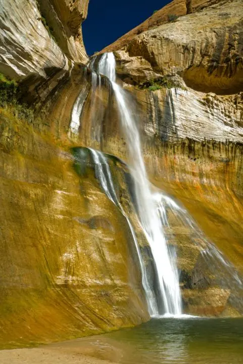
Lower Calf Creek Falls is a unique waterfall that flows over the tall canyon walls of Escalante. The falls drop 214 feet into Calf Creek.
Depending on the time of year the falls are more impressive. But there is green moss behind the flowing waterfall making it a beautiful sight.
The hike to Lower Calf Creek falls is 6.7 miles with 521 feet elevation change. There is a $2 parking fee at the parking lot.
Be sure to pack enough water along for the hike as it is exposed for the majority of the hike. But this hike should be high on the list if you are trying to experience Grand Staircase Escalante National Monument to the fullest.
Check out our youtube video exploring Lower Calf Creek Falls.
Cosmic Ashtray:
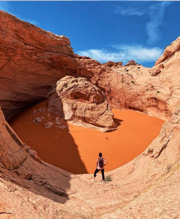
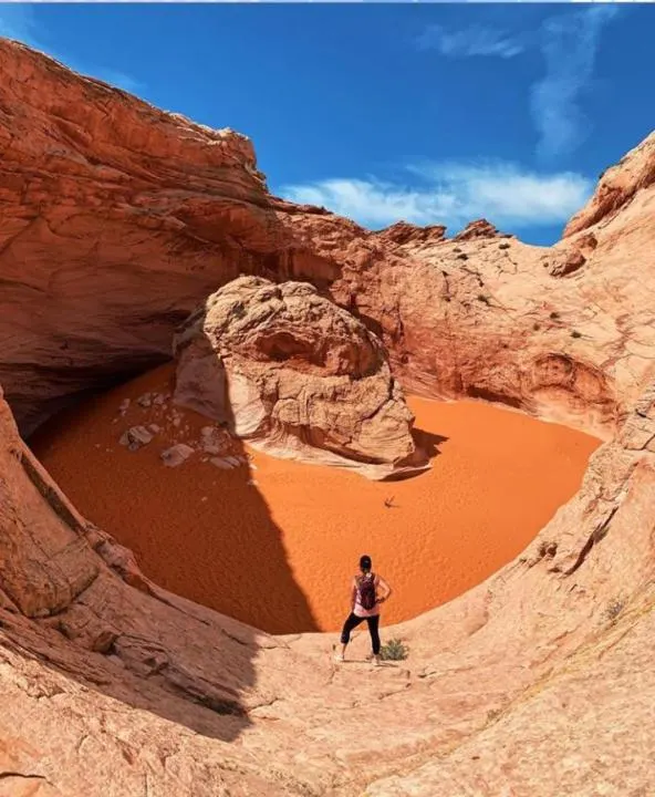
I’ve left this one for last because it is not for everyone, even us! We don’t have a very good car that can get us deep into these remote spots that require off-road vehicles.
And after doing research, we noticed many people stating that the road out here is a challenge and 4×4 and high clearance is highly suggested. We thought we put our van through enough going to reflection canyon, so left this one out.
But after all, this is the ultimate guide to Grand Staircase Escalante National Monument, so we thought this one should go on the list.
This hike is 8.3 miles with 882 feet elevation change. The hike is exposed most of the route and rated as hard. It is strongly encouraged to follow a GPS route, because there is no maintained trail.
It is also not encouraged to go into the “ashtray”, because it is hard to get back out and help is far away. But some climbers have been brave enough to climb into the ashtray.
So, if you have repelling experience, be extra careful and make sure you take all precautionary measures.
Takeaway: Grand Staircase Escalante National Monument
Grand Staircase Escalante National Monument is a hidden gem in the state of Utah. It is often overlooked because of Utah’s 5 thriving National Parks.
Such as Bryce Canyon National Park & Zion National Park which are easier to get to and offer stunning viewpoints right from your car.
But Grand Staircase-Escalante National Monument offers a similar feel to Capitol Reef National Park. So if you enjoy your time here, you don’t want to miss out on this Capitol Reef Guide.
Grand Staircase is definitely getting more popular. But there are plenty of trails where you will find complete solitude roaming the Escalante canyons.
But, do plan accordingly when adventuring in The Grand Staircase Escalante. These hikes are often very exposed and water is scarce. So bring at least a gallon of water per person on each hike and plenty of sunscreen!
If you need help on what to pack on your hike, check out our post: 8 Essentials For Your Hiking Pack.
We hope you enjoy The Ultimate Guide To Grand Staircase Escalante National Monument.
Local Eats Near Escalante, UT
If you are looking for a place to grab breakfast, Jake and I stopped at Kiva Koffeehouse. It offers one of the coolest views over Grand Staircase.
Or if you are headed north, a restaurant you must visit is Sweetwater Kitchen. This is one of our absolute favorite dining experiences in Utah. They locally grow their ingredients and incorporate them into some delicious meals.
Also, definitely don’t miss the Burr Trail scenic byway if you are heading north. It is a well-maintained dirt road that takes you through some amazing scenery of Grand Staircase. This can also offer a unique way to get over to Capitol Reef National Park.
Save This ‘Grand Staircase Escalante Ultimate Guide’ For Later


Top 5 Things To Do In Page, AZ - tworoamingsouls
Saturday 11th of March 2023
[…] One of the coolest parts, is you can actually see Lake Powell from a few different hikes in the area. Reflection Canyon is one of our all time favorite backpacking trips. But you can also drive to hole in the wall, which used to be where the Native Americans transported items from one side of the canyon to the other. Check out our ultimate guide for the Grand Staircase Escalante National Monument. […]